Sarasota County
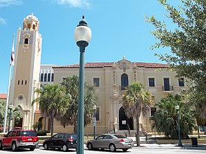
 Sarasota County Courthouse |
|
| administration | |
|---|---|
| US state : | Florida |
| Administrative headquarters : | Sarasota |
| Address of the administrative headquarters: |
County Courthouse P.O. Box 8 Sarasota, FL 34230-0008 |
| Foundation : | May 14, 1921 |
| Made up from: | Manatee County |
| Area code : | 001 941 |
| Demographics | |
| Residents : | 379,448 (2010) |
| Population density : | 256.4 inhabitants / km 2 |
| geography | |
| Total area : | 1878 km² |
| Water surface : | 398 km² |
| map | |
| Website : www.co.sarasota.fl.us | |
The Sarasota County is a county in the state of Florida of the United States . The county seat is Sarasota .
history
Sarasota County was formed on May 14, 1921 from parts of Manatee County. It was named after a word from the Calusa Indian language, which means rock marking .
geography
The county has an area of 1,878 square kilometers, of which 398 square kilometers are water. It is bordered in a clockwise direction by the following counties: Manatee County , DeSoto County, and Charlotte County . Together with Manatee County, the county forms the metropolitan area of Sarasota .
Demographic data
| growth of population | |||
|---|---|---|---|
| Census | Residents | ± in% | |
| 1930 | 12,440 | - | |
| 1940 | 16,106 | 29.5% | |
| 1950 | 28,827 | 79% | |
| 1960 | 76,895 | 166.7% | |
| 1970 | 120,413 | 56.6% | |
| 1980 | 202.251 | 68% | |
| 1990 | 277.776 | 37.3% | |
| 2000 | 325,957 | 17.3% | |
| 2010 | 379,448 | 16.4% | |
| 1930–1990 2000 + 2010 | |||
According to the 2010 census , Sarasota County had 379,448 people in 228,117 households. The population density was 256.4 inhabitants per square kilometer. Ethnically, the population was composed of 90.2% white, 4.7% African American , 0.2% American Indian and 1.3% Asian Americans . 2.0% were members of other ethnic groups and 1.6% of different ethnic groups. 7.9% of the population were Hispanics or Latinos .
In 2010 children under the age of 18 and 46.2% of all households lived in 19.2% of all households with persons at least 65 years of age. 60.9% of households were family households (consisting of married couples with or without offspring or one parent with offspring). The average household size was 2.13 people and the average family size was 2.64 people.
17.6% of the population were younger than 20 years, 16.9% were 20 to 39 years old, 26.3% were 40 to 59 years old, and 39.4% were at least 60 years old. The mean age was 53 years. 47.7% of the population were male and 52.3% were female.
The median income for a household in the 48,900 USD , while 11.6% of the population lived below the poverty line.
In 2010, English was the mother tongue of 87.61% of the population, 6.17% spoke Spanish and 6.22% had another mother tongue.
Further educational institutions
- Goshen College in North Port
- Eckerd College in Sarasota
- Goshen College in Sarasota
- International College in Sarasota
- Keizer College in Sarasota
- Manatee Community College in Sarasota
- New College of Florida in Sarasota
- Ringling College of Art and Design in Sarasota
- University of South Florida at Sarasota
- Webster University Sarasota in Sarasota
Places in Sarasota County
Sarasota County localities with population from the 2010 census :
Cities :
- North Port - 57,357 residents
- Sarasota ( County Seat ) - 51,917 residents
- Venice - 20,748 inhabitants
Town :
- Longboat Key - 6,888 residents
- Bee Ridge - 9,598 residents
- Desoto Lakes - 3,646 inhabitants
- Englewood - 14,863 residents
- Fruitville - 13,224 residents
- Gulf Gate Estates - 10,911 residents
- Kensington Park - 3,901 residents
- Lake Sarasota - 4,679 residents
- Laurel - 8,171 inhabitants
- The Meadows - 3,994 residents
- Nokomis - 3,167 inhabitants
- North Sarasota - 6,982 residents
- Osprey - 6,100 inhabitants
- Plantation - 4,919 residents
- Ridge Wood Heights - 4,795 residents
- Sarasota Springs - 14,395 residents
- Siesta Key - 6,565 residents
- Southgate - 7,173 residents
- South Gate Ridge - 5,688 residents
- South Sarasota - 4,950 residents
- South Venice - 13,949 inhabitants
- Vamo - 4,727 inhabitants
- Venice Gardens - 7,104 residents
- Warm Mineral Springs - 5,061 residents
Web links
- Official website (English).
- Tourist information (Engl.)
Individual evidence
- ↑ GNIS-ID: 295741. Retrieved on February 22, 2011 (English).
- ↑ Extract from Census.gov . Retrieved February 14, 2011
- ↑ Extract from census.gov (2000 + 2010). Accessed March 31, 2012
- ^ Profile of General Population and Housing Characteristics: 2010 . United States Census Bureau . Retrieved August 29, 2014.
- ↑ Language distribution 2010 . Modern Language Association . Archived from the original on August 15, 2013. Info: The archive link was inserted automatically and has not yet been checked. Please check the original and archive link according to the instructions and then remove this notice. Retrieved August 29, 2014.
Coordinates: 27 ° 11 ′ N , 82 ° 22 ′ W

