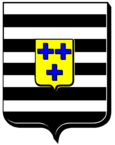
Courcelles (Meurthe-et-Moselle)
| Courcelles | ||
|---|---|---|

|
|
|
| region | Grand Est | |
| Department | Meurthe-et-Moselle | |
| Arrondissement | Toul | |
| Canton | My au Saintois | |
| Community association | Pays de Colombey et du Sud Toulois | |
| Coordinates | 48 ° 22 ′ N , 6 ° 2 ′ E | |
| height | 312-400 m | |
| surface | 4.31 km 2 | |
| Residents | 104 (January 1, 2017) | |
| Population density | 24 inhabitants / km 2 | |
| Post Code | 54930 | |
| INSEE code | 54140 | |
 Mairie Courcelles |
||
Courcelles is a French commune with 104 inhabitants (as of January 1, 2017) in the Meurthe-et-Moselle department in the Grand Est region (until 2015 Lorraine ). It belongs to the arrondissement of Toul and the municipality association Pays de Colombey et du Sud Toulois .
geography
The municipality of Courcelles is located in Saintois in the south of the Meurthe-et-Moselle department, on the border with the Vosges department , 35 kilometers south of Nancy . The Ruisseau de la Chouée rises in Courcelles and drains south-east to the Madon tributary of the Moselle . Just east of community border is the watershed of the catchment areas of Rhein and Maas . To the north of the undulating ground relief around Courcelles rise ridges, from which the striking Colline de Sion with the tower Signal de Vaudémont (541 meters above sea level) stands out. The largest part of the municipality is used for agriculture; in the southwest there is an approximately 30 hectare forest area.
Neighboring municipalities of Courcelles are Pulney in the north, Fraisnes-en-Saintois in the east, Blémerey in the south, Chef-Haut in the southwest, Aboncourt in the west and Grimonviller in the northwest.
Population development
| year | 1962 | 1968 | 1975 | 1982 | 1990 | 1999 | 2007 | 2017 | |
| Residents | 120 | 122 | 115 | 102 | 94 | 101 | 85 | 104 | |
| Sources: Cassini and INSEE | |||||||||
Attractions
- Church of St. Jacob ( Saint-Jacques ) with Romanesque tower, nave and apse from 1778
Economy and Infrastructure
The people of Courcelles make a living from agriculture, forestry and small craft businesses. Eleven agricultural businesses are located in the municipality (cultivation of grain and aromatic plants, dairy farming, cattle breeding, sheep and goat farming).
Courcelles is away from the national traffic flows. Seven kilometers east of the village, the road runs from Mirecourt via Tantonville to Nancy , eight kilometers south of the partly two-lane D 166 from Épinal to Neufchâteau with a connection to the A31 autoroute .
From 1883 to 1953 Courcelles had a rail connection on the line from Frenelle-la-Grande / Puzieux to Barisey-la-Côte . Passenger traffic on this route was stopped in 1939. To the west of the main town, the railway line crossed a 160-meter-long tunnel that still exists today. Today the railway line is built over, partly with bike paths.
supporting documents
- ↑ Courcelles on cassini.ehess.fr
- ↑ Courcelles on insee.fr
- ↑ Farms on annuaire-mairie.fr (French)
- ↑ picture of the southern tunnel portal. Retrieved January 1, 2011 .
- ^ Picture of the former train station. Retrieved January 1, 2011 .


