
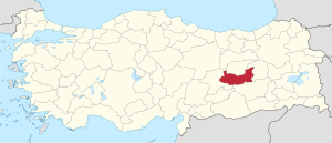
Elazığ (Province)
| Elâzığ | |
|---|---|
| Province number: | 23 |
  |
|
| Counties | |
 |
|
| Basic data | |
| Coordinates: | 38 ° 40 ′ N , 39 ° 22 ′ E |
| Provincial capital: | Elazığ |
| Region: | Eastern Anatolia |
| Surface: | 9,383 km² |
| Population: | 595,638 (2018) |
| Population density: | 63.5 inhabitants / km² |
| Political | |
| Governor: | Çetin Oktay Kaldırım |
| Seats in Parliament: | 4th |
| Structural | |
| Telephone code: | 0424 |
| Features : | 23 |
| Website | |
| www.elazig.gov.tr (Turkish) | |
Elâzığ ( kurd. Elazîz ) is a province ( İl ) in eastern Turkey . To the east lies Bingöl , in the north Tunceli (Kurdish Dersim ), in the west Malatya and in the south Diyarbakır . The province was named after the capital Elazığ .
geography
Elâzığ is located at an altitude of 1060 meters. 826 km² of the province are water bodies, as there are many reservoirs in Elâzığ . The largest reservoirs are the Keban and Karakaya reservoirs on the course of the Euphrates , the Kralkızı reservoir on the Tigris and the Özlüce reservoir on the Peri . There are also natural lakes such as Hazar Lake, which is 86 km².
Administrative division
Some places / districts in the province have Kurdish names:
- Alacakaya - Guleman
- Karakoçan - Depe (Zazaish: Qeze)
- Kovancılar - Macîran
- Palu - Palo
- Sivrice - Xox
The province of Elazığ is divided into eleven districts:
| district | Area 1 (km²) |
Population (2018) 2 | Number of Units | Density (Ew / km²) |
urban share (in%) |
Sex ratio 3 |
Founding date 4.5 |
|||
|---|---|---|---|---|---|---|---|---|---|---|
| District ( İlçe ) | Administrative headquarters (Merkez) |
Municipalities (Belediye) |
City quarter (Mahalle) |
Villages (Köy) |
||||||
| Ağın | 242 | 2,776 | 1,690 | 1 | 4th | 16 | 11.47 | 60.88 | 1035 | 06/01/1954 |
| Alacakaya | 318 | 6,566 | 2,812 | 1 | 6th | 10 | 20.65 | 42.83 | 910 | May 20, 1990 |
| Aricak | 354 | 17,028 | 4,312 | 4th | 23 | 10 | 48.10 | 75.69 | 929 | 07/04/1987 |
| Baskil | 1,318 | 20,505 | 4,716 | 1 | 6th | 60 | 15.56 | 23.00 | 981 | 06/26/1926 |
| Karakoçan | 1,049 | 28,702 | 14,397 | 2 | 9 | 88 | 27.36 | 57.76 | 989 | 04/01/1936 |
| Keban | 641 | 8,409 | 4,059 | 1 | 4th | 30th | 13.12 | 48.27 | 1029 | |
| Kovancılar | 960 | 38,774 | 23,798 | 1 | 12 | 76 | 40.39 | 61.38 | 1006 | 07/04/1987 |
| Maggots | 819 | 16.608 | 5,373 | 1 | 2 | 38 | 20.28 | 32.35 | 993 | |
| Merkez Elazığ | 2,243 | 421.726 | 353,629 | 5 | 64 | 135 | 188.02 | 90.46 | 1019 | |
| Palu | 730 | 23,834 | 9,504 | 2 | 14th | 37 | 32.65 | 58.37 | 955 | |
| Sivrice | 710 | 10,710 | 4,377 | 1 | 7th | 50 | 15.08 | 40.87 | 1017 | 04/01/1936 |
| Elazığ PROVINCE | 9,383 | 595,638 | 20th | 151 | 550 | 63.48 | 79.19 | 1008 | ||
swell
1 Area 2014
2 Population update on December 31, 2018
3 Gender ratio : number of women per 1000 men (calculated)
4 PDF file of the Ministry of the Interior
5 districts that were only formed after Turkey was founded (1923).
population
The population consists mainly of Turks and Kurds . The Alevis are a religious minority. In the 1970s, there were violent clashes between Sunnis and Alevis during the fasting month of Ramadan . More than 1,000 people were killed in these clashes. Many of the Alevis living in Elâzığ come from the neighboring province of Tunceli.
Up until the First World War there were numerous Armenian villages and communities in the province, which is why it was counted among the Six Armenian Vilâyets ( Vilâyat-ı custom ).
Results of the population extrapolation
The following table shows the annual population development at the end of the year after updating by the addressable population register (ADNKS) introduced in 2007. In addition, the population growth rate and the sex ratio (ie number of women per 1000 men) are listed. The 2011 census determined 559,063 inhabitants, which is more than 10,000 inhabitants less than the 2000 census.
| year | Population at the end of the year | Population growth rate (in%) |
Gender ratio (women per 1000 men) |
Rank (among 81 provinces) |
||
|---|---|---|---|---|---|---|
| total | male | Female | ||||
| 2018 | 595,638 | 296,641 | 298.997 | 2.05 | 1008 | 37 |
| 2017 | 583,671 | 290,692 | 292,979 | 0.84 | 1008 | 37 |
| 2016 | 578,789 | 287.991 | 290,798 | 0.78 | 1010 | 36 |
| 2015 | 574,304 | 285,511 | 288,793 | 0.98 | 1011 | 36 |
| 2014 | 568,753 | 281,583 | 287.170 | 0.09 | 1020 | 37 |
| 2013 | 568.239 | 282.049 | 286.190 | 0.98 | 1015 | 37 |
| 2012 | 562.703 | 279,599 | 283.104 | 0.74 | 1013 | 37 |
| 2011 | 558,556 | 277.151 | 281,405 | 1.07 | 1015 | 37 |
| 2010 | 552,646 | 272,500 | 280.146 | 0.36 | 1028 | 37 |
| 2009 | 550,667 | 273.212 | 277,455 | 0.57 | 1016 | 37 |
| 2008 | 547,562 | 271,330 | 276.232 | 1.16 | 1018 | 37 |
| 2007 | 541.258 | 266.284 | 274.974 | - | 1033 | 38 |
| 2000 | 569,616 | 364.274 | 205,342 | 564 | 39 | |
Census results
The following tables show the population of Elazığ province documented in the 14 censuses .
The values in the table on the left are taken from e-books (from the original documents), the values in the table on the right come from the data query of the Turkish statistical institute TÜIK - available on this website:
| year | population | rank | |
|---|---|---|---|
| province | Turkey | ||
| 1927 | 213,777 | 13,648,270 | 25th |
| 1935 | 256.189 | 16.158.018 | 30th |
| 1940 | 190.366 | 17,820,950 | 45 |
| 1945 | 198.081 | 18,790,174 | 44 |
| 1950 | 213,330 | 20,947,188 | 45 |
| 1955 | 242.914 | 24,064,763 | 44 |
| 1960 | 278,332 | 27,754,820 | 42 |
| year | population | rank | |
|---|---|---|---|
| province | Turkey | ||
| 1965 | 322,727 | 31,391,421 | 42 |
| 1970 | 376.915 | 35.605.176 | 40 |
| 1975 | 417.924 | 40,347,719 | 40 |
| 1980 | 440,808 | 44,736,957 | 42 |
| 1985 | 483.715 | 50,664,458 | 42 |
| 1990 | 498.225 | 56.473.035 | 41 |
| 2000 | 569,616 | 67,803,927 | 39 |
Number of provinces in relation to the census years:
- 1927, 1940 to 1950: 63 provinces
- 1935: 57 provinces
- 1955: 67 provinces
- 1960 to 1985: 73 provinces
- 1990: 73 provinces
- 2000: 81 provinces
history
The city of Elazığ is relatively young and thus contrasts with the long history of the region. Traces of settlement are around 5000 years old.
The Hittites called this region Išuwa . Between the 12th and 7th centuries BC BC Elâzığ belonged to Urartu . Some settlements and mountain fortresses, such as the fortresses of Palu and Harput, date from this period. After that Elâzığ fell to the Medes , Persians , Romans , Byzantines and Arabs .
After the invasion of Turkish peoples, the region came under the Turkish Çubukoğulları dynasty in 1085. In 1234 Elâzığ fell to the Seljuks . In 1243 the Mongolian Ilkhan dynasty conquered Elâzığ from Iran . In 1363 the Dulkadir ruled , in 1465 the Turkmen Akkoyunlular and from 1516 the Ottomans . In 1834 the center of the province was relocated from Harput city to Elâzığ city. From 1864 it became the center of the new Mamuretül-Aziz Vilâyet . In the genocide of the Armenians in 1915, almost all of the Armenian population in the province was deported, and the Mamuretül-Aziz massacre near Harput took place . Elâzığ has been an independent province since 1921. Until 1937, the city and province were called Mamuret el- Aziz (city built by Aziz), as the new city was built under the Ottoman Sultan Abdul-Aziz .
education
The Fırat University was founded in the 1975th
Personalities
- Mehmet Ağar , politician
- Mehmet Aydın , philosopher, politician and minister of state
- Selahattin Demirtaş , lawyer and politician
- Yusuf Harputlu , singer
- Dursun Karataş , politician
- Validan Kışanak , Kurdish politician
- Necati Şaşmaz , actor
- Nerses IV. Schnorhali , church leader
- Aysel Tuğluk , lawyer and politician
Others
Harput is the oldest city in the region. Established as a fortress, the city's importance has declined in recent decades. The origin of the name is not entirely clear. Strabo called the area Karkathiokerta . The Persians knew this area as Ziata Castellum . In Arabic it was called Hısnıziyad as Hisn means fortress. In Assyrian sources, Harput was called Karpata . The Byzantines called it Kharpote and the Franks Quartapiert . The scholar and traveler Evliya Çelebi called it Hasan Ziyad ülkesi ("The Land of Hasan Ziyad"). In the Ottoman documents there were the names Hartabird , Harpurt or Harpurd .
Individual evidence
- ↑ Türkiye Nüfusu İl ve İlçelere Göre Nüfus Bilgileri , accessed on June 12, 2019
- ↑ Governor's portrait on the Elazığ Province website
- ↑ Directorate General of Mapping (PDF; 0.25 MB).
- ↑ Türkiye Nüfusu İl İlçe Mahalle Köy Nüfusu , accessed on June 12, 2019
- ↑ illeridaresi.gov.tr (PDF; 1.4 MB).
- ↑ Genel Nüfus Sayımları (census results 1965 to 2000)
Adana | Adıyaman | Afyonkarahisar | Ağrı | Aksaray | Amasya | Ankara | Antalya | Ardahan | Artvin | Aydın | Balıkesir | Bartın | Batman | Bayburt | Bilecik | Bing oil | Bitlis | Bolu | Burdur | Bursa | Çanakkale | Çankırı | Çorum | Denizli | Diyarbakır | Düzce | Edirne | Elazığ | Erzincan | Erzurum | Eskişehir | Gaziantep | Giresun | Gümüşhane | Hakkâri | Hatay | Iğdır | Isparta | İstanbul | İzmir | Kahramanmaraş | Karabük | Karaman | Kars | Kastamonu | Kayseri | Kırıkkale | Kırklareli | Kırşehir | Kilis | Kocaeli | Konya | Kutahya | Malatya | Manisa | Mardin | Mersin | Muğla | Muş | Nevşehir | Niğde | Ordu | Osmaniye | Rize | Sakarya | Samsun | Siirt | Sinop | Sivas | Şanlıurfa | Şırnak | Tekirdağ | Tokat | Trabzon | Tunceli | Usak | Van | Yalova | Yozgat | Zonguldak