Bischofsheim in the Rhön
| coat of arms | Germany map | |
|---|---|---|

|
Coordinates: 50 ° 24 ' N , 10 ° 0' E |
|
| Basic data | ||
| State : | Bavaria | |
| Administrative region : | Lower Franconia | |
| County : | Rhön-Grabfeld | |
| Height : | 448 m above sea level NHN | |
| Area : | 67.71 km 2 | |
| Residents: | 4822 (Dec. 31, 2019) | |
| Population density : | 71 inhabitants per km 2 | |
| Postal code : | 97653 | |
| Area code : | 09772 | |
| License plate : | NES, CAN, MET | |
| Community key : | 09 6 73 117 | |
| LOCODE : | DE FSO | |
| NUTS : | DE266 | |
| City structure: | 14 districts | |
City administration address : |
Kirchplatz 4 97653 Bischofsheim idRhön |
|
| Website : | ||
| First Mayor : | Georg Seiffert (CSU) | |
| Location of the town of Bischofsheim idRhön in the Rhön-Grabfeld district | ||
Bischofsheim in der Rhön (officially: Bischofsheim idRhön ) is a town in the Lower Franconian district of Rhön-Grabfeld , which was called Bischofsheim an der Rhön (officially: Bischofsheim adRhön ) before January 8, 2020 .
geography
The city lies at the foot of the Kreuzberg in the Rhön .
City structure
There are 14 districts:
|
history
Until the church is planted
The oldest documents date from the beginning of the 13th century. However, finds from the Celtic period show that Bischofsheim is much older. Traditionally it is assumed that the name goes back to Saint Boniface . From Fulda , where he built a Benedictine monastery in 744 , the bishop's path led via Bischofsheim to the Kaiserpfalz Salz. There he built a settlement to take a break on the way.
The folk etymological explanation of the village name as a reference to the bishop is unlikely, however. In the Middle Ages , the use of the word 'bishop' as a functional designation was atypical - if so, then one would have chosen the name of the specific bishop who founded, acquired or granted rights to the place, especially with such a dominant figure as Boniface (Winfried) .
The location on a mountain in particular suggests another explanation for the place name. It follows the vascular hypothesis . The Munich linguist Theo Vennemann , who advocates this hypothesis, points out that existing toponyms (place names) are usually adopted by new immigrants (linguistic substrate). A conspicuous accumulation of similar names in a similar geography would therefore be an indicator of an existing word in an earlier settlement phase. The accumulation of "bishop" place names on each elongated mountain ridge suggests that this could also have been the case here (although in individual cases it can of course always be a coincidence or another derivation). In any case, this topological description 'fits' clearly to "Bischofsheim", as well as to many other, similar place names. The vasconic hypothesis is based on an old European language , the last existing relic of which is Basque . There is the word 'bizkar' which means 'ridge', 'elongated hill in the mountains'. This toponymic description applies here in particular to the monastery.
If this explanation were to be correct, it would also mean that the region was settled in old European times. Accordingly, the area of today's place Bischoffroda would have been inhabited before the Indo-European conquest, i.e. before the third millennium BC.
The upper office of the Hochstift Würzburg , which belonged to the Franconian Empire , was left to Archduke Ferdinand of Tuscany to form the Grand Duchy of Würzburg after the secularization in favor of Bavaria in 1805 , and with this in 1814 it finally fell to Bavaria. In 1818 the political municipality was established.
Incorporations
On July 1, 1972, Wegfurt was incorporated. Haselbach in the Rhön was added on February 1, 1975. Frankenheim, Oberweißbrunn and Unterweißbrunn followed on May 1, 1978.
Population development
| Population numbers | ||||||||||||||
|---|---|---|---|---|---|---|---|---|---|---|---|---|---|---|
| year | 1840 | 1900 | 1939 | 1950 | 1961 | 1970 | 1987 | 1991 | 1995 | 2005 | 2010 | 2015 | ||
| Residents | 4296 | 3529 | 4077 | 4927 | 4809 | 4942 | 4610 | 4915 | 5248 | 5073 | 4811 | 4698 | ||
The House of Small Miracles children's museum, founded in 2007, lasted until 2012.
religion
The following Christian communities exist in Bischofsheim:
-
Catholic parish community Am Kreuzberg, Bischofsheim / Rhön in the dean's office in Bad Neustadt
- St. Georg Bischofsheim,
- St. Wendelin Haselbach,
- St. Antonius and St. Vitus Oberweißbrunn,
- St. Kilian Frankenheim,
- St. Katharina Unterweissenbrunn,
- St. Peter and Paul Wegfurt,
- St. Laurentius Schönau
- Kreuzberg monastery church
- Evangelical Lutheran parish in Bischofsheim
- Christian community Bischofsheim e. V.
- Orthodox parish of St. Nektarios v. Aegina
politics
City council
The local elections on March 15, 2020 resulted in the following composition of the city council:
| Party / list | Share of votes | Seats |
|---|---|---|
| CSU | 44.70% | 7th |
| Free voters | 13.19% | 2 |
| Wegfurt Citizens List | 16.89% | 3 |
| Haselbach Citizens List | 11.82% | 2 |
| NEO - choose the future - strengthen your home! | 11.34% | 2 |
mayor
Georg Seiffert (CSU) has been the first mayor since 2016. He was elected on June 19, 2016 with 55.06% of the valid votes. Its predecessors were:
- April 1945 Karl Röder (used by the Americans because he spoke English)
- 1946–1952 Josef Mai (CSU)
- 1952–1960 Ferdinand Krenzer (SPD)
- 1960–1966 Herrmann Fromme (SPD)
- 1966–1992 Hans Repp (SPD / CSU; CSU member since 1972 )
- 1992–2004 Armin Lommel (CSU; elected by the list of FW)
- 2004–2016 Udo Baumann (CSU)
Community finances
In 2013 the municipal tax revenue amounted to 2,956,000 euros , of which 897,000 euros were trade tax revenue (net).
coat of arms
| Blazon : “In red a silver fortification with three blue-roofed silver tin towers; under the eyelash-like archway in blue the head of a bishop with a silver miter. " | |
Town twinning
Bischofsheim maintains partnerships with Gau-Bischofsheim in Rhineland-Palatinate and Manduel in the southern French region of Occitania .
Economy and Infrastructure
economy
In 2013, according to official statistics, there were 515 employees in the manufacturing sector and 277 in trade, transport and hospitality at the place of work. In other areas of the economy 150 people were employed at the place of work subject to social security contributions. There were a total of 1825 employees at the place of residence subject to social security contributions. There were seven companies in the manufacturing sector and five in the main construction sector. In 2010 there were also 83 farms with a total of 1269 hectares used agriculturally, of which 366 hectares were arable land and 1045 hectares were permanent green space.
traffic
Bischofsheim can be reached via the BAB-7 connection point Bad Brückenau / Wildflecken and the BAB-71 connection point Bad Neustadt an der Saale . The city lies on the B 279 Fulda –Bischofsheim– Bamberg and is the starting point for the B 278 , which leads via Tann (Rhön) into Buttlar in Thuringia . The Hochrhönstrasse connects Bischofsheim with Fladungen .
From 1885 to 1989 the place was connected to the Bad Neustadt – Bischofsheim railway line . The next train station today is in Gersfeld (Rhön) .
education
There are the following facilities:
- 225 kindergarten places in four day-care centers with 159 children (kindergartens in Bischofsheim in der Rhön, Wegfurt, Oberweißbrunn and Unterweißbrunn) (as of 2013)
- Two elementary schools with 24 teachers and 354 students (school year: 2012/2013)
- State vocational school for wood carvers. It is the only wood carving school in Northern Bavaria and the oldest in Germany. It was founded on May 1, 1843 in Poppenhausen (Wasserkuppe) and moved to Bischofsheim in 1861. In 2003 it celebrated its 150th anniversary.
- Agricultural School, Housekeeping Department
- The Bauersberg school camp of the Lower Franconia school camp
Culture and sights
Buildings
- City parish church St. Georg
- Historic city tower Zentturm ( 13th century , 26 meters high)
- historic Rentamt , was once the district court of Bischofsheim an der Rhön
- Kreuzberg monastery with pilgrimage church (built from 1681 to 1692)
- Transmitter mast Kreuzberg , 208 meters
- Heidelstein transmitter mast , 218 meters
Architectural monuments
Worth seeing
- Two fountains on the market square, enclosed by artistically designed cast iron plates (from the 16th century)
- The wooden sculpture path through Bischofsheim
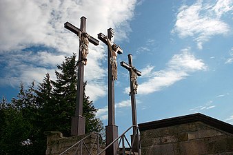
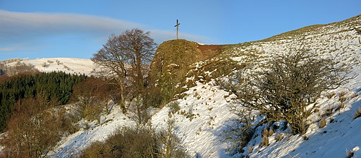
- Kreuzberg , the second highest mountain in Lower Franconia, third highest mountain in the Rhön (927.8 m above sea level)
- Osterburg castle ruins
- Black moor
- Red moor
- Arnsberg
- Rockenstein
- Heavenly Dunk Mountain
- Rothsee
- Holzberg hunting lodge
- Devil's mill
- Adventure mine on the Bauersberg
- Ski lifts on the Kreuzberg and on the Arnsberg
The former Holzberg hunting lodge (Holzberghof), today a restaurant and guesthouse
Others
Bischofsheim is a member of the Cittàslow movement to improve the quality of life by slowing down . The annual Braveheartbattle obstacle course has been taking place in Bischofsheim in the Rhön since 2016 .
Born in Bischofsheim
- Andreas Metz (1767–1839), German clergyman, philosopher, mathematician and professor
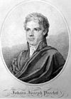
- Johann Joseph von Prechtl (1778–1854), Austrian technical researcher
- Johann Baptist Hergenröther (1780–1835), German theologian and clergyman
- Hans Schlenck (1901–1944), German actor, theater director and theater manager
- Hermann Hartmann (1914–1984), German chemist
- Wilhelm Freiherr von Waldenfels (* 1932), German physicist and mathematician
- Hansjürgen Garstka (* 1947), German data protection expert
See also
Web links
- City of Bischofsheim in the Rhön
- Website of the tourist information office in Bischofsheim in the Rhön
- Bischofsheim in der Rhön: Official statistics of the LfStat
Individual evidence
- ↑ "Data 2" sheet, Statistical Report A1200C 202041 Population of the municipalities, districts and administrative districts 1st quarter 2020 (population based on the 2011 census) ( help ).
- ^ The mayor of the town of Bischofsheim idRhön. City administration Bischofsheim idRhön, accessed on May 31, 2020 .
- ^ Information from Bayerischer Rundfunk on the renaming of Bischofsheim
- ↑ Destatis: Area changes from 01.01. until March 31 , 2020 from February 26, 2020, accessed on March 12, 2020
- ↑ http://www.bayerische-landesbibliothek-online.de/orte/ortssuche_action.html ? Anzeige=voll&modus=automat&tempus=+20111120/181525&attr=OBJ&val= 1589
- ^ Wilhelm Volkert (ed.): Handbook of Bavarian offices, communities and courts 1799–1980 . CH Beck, Munich 1983, ISBN 3-406-09669-7 , p. 428 .
- ^ Federal Statistical Office (ed.): Historical municipality directory for the Federal Republic of Germany. Name, border and key number changes for municipalities, counties and administrative districts from May 27, 1970 to December 31, 1982 . W. Kohlhammer GmbH, Stuttgart / Mainz 1983, ISBN 3-17-003263-1 , p. 740 and 741 .
- ↑ Municipal statistics 2013
- ↑ Results of the city council election 2020
- ↑ http://www.bischofsheim.rhoen-saale.net/Allgemeines/Rathaus/Ppolitik/Buergermeister--in
- ↑ https://www.rhoenundsaalepost.de/lokales/aktuelles/art2826,436262
- ↑ Entry on the coat of arms of Bischofsheim in the Rhön in the database of the House of Bavarian History
- ↑ a b c Bischofsheim Rhön at rhoentourist.de
- ^ Eva-Maria Wagner: Winding streets, humpback places . In: Die Rhön (= Merian , vol. 17 (1964), issue 4), pp. 19–24, here p. 21.


