
Graitschen at Bürgel
| coat of arms | Germany map | |
|---|---|---|

|
Coordinates: 50 ° 57 ' N , 11 ° 43' E |
|
| Basic data | ||
| State : | Thuringia | |
| County : | Saale-Holzland district | |
| Fulfilling municipality : | Bürgel | |
| Height : | 181 m above sea level NHN | |
| Area : | 4.66 km 2 | |
| Residents: | 398 (Dec. 31, 2019) | |
| Population density : | 85 inhabitants per km 2 | |
| Postal code : | 07616 | |
| Area code : | 036692 | |
| License plate : | SHK, EIS, SRO | |
| Community key : | 16 0 74 028 | |
| Association administration address: | Am Markt 1 07616 Bürgel |
|
| Website : | ||
| Mayoress : | Heike Langrock (independent) | |
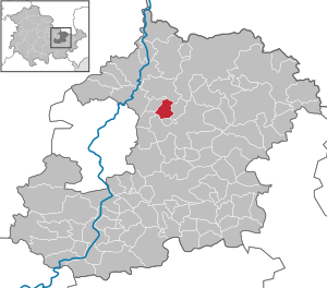
| Location of the municipality of Graitschen near Bürgel in the Saale-Holzland district | ||
  |
||


Graitschen bei Bürgel (officially: Graitschen b. Bürgel ) is a municipality in the Saale-Holzland district . The city of Bürgel is the fulfilling municipality .
geography
Graitschen lies in the valley of the tracks . Adjacent communities are Tautenburg in the north, Poxdorf in the east, Nausnitz and the city of Bürgel in the south and Jenalöbnitz and Löberschütz in the west.
Part of the old Gleisberg is located in the municipality , but its highest point is northeast of Graitschen in the neighboring municipality of Löberschütz . The mountain has an important prehistoric hilltop settlement.
coat of arms
Description of the coat of arms : In gold, a green bunch of grapes with two equally colored leaves on the stem surrounded by 12 red diamonds like a border .
history
Graitschen (formerly Graitzschen ) was first mentioned in 1146. But there were already settlements in the area in the Stone Age. The place names in the area (mostly ending with itz and ütz) indicate the Slavic origins of the villages.
About 1 km northeast of Graitschen, on the edge of the Poxdorfer Höhe, was a medieval castle. With the castle, the route across the Tautenburger forest to Wetzdorf was controlled. 1302, 1307 and 1327 a Dietrich von Graitzschen was mentioned. In 1380 an Anna von Graitzschen is known as the abbess of the Petersberg monastery near Eisenberg.
In 1836 the place had 338 inhabitants in 68 houses, a manor belonging to the von Wangenheim family and two mills.
The place belonged partly to the Ernestine offices of Dornburg and Eisenberg , which belonged to different Ernestine duchies due to several divisions . The Dornburg part belonged from 1815 to the Grand Duchy of Saxony-Weimar-Eisenach , which in 1850 affiliated it to the administrative district Weimar II ( administrative district Apolda ). The Eisenberg part was an exclave and until 1826 belonged to the Duchy of Saxony-Gotha-Altenburg . Around 1900 the place belonged to the Grand Duchy of Saxony-Weimar-Eisenach .
Historical monuments
A plaque at the entrance to the cemetery and a boulder next to their graves has been commemorating two forced laborers from Poland who are known by name and who were murdered by the Gestapo in 1945 . They were among the 30 prisoners of war and forced laborers from Poland and France who had to work in agriculture and forestry.
politics
The local council consists of six members, all of whom have been provided by the Graitschen community since the local elections on June 7, 2009.
Since the mayoral election on June 6, 2010, Heike Langrock, also from the Graitschen constituency, has been the honorary mayor.
Attractions

societies
The life of the community is shaped by numerous clubs such as the fire brigade club, the homeland club, the sports club (Spielvereinigung Rot / Weiß-Graitschen), the tractor friends and the Pentecostal club. Every year the fire brigade organizes the traditional maypole setting and for several years also the Christmas market.
fire Department
The community of Graitschen has an active volunteer fire brigade . The Graitschen fire brigade has a small fire engine (KLF-Thuringia) with a strength of 1/4 (1 group leader and 4 other emergency services) and basic fire fighting equipment. The comrades of the volunteer fire brigade Graitschen and the fire brigade association Graitschen eV also organize the traditional Maypole setting on May 1st and the Christmas market.
traffic
In 1905 Graitschen was connected to the Crossen – Porstendorf railway line with a stop , and in 1969 it was shut down again. A cycle path has been laid out on the Bürgel – Porstendorf stretch. Today the closest train station is Jena.

A country road runs through Graitschen, on which the bus line 433 Bürgel – Jena operated by JES Verkehrsgesellschaft mbH runs at regular intervals . In 2005, all weekend connections on the bus route were canceled without replacement for cost reasons. A pilot project in 2011 to reintroduce the buses met with little participation and was not continued. Graitschen has been part of the Central Thuringia Transport Association since 2010 .
Web links
- Private information page about Graitschen
- Pictures from Graitschen
- Topographic maps Thuringia, sheet name Bürgel, sheet no. 5036, edition 2016 ( TIFF file )
Individual evidence
- ^ Population of the municipalities from the Thuringian State Office for Statistics ( help on this ).
- ↑ Michael Köhler: Thuringian castles and fortified prehistoric and early historical living spaces. Jenzig-Verlag Köhler, Jena 2001, ISBN 3-910141-43-9 , p. 113.
- ↑ Jonathan C. Zenker : Historical-topographical pocket book of Jena and its surroundings, especially in scientific and medical relationship. Frommann, Jena 1836, p. 119 .
- ^ Johann Ernst Fabri : Geography for all estates. Part 1, Volume 4: Which contains the continuation and the resolution of the Upper Saxon Circle. Schwickert, Leipzig 1793, p. 227 .
- ↑ Geographical overview of the Saxon-Ernestine, Schwarzburg, Reussian and adjacent lands. Perthes, Gotha 1826, p. 86 f.
- ↑ Graitschen in the municipality register 1900 .
- ↑ Thuringian Association of the Persecuted of the Nazi Regime - Association of Antifascists and Study Group of German Resistance 1933–1945 (Ed.): Local history guide to sites of resistance and persecution 1933–1945. Volume 8: Thuringia. VAS - Verlag für Akademische Schriften, Frankfurt am Main 2003, ISBN 3-88864-343-0 , p. 209.
- ↑ Local elections in Thuringia - election results. Retrieved June 16, 2010
Albersdorf | Altenberga | Bad Klosterlausnitz | Bibra | Bobeck | Bremsnitz | Bucha | Bürgel | Crossing the Elster | Dornburg-Camburg | Eichenberg | Eineborn | Eisenberg | Frauenprießnitz | Outdoor orla | Geisenhain | Gneus | Golmsdorf | Gosen | Graitschen at Bürgel | Greater buckedra | Grosseutersdorf | Großlöbichau | Großpürschütz | Gumperda | Hainichen | Hainspitz | Hartmannsdorf | Heathland | Hermsdorf | Hummelshain | Jenalöbnitz | Kahla | Karlsdorf | Little buckedra | Kleinebersdorf | Kleineutersdorf | Laasdorf | Lehesten | Lindig | Lippersdorf-Erdmannsdorf | Löberschütz | Mertendorf | Meusebach | Milda | Möckern | Mörsdorf | Nausnitz | Neuengönna | Oberbodnitz | Orlamünde | Ottendorf | Petersberg | Poxdorf | Rattelsdorf | Rauda | Rauschwitz | Rausdorf | Reichenbach | Reinstädt | Renthendorf | Rothenstein | Ruttersdorf-Lotschen | Scheiditz | Schkölen | Grinding trips | Schlöben | Schöngleina | Schöps | Side rod | Serba | Silbitz | Stadtroda | St. Gangloff | Sulza | Tautenburg | Tautendorf | Tautenhain | Animal snail | Tissa | Trobnitz | Trockenborn-Wolfersdorf | Unterbodnitz | Waldeck | Walpernhain | Waltersdorf | Weissbach | Weißenborn | Wichmar | Rooms | Zollnitz