| Surname |
location |
category |
entry |
image
|
|
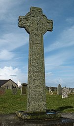
Hugh MacKay's grave
|
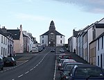
Orsay
55 ° 40 ′ 32.8 " N , 6 ° 30 ′ 44" W.55.675777777778 -6.5122222222222
|
B.
|
11895
|
|
|
Farm near Ballymeanach
|
near Ballymeanach
55 ° 41 ′ 27.7 " N , 6 ° 30 ′ 12.4" W.55.691027777778 -6.5034444444444
|
B.
|
11896
|
|
|
St. Ciaran's Chapel
|
Kilchiaran
55 ° 45 ′ 12.2 " N , 6 ° 27 ′ 25.2" W.55.753388888889 -6.457
|
B.
|
11897
|

|
|
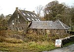
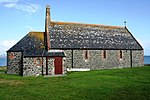
Kilchiaran Farmhouse
|
Kilchiaran
55 ° 40 ′ 32.8 " N , 6 ° 30 ′ 44" W.55.675777777778 -6.5122222222222
|
B.
|
11898
|

|
|
Kilchiaran steading
|
Kilchiaran
55 ° 45 ′ 19.4 " N , 6 ° 27 ′ 12" W.55.755388888889 -6.4533333333333
|
B.
|
11899
|

|
|
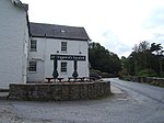
Bruichladdich distillery
|
Bruichladdich
55 ° 45 ′ 53.2 " N , 6 ° 21 ′ 42.6" W.55.764777777778 -6.3618333333333
|
C.
|
11900
|

|
|
Foreland House
|
near Lyrabus
55 ° 47 ′ 41.8 " N , 6 ° 21 ′ 26.5" W.55.794944444444 -6.3573611111111
|
B.
|
11901
|
|
|
Kilchoman Church
|
near Kilchoman
55 ° 46 ′ 55.4 " N , 6 ° 26 ′ 29.5" W.55.782055555556 -6.4415277777778
|
B.
|
11902
|

|
|
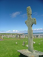
Kilchoman Cross
|
near Kilchoman
55 ° 46 ′ 54.5 " N , 6 ° 26 ′ 29.9" W.55.781805555556 -6.4416388888889
|
B.
|
11903
|
|
|
Kilslevan House
|
near Port Charlotte
55 ° 44 ′ 52.8 " N , 6 ° 22 ′ 27.9" W.55.748 -6.3744166666667
|
B.
|
11904
|
|
|
Kilnave Chapel
|
Kilnave
55 ° 51 ′ 36.7 " N , 6 ° 20 ′ 24.5" W.55.860194444444 -6.3401388888889
|
B.
|
11905
|

|
|
Kilnave Cross
|
Kilnave
55 ° 51 ′ 37.2 " N , 6 ° 20 ′ 25" W.55.860333333333 -6.3402777777778
|
B.
|
11906
|
|
|
Ardnave House
|
Ardnave
55 ° 52 ′ 24.8 " N , 6 ° 20 ′ 41.2" W.55.873555555556 -6.3447777777778
|
B.
|
11907
|

|
|
Ardnave steading
|
Ardnave
55 ° 52 ′ 25.8 " N , 6 ° 20 ′ 45" W.55.873833333333 -6.3458333333333
|
B.
|
11908
|

|
|
Nave Island Chapel
|
Nave
55 ° 53 ′ 58.4 ″ N , 6 ° 20 ′ 1.2 ″ W.55.899555555556 -6.3336666666667
|
B.
|
11909
|

|
|
Craigens Farm
|
near Lyrabus
55 ° 49 '18.8 " N , 6 ° 18' 58.8" W.55.821888888889 -6.3163333333333
|
B.
|
11910
|
|
|
Gorton School
|
near Bruichladdich
55 ° 46 ′ 47.4 ″ N , 6 ° 21 ′ 8.8 ″ W.55.779833333333 -6.3524444444444
|
B.
|
11911
|

|
|
26-29 Shore Street
|
Port Charlotte
55 ° 44 ′ 20.6 " N , 6 ° 22 ′ 41.7" W.55.739055555556 -6.37825
|
B.
|
11924
|

|
|
22-24 Shore Street
|
Port Charlotte
55 ° 44 ′ 19.8 " N , 6 ° 22 ′ 39.8" W.55.738833333333 -6.3777222222222
|
B.
|
11925
|
|
|
Campbell House
|
Port Charlotte
55 ° 44 ′ 19.5 " N , 6 ° 22 ′ 40.5" W.55.73875 -6.3779166666667
|
C.
|
11926
|
|
|
Woodrow and Ross House
|
Port Charlotte
55 ° 44 ′ 19.6 " N , 6 ° 22 ′ 41" W.55.738777777778 -6.3780555555556
|
C.
|
11927
|
|
|
13-18 Main Street
|
Port Charlotte
55 ° 44 ′ 20.6 " N , 6 ° 22 ′ 41.7" W.55.739055555556 -6.37825
|
B.
|
11928
|
|
|
81-86 Main Street
|
Port Charlotte
55 ° 44 ′ 22.7 " N , 6 ° 22 ′ 42.5" W.55.739638888889 -6.3784722222222
|
B.
|
11929
|
|
|
75-80 Main Street
|
Port Charlotte
55 ° 44 ′ 16.7 " N , 6 ° 22 ′ 47.5" W.55.737972222222 -6.3798611111111
|
B.
|
11930
|
|
|
65-68 Main Street
|
Port Charlotte
55 ° 44 ′ 18.8 " N , 6 ° 22 ′ 44.8" W.55.738555555556 -6.3791111111111
|
B.
|
11931
|
|
|
Main Street Cottage
|
Port Charlotte
55 ° 44 ′ 17.5 " N , 6 ° 22 ′ 46.4" W.55.738194444444 -6.3795555555556
|
C.
|
11932
|
|
|
Laggan View
|
Port Charlotte
55 ° 44 ′ 17 " N , 6 ° 22 ′ 47" W.55.738055555556 -6.3797222222222
|
C.
|
11933
|
|
|
Campbell Houses
|
Port Charlotte
55 ° 44 ′ 16.7 " N , 6 ° 22 ′ 47.5" W.55.737972222222 -6.3798611111111
|
C.
|
11934
|
|
|
Old Blacksmith's House
|
Port Charlotte
55 ° 44'15.2 " N , 6 ° 22'49.3" W.55.737555555556 -6.3803611111111
|
C.
|
11935
|
|
|
West End Cottage
|
Port Charlotte
55 ° 44'15 " N , 6 ° 22'49.7" W.55.7375 -6.3804722222222
|
C.
|
11936
|
|
|
Lochview Cottage
|
Port Charlotte
55 ° 44 ′ 12.5 " N , 6 ° 22 ′ 53.9" W.55.736805555556 -6.3816388888889
|
C.
|
11937
|
|
|
Achnamara
|
Port Charlotte
55 ° 44 ′ 15.8 " N , 6 ° 22 ′ 47.2" W.55.737722222222 -6.3797777777778
|
C.
|
11938
|
|
|
Clark Cottage
|
Port Charlotte
55 ° 44 ′ 16 " N , 6 ° 22 ′ 46.9" W.55.737777777778 -6.3796944444444
|
C.
|
11939
|
|
|
Portnahaven Church
|
Portnahaven
55 ° 40 ′ 52 " N , 6 ° 30 ′ 24.2" W.55.681111111111 -6.5067222222222
|
B.
|
11940
|

|
|
Port Charlotte Village Hall
|
Port Charlotte
55 ° 44 ′ 20.4 " N , 6 ° 22 ′ 48.7" W.55.739 -6.3801944444444
|
B.
|
11941
|

|
|
Old Portnahaven rectory
|
near Portnahaven
55 ° 40 ′ 52 ″ N , 6 ° 30 ′ 10.2 ″ W55.681111111111 -6.5028333333333
|
C.
|
11942
|
|
|
Atlantic View
|
Portnahaven
55 ° 40 ′ 48.1 " N , 6 ° 30 ′ 20.3" W.55.680027777778 -6.5056388888889
|
C.
|
11943
|
|
|
Rhinns of Islay Lighthouse
|
Orsay
55 ° 40 ′ 23 " N , 6 ° 30 ′ 47.2" W.55.673055555556 -6.5131111111111
|
A.
|
11944
|

|
|
St Oran's Chapel
|
Orsay
55 ° 40 ′ 31.9 " N , 6 ° 30 ′ 44.4" W.55.675527777778 -6.5123333333333
|
B.
|
11945
|
|
|
Kilchoman House
|
Kilchoman
55 ° 46 ′ 52 ″ N , 6 ° 26 ′ 26.1 ″ W.55.781111111111 -6.4405833333333
|
C.
|
11946
|
|
| Customs warehouse of the Lochindaal distillery
|
Port Charlotte
55 ° 44 ′ 28.4 " N , 6 ° 22 ′ 43.7" W.55.741222222222 -6.3788055555556
|
C.
|
11947
|

|
|
33-41 Main Street
|
Port Charlotte
55 ° 44'25.2 " N , 6 ° 22'44.7" W.55.740333333333 -6.3790833333333
|
B.
|
11948
|

|
|
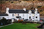
Port Charlotte Hotel
|
Port Charlotte
55 ° 44 ′ 24.5 " N , 6 ° 22 ′ 42" W.55.740138888889 -6.3783333333333
|
C.
|
11949
|
|
|
Ardview Hotel
|
Port Ellen
55 ° 37 ′ 47.6 ″ N , 6 ° 11 ′ 9.6 ″ W.55.629888888889 -6.186
|
C.
|
11969
|

|
|
31-35 School Street
|
Port Ellen
55 ° 37 ′ 46.2 " N , 6 ° 11 ′ 21.3" W.55.6295 -6.18925
|
C.
|
11970
|
|
|
Port Ellen Distillery
|
Port Ellen
55 ° 38 ′ 1.3 ″ N , 6 ° 11 ′ 49.5 ″ W.55.633694444444 -6.1970833333333
|
B.
|
11971
|

|
|
The Oa Church
|
near Coillabus
55 ° 36 '43.2 " N , 6 ° 16' 0.2" W.55.612 -6.2667222222222
|
C.
|
11972
|

|
|
Port Ellen Lighthouse
|
near Kilnaughton
55 ° 37 ′ 12.9 " N , 6 ° 12 ′ 42.1" W.55.62025 -6.2116944444444
|
B.
|
11973
|

|
|
Mechtan's Church
|
Kilnaughton
55 ° 37 ′ 40.3 " N , 6 ° 13 ′ 13.8" W.55.627861111111 -6.2205
|
B.
|
11974
|

|
|
Texa Chapel
|
Texa
55 ° 37 '4.4 " N , 6 ° 8" 43 " W.55.617888888889 -6.1452777777778
|
B.
|
11975
|
|
|
Kildalton Small Cross
|
Kintour
55 ° 41 '4.4 " N , 6 ° 2' 41.9" W.55.684555555556 -6.0449722222222
|
B.
|
11999
|

|
|
Ardtalla Farm
|
Ardtalla
55 ° 43 ′ 5.3 " N , 6 ° 2 ′ 9.5" W.55.718138888889 -6.0359722222222
|
C.
|
12000
|
|
|
Kildalton Castle
|
near Ardbeg
55 ° 39 ′ 12 " N , 6 ° 4 ′ 34" W.55.653333333333 -6.0761111111111
|
C.
|
12001
|
|
|
144-145 Frederick Crescent
|
Port Ellen
55 ° 37 ′ 33.8 " N , 6 ° 11 ′ 14.2" W.55.626055555556 -6.1872777777778
|
C.
|
12002
|
|
|
The Grange
|
Port Ellen
55 ° 37 ′ 51.5 " N , 6 ° 10 ′ 52.3" W.55.630972222222 -6.1811944444444
|
C.
|
12003
|
|
|
Bunnahabhain distillery
|
Bunnahabhain
55 ° 52 ′ 57.7 " N , 6 ° 7 ′ 33.9" W.55.882694444444 -6.1260833333333
|
C.
|
12116
|

|
|
Rhuvaal Lighthouse
|
Ruvaal
55 ° 56 '11.1 " N , 6 ° 7' 24.7" W.55.936416666667 -6.1235277777778
|
B.
|
12117
|

|
|
Sornbank House
|
Bridgend
55 ° 46 ′ 54.2 " N , 6 ° 14 ′ 58.4" W.55.781722222222 -6.2495555555556
|
B.
|
12141
|
|
|
Islay House
|
near Bridgend
55 ° 47 ′ 6 " N , 6 ° 15 ′ 14.2" W.55.785 -6.2539444444444
|
A.
|
12142
|

|
|
Islay Woolen Mill
|
near Bridgend
55 ° 47 ′ 22.4 " N , 6 ° 13 ′ 29.5" W.55.789555555556 -6.2248611111111
|
A.
|
12143
|
|
|
Islay Home Farm
|
Bridgend
55 ° 47 '5.6 " N , 6 ° 15" 5.2 " W.55.784888888889 -6.2514444444444
|
B.
|
12144
|

|
|
Dry Bridge
|
Bridgend
55 ° 46 ′ 58.1 ″ N , 6 ° 14 ′ 57 ″ W.55.782805555556 -6.2491666666667
|
C.
|
12145
|
|
|
West Lodge
|
Bridgend
55 ° 46 ′ 54 " N , 6 ° 15 ′ 6.4" W.55.781666666667 -6.2517777777778
|
C.
|
12146
|
|
|
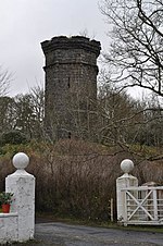
East tower
|
Bridgend
55 ° 46 ′ 55.1 ″ N , 6 ° 15 ′ 5.9 ″ W.55.781972222222 -6.2516388888889
|
B.
|
12147
|
|
|
West tower
|
near Bridgend
55 ° 47 '2.3 " N , 6 ° 16" 24 " W.55.783972222222 -6.2733333333333
|
B.
|
12148
|
|
|
Bluehouse
|
Bridgend
55 ° 47 ′ 9 " N , 6 ° 15 ′ 36.9" W.55.785833333333 -6.26025
|
B.
|
12149
|
|
|
Eallabus House
|
near Bridgend
55 ° 47 ′ 20.3 " N , 6 ° 15 ′ 6.3" W.55.788972222222 -6.25175
|
B.
|
12150
|
|
|
Newton House
|
near Bridgend
55 ° 47 '4.1 " N , 6 ° 14" 11.5 " W.55.784472222222 -6.2365277777778
|
C.
|
12151
|
|
|
Daill House
|
near Bridgend
55 ° 47 '4.6 " N , 6 ° 12" 25.7 " W.55.784611111111 -6.2071388888889
|
B.
|
12152
|
|
|
East Lodge
|
near Bridgend
55 ° 47 ′ 46.9 " N , 6 ° 12 ′ 59.5" W.55.796361111111 -6.2165277777778
|
B.
|
12153
|
|
|
Kilmeny Parish Church
|
Kilmeny
55 ° 48 ′ 50.5 " N , 6 ° 10 ′ 5.1" W.55.814027777778 -6.1680833333333
|
B.
|
12154
|

|
|
Old Kilmeny rectory
|
Kilmeny
55 ° 48 ′ 47.9 " N , 6 ° 10 ′ 16.1" W.55.813305555556 -6.1711388888889
|
B.
|
12155
|
|
|
Emeraconart Cottage
|
near Esknish
55 ° 48 ′ 34.2 " N , 6 ° 11 ′ 54.8" W.55.8095 -6.1985555555556
|
C.
|
12156
|
|
|
Knocklearoch Farm
|
near Ballygrant
55 ° 48 '27 " N , 6 ° 9" 8.3 " W.55.8075 -6.1523055555556
|
C.
|
12157
|
|
|
Finlaggan Castle
|
Loch Finlaggan
55 ° 50 ′ 7 " N , 6 ° 10 ′ 21.8" W.55.835277777778 -6.1727222222222
|
C.
|
12158
|

|
|
Finlaggan Chapel
|
Loch Finlaggan
55 ° 50 '7.9 " N , 6 ° 10' 19.4" W.55.835527777778 -6.1720555555556
|
C.
|
12159
|

|
|
Dunlossite House
|
near Port Askaig
55 ° 50 ′ 44.7 " N , 6 ° 6 ′ 15.4" W.55.84575 -6.1042777777778
|
C.
|
12160
|

|
|
Heatherhouse
|
Caol Ila
55 ° 51 '4.2 " N , 6 ° 7' 4" W.55.851166666667 -6.1177777777778
|
B.
|
12161
|
|
|
Port Askaig Hotel
|
Port Askaig
55 ° 50 ′ 51.7 " N , 6 ° 6 ′ 19.5" W.55.847694444444 -6.1054166666667
|
C.
|
12162
|

|
|
Port Askaig shop
|
Port Askaig
55 ° 50 ′ 52.6 " N , 6 ° 6 ′ 20.9" W.55.847944444444 -6.1058055555556
|
C.
|
12163
|
|
|
Port Askaig jetty
|
Port Askaig
55 ° 50 '53.1 " N , 6 ° 6' 17.4" W.55.848083333333 -6.1048333333333
|
C.
|
12164
|

|
|
Port Askaig post office
|
Port Askaig
55 ° 50 ′ 54.2 " N , 6 ° 6 ′ 18.4" W.55.848388888889 -6.1051111111111
|
C.
|
12165
|

|
|
Macbrane's Storehouse
|
Port Askaig
55 ° 50 ′ 55.4 " N , 6 ° 6 ′ 18.1" W.55.848722222222 -6.1050277777778
|
C.
|
12166
|
|
|
Kilarrow Parish Church
|
Bowmore
55 ° 46 ′ 32.3 " N , 6 ° 14 ′ 55.9" W.55.775638888889 -6.2488611111111
|
A.
|
12184
|
|
|
Town Hall
|
Bowmore
55 ° 45 ′ 21.2 " N , 6 ° 17 ′ 12.9" W.55.755888888889 -6.2869166666667
|
B.
|
12185
|
|
|
59-60 Jamieson Street
|
Bowmore
55 ° 45 '24.5 " N , 6 ° 17' 4.7" W.55.756805555556 -6.2846388888889
|
C.
|
12186
|
|
|
Island House
|
near Bowmore
55 ° 43 ′ 43.3 " N , 6 ° 17 ′ 23" W.55.728694444444 -6.2897222222222
|
B.
|
12187
|
|
|
John Francis Campbell Monument
|
near Bridgend
55 ° 46 ′ 32.3 " N , 6 ° 14 ′ 55.9" W.55.775638888889 -6.2488611111111
|
C.
|
12188
|

|
|
Bridgend Hotel
|
Bridgend
55 ° 46 ′ 51.4 " N , 6 ° 14 ′ 56.5" W.55.780944444444 -6.2490277777778
|
C.
|
12189
|
|
|
Mailroom (Bridgend)
|
Bridgend
55 ° 46 ′ 53.1 " N , 6 ° 14 ′ 59.2" W.55.781416666667 -6.2497777777778
|
C.
|
12190
|
|
|
Sorn Bridge
|
Bridgend
55 ° 46 ′ 53.7 " N , 6 ° 14 ′ 57.9" W.55.781583333333 -6.2494166666667
|
B.
|
12191
|
|
|
61 Jamieson Street
|
Bowmore
55 ° 45 ′ 24.7 " N , 6 ° 17 ′ 4" W.55.756861111111 -6.2844444444444
|
C.
|
12428
|
|
|
House on Shore Street
|
Bowmore
55 ° 45 ′ 26.2 " N , 6 ° 17 ′ 10.9" W.55.757277777778 -6.2863611111111
|
B.
|
12429
|
|
|
Laggan Bridge
|
near Bowmore
55 ° 43 ′ 51 ″ N , 6 ° 17 ′ 11 ″ W.55.730833333333 -6.2863888888889
|
C.
|
12430
|
|
|
Bridge House
|
near Bowmore
55 ° 43 ′ 51 ″ N , 6 ° 17 ′ 10 ″ W.55.730833333333 -6.2861111111111
|
C.
|
12431
|
|
|
Gate entrance to the nursery of Islay House
|
Bridgend
55 ° 46 '53.7 " N , 6 ° 15' 4.7" W.55.781583333333 -6.2513055555556
|
C.
|
12432
|
|
|
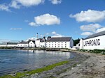
Laphroaig distillery
|
near Lagavulin
55 ° 47 '37 " N , 6 ° 9' 5" W.55.793611111111 -6.1513888888889
|
C.
|
12435
|
|
|
1-2 Rhu
|
Port Charlotte
55 ° 44 ′ 17.4 " N , 6 ° 22 ′ 42.7" W.55.738166666667 -6.3785277777778
|
B.
|
12436
|
|
|
Portnahaven School
|
Portnahaven
55 ° 40 '49.2 " N , 6 ° 30' 3.4" W.55.680333333333 -6.5009444444444
|
B.
|
12437
|

|
|
Bowmore Free Church
|
Bowmore
55 ° 45 '22.1 " N , 6 ° 17' 2.1" W.55.756138888889 -6.2839166666667
|
C.
|
12947
|
|
|
1-2 Port Wemyss
|
Port Wemyss
55 ° 40 ′ 35.5 " N , 6 ° 30 ′ 17.9" W.55.676527777778 -6.5049722222222
|
B.
|
13792
|

|
|
8-12 Shore Street
|
Port Charlotte
55 ° 44 ′ 23.5 " N , 6 ° 22 ′ 39.9" W.55.739861111111 -6.37775
|
B.
|
13793
|
|
|
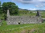
Kildalton Chapel
|
near Kintour
55 ° 41 ′ 2.7 " N , 6 ° 2 ′ 43.6" W.55.684083333333 -6.0454444444444
|
B.
|
13797
|
|
|
St Kiaran's Church
|
near Port Charlotte
55 ° 45 ′ 6.2 " N , 6 ° 22 ′ 21.6" W.55.751722222222 -6.3726666666667
|
B.
|
13818
|
|
|
Dunlossite memorial cross
|
near Port Askaig
55 ° 50 ′ 49.9 " N , 6 ° 6 ′ 31.6" W.55.847194444444 -6.1087777777778
|
C '
|
47367
|
|
|
St John's Church
|
Port Ellen
55 ° 37 ′ 40.4 " N , 6 ° 10 ′ 58.7" W.55.627888888889 -6.1829722222222
|
B.
|
49190
|
|


.jpg)


.jpg)


.jpg)


.jpg)


.jpg)


