Mézières-en-Gâtinais
| Mézières-en-Gâtinais | ||
|---|---|---|

|
|
|
| region | Center-Val de Loire | |
| Department | Loiret | |
| Arrondissement | Montargis | |
| Canton | Lorris | |
| Community association | Canaux et Forêts en Gâtinais | |
| Coordinates | 48 ° 2 ′ N , 2 ° 29 ′ E | |
| height | 92-111 m | |
| surface | 9.86 km 2 | |
| Residents | 272 (January 1, 2017) | |
| Population density | 28 inhabitants / km 2 | |
| Post Code | 45270 | |
| INSEE code | 45205 | |
Mezieres-en-Gâtinais is a commune with 272 inhabitants (as of January 1 2017) in the department of Loiret in the region Center-Val de Loire . It is part of the canton of Lorris (until 2015: canton of Bellegarde ) in the arrondissement of Montargis . The inhabitants are called Macériens .
geography
Mézières-en-Gâtinais is about 40 kilometers east-northeast of Orléans . Mézières-en-Gâtinais is surrounded by the neighboring communities Juranville in the north, Lorcy in the east and northeast, Ladon in the east and southeast, Ouzouer-sous-Bellegarde in the south, Fréville-du-Gâtinais in the west and Saint-Loup-des-Vignes in the Northwest.
Population development
| 1962 | 1968 | 1975 | 1982 | 1990 | 1999 | 2006 | 2013 | |
|---|---|---|---|---|---|---|---|---|
| 283 | 257 | 204 | 207 | 210 | 183 | 254 | 262 | |
| Source: Cassini and INSEE | ||||||||
Attractions
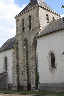
- Saint-Benoît-et-Saint-Blaise church
Web links
Commons : Mézières-en-Gâtinais - Collection of images, videos and audio files

