
Möckern (Thuringia)
| coat of arms | Germany map | |
|---|---|---|
 Help on coat of arms |
Coordinates: 50 ° 51 ' N , 11 ° 46' E |
|
| Basic data | ||
| State : | Thuringia | |
| County : | Saale-Holzland district | |
| Fulfilling municipality : | Stadtroda | |
| Height : | 285 m above sea level NHN | |
| Area : | 5.34 km 2 | |
| Residents: | 107 (Dec. 31, 2019) | |
| Population density : | 20 inhabitants per km 2 | |
| Postal code : | 07646 | |
| Area code : | 036428 | |
| License plate : | SHK, EIS, SRO | |
| Community key : | 16 0 74 058 | |
| Association administration address: | Straße des Friedens 17 07646 Stadtroda |
|
| Website : | ||
| Mayor : | Dietmar Schleßiger | |
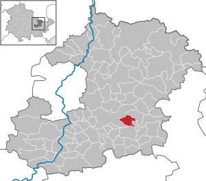
| Location of the municipality Möckern in the Saale-Holzland district | ||
  |
||

Möckern is a municipality in the Saale-Holzland district . The fulfilling municipality is the city of Stadtroda .

geography
The village is located about two kilometers east of the city center of Stadtroda. Adjacent communities are Mörsdorf in the east, Lippersdorf-Erdmannsdorf in the south, Tissa in the west and Quirla in the north. The village road leading through the village connects Möckern with Quirla and with Ulrichswalde in the southwest. The form of settlement corresponds to that of a cluster village . In the middle of the village stands the church ( Lage → ) with the oval cemetery surrounded by a wall.
history
In 1281 the first mention of the town of Möckern took place. Landlords were u. a. that of Obernitz
Attractions
Individual evidence
- ^ Population of the municipalities from the Thuringian State Office for Statistics ( help on this ).
- ^ Wolfgang Kahl : First mention of Thuringian towns and villages. A manual. 5th improved and significantly expanded edition, new edition. Rockstuhl, Bad Langensalza 2010, ISBN 978-3-86777-202-0 , p. 182.
Web links
Albersdorf | Altenberga | Bad Klosterlausnitz | Bibra | Bobeck | Bremsnitz | Bucha | Bürgel | Crossing the Elster | Dornburg-Camburg | Eichenberg | Eineborn | Eisenberg | Frauenprießnitz | Outdoor orla | Geisenhain | Gneus | Golmsdorf | Gosen | Graitschen at Bürgel | Greater buckedra | Grosseutersdorf | Großlöbichau | Großpürschütz | Gumperda | Hainichen | Hainspitz | Hartmannsdorf | Heathland | Hermsdorf | Hummelshain | Jenalöbnitz | Kahla | Karlsdorf | Little buckedra | Kleinebersdorf | Kleineutersdorf | Laasdorf | Lehesten | Lindig | Lippersdorf-Erdmannsdorf | Löberschütz | Mertendorf | Meusebach | Milda | Möckern | Mörsdorf | Nausnitz | Neuengönna | Oberbodnitz | Orlamünde | Ottendorf | Petersberg | Poxdorf | Rattelsdorf | Rauda | Rauschwitz | Rausdorf | Reichenbach | Reinstädt | Renthendorf | Rothenstein | Ruttersdorf-Lotschen | Scheiditz | Schkölen | Grinding trips | Schlöben | Schöngleina | Schöps | Side rod | Serba | Silbitz | Stadtroda | St. Gangloff | Sulza | Tautenburg | Tautendorf | Tautenhain | Animal snail | Tissa | Trobnitz | Trockenborn-Wolfersdorf | Unterbodnitz | Waldeck | Walpernhain | Waltersdorf | Weissbach | Weißenborn | Wichmar | Rooms | Zollnitz