
Metelsdorf
| coat of arms | Germany map | |
|---|---|---|

|
Coordinates: 53 ° 51 ' N , 11 ° 26' E |
|
| Basic data | ||
| State : | Mecklenburg-Western Pomerania | |
| County : | Northwest Mecklenburg | |
| Office : | Mecklenburg-Bad Kleinen village | |
| Height : | 30 m above sea level NHN | |
| Area : | 8.21 km 2 | |
| Residents: | 493 (Dec. 31, 2019) | |
| Population density : | 60 inhabitants per km 2 | |
| Postal code : | 23972 | |
| Area code : | 03841 | |
| License plate : | NWM, GDB, GVM, WIS | |
| Community key : | 13 0 74 053 | |
| Office administration address: | Am Wehberg 17 23972 Dorf Mecklenburg |
|
| Website : | ||
| Mayor : | Ulrich Guild | |
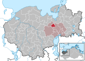
| Location of the municipality Metelsdorf in the district of Northwest Mecklenburg | ||
  |
||

Metelsdorf is a municipality in the district of Northwest Mecklenburg in Mecklenburg-Western Pomerania, Germany. The municipality is administered by the Amt Dorf Mecklenburg-Bad Kleinen , based in the municipality of Dorf Mecklenburg .
Agriculture still plays a role in the community today. Metelsdorf's fountains have been supplying the port city of Wismar for hundreds of years.
geography
The municipality of Metelsdorf is located in hilly terrain on the southern city limits of the Hanseatic city of Wismar . The Tridamsberg in the municipality reaches a height of 56 m above sea level. NN . At the Wismar-Mitte motorway junction , which touches the north of the municipality of Metelsdorf, the construction of the route from Lübeck to Stettin began in 1992 with the groundbreaking for the A 20 Baltic Sea motorway .
The districts of Klüssendorf, Martensdorf and Schulenbrook belong to Metelsdorf.
history
In the 17th century the place was called "Martensdorp". On July 1, 1950, the previously independent municipality of Klüssendorf was incorporated.
politics
coat of arms
|
|
Blazon : “Split; in front in silver half a ten-spoke red wheel at the gap; in the back four (1: 2: 1) silver drops of water in blue. "
The coat of arms was designed by the Wismar company Werbetechnik Vagt based on a design by Wismar's Peter Neichel . It was approved by the Ministry of the Interior on April 20, 1999 and registered under No. 186 of the coat of arms of the state of Mecklenburg-Western Pomerania. |
| Reasons for the coat of arms: In the coat of arms, the half red wheel borrowed from the von Stralendorf family's coat of arms reminds of the temporary local lords. The water droplets are intended to symbolize the Metelsdorfer Spring on the one hand, and to indicate the number of the four districts of the community on the other. |
flag
The flag is evenly striped lengthways with red, white and red. In the center of the flag, at half the height of the two red stripes, is the municipal coat of arms. The relation of the height of the flag cloth to the length is like 3: 5.
Official seal
The official seal shows the municipal coat of arms with the inscription "GEMEINDE METELSDORF • LANDKREIS NORDWESTMECKLENBURG".
Transport links
The proximity to Wismar and the Baltic Sea coast as well as the good transport connections (in addition to the autobahn, Metelsdorf is also on the federal highway 208 to Gadebusch ) have a major influence on building activity in the community, which has become a popular place to live. Like all municipalities in Mecklenburg-Western Pomerania, which are located on the periphery of larger cities, Metelsdorf also has a strong increase in population.
Sons and daughters
Klüssendorf:
- Karl Friedrich Deiters (1807–1879), economist and parliamentarian
Web links
Individual evidence
- ↑ Statistisches Amt MV - population status of the districts, offices and municipalities 2019 (XLS file) (official population figures in the update of the 2011 census) ( help ).
- ↑ Hans-Heinz Schütt: On shield and flag - the coats of arms and flags of the state of Mecklenburg-Western Pomerania and its municipalities . Ed .: production office TINUS; Schwerin. 2011, ISBN 978-3-9814380-0-0 , pp. 172/173 .
- ↑ a b main statute § 1 (PDF).

Alt Meteln | Bad little ones | Barnekov | Benz | Bernstorf | Bibow | Blowatz | Bobitz | Boiensdorf | Boltenhagen | Brüsewitz | Carlow | Cramonshagen | Dalberg-Wendelstorf | Damshagen | Dassow | Dechow | Mecklenburg village | Dragun | Gadebusch | Gägelow | Glasin | God's gift | Grambov | Grevesmühlen | Greaves | Large Molzahn | Big Stieten | Hohenkirchen | Tall beasts | Holdorf | Hornstorf | Poel Island | Jesendorf | Kalkhorst | Klein Trebbow | Klütz | Kneese | Koenigsfeld | Krembz | Krusenhagen | Lübberstorf | Luebow | Lübstorf | Lüdersdorf | Lützow | Menzendorf | Metelsdorf | Mills Eichsen | Neuburg | Neukloster | Passee | Perlin | Pingelshagen | Pokrent | Rehna | Rieps | Roduchelstorf | Roggendorf | Rye peat | Rögnitz | Rüting | Schildenal | Schlagsdorf | Schoenberg | Seehof | Selmsdorf | Siemz-Niendorf | Stepenitztal | Testorf-Steinfort | Thandorf | Upahl | Utecht | Veelböken | Ventschow | Warin | Warnow | Wedendorfersee | Wismar | Zickhusen | Zierow | Zurow | Züsow