
Big Molzahn
| coat of arms | Germany map | |
|---|---|---|

|
Coordinates: 53 ° 44 ' N , 10 ° 52' E |
|
| Basic data | ||
| State : | Mecklenburg-Western Pomerania | |
| County : | Northwest Mecklenburg | |
| Office : | Rehna | |
| Height : | 48 m above sea level NHN | |
| Area : | 6.31 km 2 | |
| Residents: | 393 (Dec. 31, 2019) | |
| Population density : | 62 inhabitants per km 2 | |
| Postal code : | 19217 | |
| Area code : | 038875 | |
| License plate : | NWM, GDB, GVM, WIS | |
| Community key : | 13 0 74 028 | |
| Office administration address: | Freiheitsplatz 1 19217 Rehna |
|
| Website : | ||
| Mayor : | Maurice Huebner | |
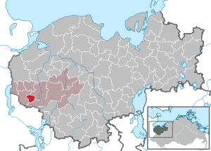
| Location of the community of Groß Molzahn in the district of Northwest Mecklenburg | ||
  |
||

Groß Molzahn is a municipality in the west of the district of Northwest Mecklenburg in Mecklenburg-Western Pomerania (Germany). The municipality is administered by the Rehna Office , based in the city of the same name .
geography
The community of Groß Molzahn in the Schaalsee Biosphere Reserve is located about eight kilometers northeast of Ratzeburg and 17 kilometers southwest of the Rehna headquarters. The area around Groß Molzahn is rich in hills, forests and lakes ( Mechower See , Lankower See , Röggeliner See ). The lakes are designated as nature reserves .
If you move through the center of the village, the so-called Rundlingdorf , you will notice strong differences in altitude. The elevation profile runs from north to south and corresponds to the direction of flow of the Vistula Ice Age glacier at that time .
Once filled with water, parts of the inaccessible lowlands were piped to be used for agriculture. The number of fields is just over 45 points. This means that the agricultural areas are among the most fertile in the state of Mecklenburg-Western Pomerania.
The appearance of the uncultivated areas is determined by wild flowering plants as well as by deciduous and coniferous trees. All of these areas are protected by inclusion in the nature reserve. Even trees, above a certain size on private land, may therefore only be felled with a corresponding permit. Some of the surrounding areas were bought by the Schaalsee Landscape Association in order to develop them into nature conservation areas.
Nature conservation, including species protection, is thus a determining factor for the municipality with a rural character.
history
Molzahn was first mentioned in a document in the Ratzeburg tithe register in 1230 .
In August 1945, seven young people were arrested by the Soviet NKVD and interned in special camp No. 9 Fünfeichen (Neubrandenburg). Nothing is known about their further fate.
In the GDR era, the community was in the restricted area . The inner-German border - today the state border with Schleswig-Holstein - is just under three kilometers away.
On July 1, 1950, the previously independent communities of Klein Molzahn and Lankow were incorporated.
A dairy cattle facility was built north of the village around 1970 and is still in use today. The machine-tractor station (MTS) , which is no longer in operation, also dates from this time . Groß Molzahn was one of the four technical bases in the Gadebusch district .
The NVA operated helipad 3370 for the radio engineering company 432, one and a half kilometers northwest of Groß Molzahn. This was not taken over by the Bundeswehr and was decommissioned. Since the collapse of the GDR and the associated loss of the restricted area status, Groß Molzahn has enjoyed population growth and improved infrastructural integration into the region.
politics
Community representation
The election of May 26, 2019 had the following results:
- 4 seats - community of voters Groß Molzahn
- 2 seats - single applicants
Coat of arms, flag, official seal
The municipality has no officially approved national emblem, neither a coat of arms nor a flag. The official seal is the small state seal with the coat of arms of the state of Mecklenburg. It shows a looking bull's head with torn off neck fur and crown and the inscription "GEMEINDE GROß MOLZAHN • LANDKREIS NORDWESTMECKLENBURG".
Attractions
The so-called “Grenzland-Tour” around the Lankower See is tailored to riding tourists and hikers. There is part of the Mönch-Ernestus hiking trail on the Rehna-Ratzeburg route. The surroundings of Groß Molzahn with agricultural areas, wet meadows and swamp forests are habitats for rare species such as crane, cormorant, white-tailed eagle, bittern and fire-bellied toad.
Transport links
Due to its proximity to federal highway 208 , Groß Molzahn is well connected to the national road network. Highway 20 passes twelve kilometers to the north . There are rail connections in the surrounding towns of Ratzeburg, Rehna and Gadebusch . There is a connection to the B 207 and the A 20 towards Hamburg / Lübeck via the neighboring municipality of Schlagsdorf and the Wakenitzbrücke near Rothenhusen in the municipality of Groß Sarau .
Web links
Individual evidence
- ↑ Statistisches Amt MV - population status of the districts, offices and municipalities 2019 (XLS file) (official population figures in the update of the 2011 census) ( help ).
- ↑ Klein Molzahn is part of today's Carlow community
- ↑ Benno Prieß: Shot at dawn . Self-published by Calw, 2002. Co-editor: State commissioner for the documents of the State Security Service of the GDR. ISBN 3-926802-36-7 . P. 219
- ^ Office Rehna: Parliament Groß Molzahn. September 17, 2016, accessed September 17, 2019 .
- ↑ Main Statute, Section 1, Paragraph 2

Alt Meteln | Bad little ones | Barnekov | Benz | Bernstorf | Bibow | Blowatz | Bobitz | Boiensdorf | Boltenhagen | Brüsewitz | Carlow | Cramonshagen | Dalberg-Wendelstorf | Damshagen | Dassow | Dechow | Mecklenburg village | Dragun | Gadebusch | Gägelow | Glasin | God's gift | Grambov | Grevesmühlen | Greaves | Large Molzahn | Big Stieten | Hohenkirchen | Tall beasts | Holdorf | Hornstorf | Poel Island | Jesendorf | Kalkhorst | Klein Trebbow | Klütz | Kneese | Koenigsfeld | Krembz | Krusenhagen | Lübberstorf | Luebow | Lübstorf | Lüdersdorf | Lützow | Menzendorf | Metelsdorf | Mills Eichsen | Neuburg | Neukloster | Passee | Perlin | Pingelshagen | Pokrent | Rehna | Rieps | Roduchelstorf | Roggendorf | Rye peat | Rögnitz | Rüting | Schildenal | Schlagsdorf | Schoenberg | Seehof | Selmsdorf | Siemz-Niendorf | Stepenitztal | Testorf-Steinfort | Thandorf | Upahl | Utecht | Veelböken | Ventschow | Warin | Warnow | Wedendorfersee | Wismar | Zickhusen | Zierow | Zurow | Züsow