
Barnekov
| coat of arms | Germany map | |
|---|---|---|

|
Coordinates: 53 ° 52 ' N , 11 ° 22' E |
|
| Basic data | ||
| State : | Mecklenburg-Western Pomerania | |
| County : | Northwest Mecklenburg | |
| Office : | Mecklenburg-Bad Kleinen village | |
| Height : | 39 m above sea level NHN | |
| Area : | 15.59 km 2 | |
| Residents: | 581 (Dec. 31, 2019) | |
| Population density : | 37 inhabitants per km 2 | |
| Postal code : | 23968 | |
| Area code : | 03841 | |
| License plate : | NWM, GDB, GVM, WIS | |
| Community key : | 13 0 74 003 | |
| LOCODE : | DE BU3 | |
| Community structure: | 4 districts | |
| Office administration address: | Am Wehberg 17 23972 Dorf Mecklenburg | |
| Website : | ||
| Mayoress : | Birgit Heine | |
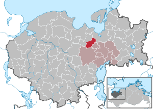
| Location of the community of Barnekow in the district of Northwest Mecklenburg | ||
  |
||

Barnekow is a municipality in the middle of the district of Northwest Mecklenburg in Mecklenburg-Western Pomerania (Germany). The municipality has been administered by the Dorf Mecklenburg-Bad Kleinen office since January 1, 2005, with its seat in the Dorf Mecklenburg municipality (previously by the now dissolved office Gägelow ).
geography
The municipality of Barnekow is located in slightly hilly terrain, sloping towards the Wismar Bay , directly on the southwestern city limits of the Hanseatic city of Wismar .
Barnekow is surrounded by the neighboring communities of Wismar in the northeast, Metelsdorf in the east, Bobitz in the south and Gägelow in the west and northwest.
The districts of Groß Woltersdorf , Klein Woltersdorf and Krönkenhagen belong to Barnekow .
history
The community is rich in sites from prehistory and early history. Friedrich Schlie mentioned
- the discovery of several bronzes in 1880 in the moor between Barnekow and Groß Woltersdorf
- Bones and stone tools, discovered in 1868 in Groß Woltersdorf on the way to Dammhusen
- On the way from Groß Woltersdorf to Stoffersdorf, in the immediate vicinity of the moor, where the bronzes were found in 1880, a Wendish castle wall
- a medieval former castle complex on the southern outskirts of Groß Woltersdorf
Barnekow was first mentioned in 1230. On February 17, 1282, Bishop Hermann and the cathedral capital of Schwerin sold the episcopal tithe from Barnekow to the Neuenkamp monastery . Reimar Plessen is first mentioned in 1325 as a lord on Barnekow. In 1430, Duchess Katharina von Mecklenburg confirmed the privileges and excise duties of the von Plessen family in Barnekow in a new deed. From 1575 to 1600 Martin von Plessen litigated for the solution of uplifts that his ancestors had pledged to St. Georg. During the Thirty Years War the village was plundered several times by troops passing through and almost completely destroyed in March 1718. On July 17, 1716, several country nobles were brought in by a Russian cavalry command, including the landowner Plessen from Barnekow. In 1717 the situation in the village was reorganized by the sovereign and a lease was founded with the “Außenland”. Barnekow later changed hands several times. The Barnekow manor was owned by the von Ladiges family from 1789 to 1864, and by the von Behr-Negendanck family from 1888 to 1945 . The old manor house was demolished in 1989.
politics
Coat of arms, flag, official seal
The municipality has no officially approved national emblem, neither a coat of arms nor a flag. The official seal is the small state seal with the coat of arms of the state of Mecklenburg. It shows a looking bull's head with torn off neck fur and crown and the inscription "GEMEINDE BARNEKOW • LANDKREIS NORDWESTMECKLENBURG".
Transport links

Barnekow is located directly on the federal motorway 20 and on the road from Wismar to Grevesmühlen . The next train station is in Wismar.
literature
- Georg Christian Friedrich Lisch : Bronze find from Barnekow in: Association for Mecklenburg History and Archeology: Yearbooks of the Association for Mecklenburg History and Archeology , Volume 46 (1881), pp. 300–303
- Friedrich Schlie : Art and historical monuments of the Grand Duchy of Mecklenburg-Schwerin, Volume 2: The district court districts of Wismar, Grevesmühlen, Rehna, Gadebusch and Schwerin . Schwerin 1896, p. 336 ff.
Web links
Individual evidence
- ↑ Statistisches Amt MV - population status of the districts, offices and municipalities 2019 (XLS file) (official population figures in the update of the 2011 census) ( help ).
- ↑ Main Statute, Section 1, Paragraph 2

Alt Meteln | Bad little ones | Barnekov | Benz | Bernstorf | Bibow | Blowatz | Bobitz | Boiensdorf | Boltenhagen | Brüsewitz | Carlow | Cramonshagen | Dalberg-Wendelstorf | Damshagen | Dassow | Dechow | Mecklenburg village | Dragun | Gadebusch | Gägelow | Glasin | God's gift | Grambov | Grevesmühlen | Greaves | Large Molzahn | Big Stieten | Hohenkirchen | Tall beasts | Holdorf | Hornstorf | Poel Island | Jesendorf | Kalkhorst | Klein Trebbow | Klütz | Kneese | Koenigsfeld | Krembz | Krusenhagen | Lübberstorf | Luebow | Lübstorf | Lüdersdorf | Lützow | Menzendorf | Metelsdorf | Mills Eichsen | Neuburg | Neukloster | Passee | Perlin | Pingelshagen | Pokrent | Rehna | Rieps | Roduchelstorf | Roggendorf | Rye peat | Rögnitz | Rüting | Schildenal | Schlagsdorf | Schoenberg | Seehof | Selmsdorf | Siemz-Niendorf | Stepenitztal | Testorf-Steinfort | Thandorf | Upahl | Utecht | Veelböken | Ventschow | Warin | Warnow | Wedendorfersee | Wismar | Zickhusen | Zierow | Zurow | Züsow