
Was in
| coat of arms | Germany map | |
|---|---|---|

|
Coordinates: 53 ° 48 ' N , 11 ° 43' E |
|
| Basic data | ||
| State : | Mecklenburg-Western Pomerania | |
| County : | Northwest Mecklenburg | |
| Office : | Neukloster-Warin | |
| Height : | 30 m above sea level NHN | |
| Area : | 44.27 km 2 | |
| Residents: | 3214 (Dec. 31, 2019) | |
| Population density : | 73 inhabitants per km 2 | |
| Postal code : | 19417 | |
| Area code : | 038482 | |
| License plate : | NWM, GDB, GVM, WIS | |
| Community key : | 13 0 74 084 | |
| Office administration address: | Hauptstrasse 27 23992 Neukloster |
|
| Website : | ||
| Mayor : | Bjorn Griese | |
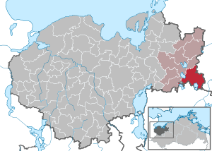
| Location of the city of Warin in the district of Northwest Mecklenburg | ||
  |
||

The small town of Warin is located in the east of the district of Northwest Mecklenburg in Mecklenburg-Western Pomerania (Germany). It belongs to the Neukloster-Warin office with its seat in Neukloster . The place is part of the Hamburg metropolitan region and a basic center for its surroundings .
geography
Geographical location
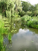
The city of Warin is located about 23 kilometers southeast of Wismar . It is surrounded by a diverse natural landscape. Warin is located on the northern edge of the Sternberg lake landscape that was formed during the last Ice Age , nestled between the Great Wariner See and the Glammsee . Both lakes are connected by the Mühlengraben in the urban area . The Groß Labenzer See is located in the districts of Klein and Groß Labenz .
Warin is located in the Sternberger Seenland nature park , which stretches from Neukloster in the north via Sternberg to Pinnow in the south. The Rothenmoorsche Sumpfwiese nature reserve is located in the eastern municipality of Warin bei Laase . The Schanzenberge are among the elevations in the area .

Great Wariner See , from the town church

South shore of the Groß Labenzer See
Mühlengraben


City structure
Warin includes the districts Allwardtshof, Graupenmühle, Groß Labenz, Klein Labenz, Mankmoos, Pennewitt and Wilhelmshof.
history
From the 12th century until today
The Großdolmen von Mankmoos , the Urdolmen von Mankmoos , the Großdolmen Groß Labenz 1 and a large stone grave in the rectangular barn are the oldest relics in the city.
The name Warin was first mentioned in 1178. In 1229 the Bishop of Schwerin began building a "summer residence", four years later Bishop Brunward first mentioned Warin as a church village. The bishop's castle founded by Bishop Hermann I von Schladen in 1263 was mentioned in 1284 as "under construction". The settlement developed under the protection of the castle already had a council in 1306, so it was a town. However, the exact date of the granting of the town charter is not verifiable. The bishop's castle was partially destroyed at Pentecost 1322, the bishopric pledged. Only under Bishop Friedrich II von Bülow could the bishopric be redeemed and the castle repaired after 1366. Under Bishop Nicolaus Böddeker , the castle was fundamentally restored and expanded in 1447/48.

By the beginning of the Thirty Years' War , the population rose to 250. In 1628 Danish troops occupied Warin, from 1634 to 1635 Swedish dragoons under Lieutenant Colonel Osterling. In 1636 much of the city burned down. At the end of the Thirty Years War Warin still had 45 citizens.


In 1648 the places Warin and Bibow came to the Mecklenburg duchy . A second major fire destroyed large parts of the city in 1773. From 1833 to 1926 Warin was the seat of the Office Warin, Neukloster, Sternberg and Tempzin. Wismar, which was returned to Mecklenburg on loan in 1803, was also temporarily administered from here. The bishop's castle was demolished in 1838, the castle cellars were preserved. On the site of the castle, the grand ducal Landdrostei was built as the administrative seat.

From 1851 Warin was a country town in Mecklenburg and as such one of the towns in the Mecklenburg district . Until 1918 it was represented on an equal footing in the Mecklenburg state parliaments of the estates united in 1523 . On August 17, 1869, the Warin volunteer fire department was founded. It is one of the oldest fire brigades in Mecklenburg-Western Pomerania. In 1878 the neo-Gothic collegiate church was consecrated. In 1887 Warin received a railway connection to the Wismar – Karow line .
The power station supplied the mill with electricity for the first time in 1906, and in 1932 the former Landdrostei became the Reich Farmers School. The Mecklenburg Farmers' College in Warin trained skilled workers for agriculture until 1945. The Warin Web School was affiliated to the university , where traditional Mecklenburg costumes, textiles and cloths were woven. The park at the university building, known as the Altes Amtshöft , was declared a natural monument in 1933.
During the Nazi era , Jewish citizens of the place were persecuted and murdered. The Jewish cemetery was devastated during the November pogrom in 1938, the remains cleared after 1945, and in 1961 a memorial stone was placed in memory of it.
On May 3, 1945, the Red Army occupied Warin. Shortly afterwards, preliminary talks for the Potsdam Conference took place in Schloss Hasenwinkel . The district hospital was built in 1948 on the site of the farmer's college. From 1960 the collectivizations in agriculture and handicraft took place, in 1962 apartment blocks were built on Fritz-Reuter-Platz. In 1983 Warin celebrated its 750th anniversary. In May 1990 free elections for community council took place.
After reunification , new infrastructure was quickly created. A retirement and nursing home as well as a new sewage treatment plant were built in 1992, and in 1993 the industrial park at Ziegelberg was handed over. The mattress factory found a new owner. But Warin also lost important infrastructure: the district hospital was closed, a new private investor could not be found.
From 1952 to 1994 Warin belonged to the Sternberg district (until 1990 in the GDR district of Schwerin , 1990–1994 in the state of Mecklenburg-Western Pomerania ). Since 1994 the city has been in the district of Northwest Mecklenburg .
Incorporations
Mankmoos was incorporated on September 1, 1973. Groß Labenz was added on January 1, 2004.
Population development
|
|
Status: December 31 of the respective year
politics


City council
The municipal council of Warin has been composed as follows since the local election on May 26, 2019 :
| Party / group of voters | be right | Seats |
| Shaping Warin together (GWG) | 38.0% | 5 |
| CDU | 33.4% | 5 |
| Future Warin districts (ZWO) | 18.1% | 3 |
| For Warin | 10.5% | 1 |
mayor
- 2009–2019: Michael Ankermann (CDU)
- since 2019: Björn Griese (Together Warin Gestalten)
Griese was elected in the mayoral election on June 16, 2019 with 62.1% of the valid votes.
coat of arms
|
|
Blazon : "In red, two obliquely crossed silver bishop's staffs with turned away golden bends."
The coat of arms was established on April 10, 1858 by Grand Duke Friedrich Franz II of Mecklenburg-Schwerin, redrawn in 1998 and registered under the number 170 of the coat of arms of the state of Mecklenburg-Western Pomerania. |
| Justification of the coat of arms: The coat of arms is based on the seal image of SIGILLVM OPPIDI WARIN - handed down as an imprint in 1584 - and was determined in its current form in April 1858. As a sign of dignity, the bishop's staff refer to the bishop of Schwerin as the founder and former landlord of the city until it was secularized. |
- Historical city arms
 |
Blazon : "In green, a golden Odal rune emerging from the lower edge."
The coat of arms was designed by Hans Herbert Schweitzer . It was awarded on September 14, 1940 by the Reichsstatthalter in Mecklenburg. |
| Justification of the coat of arms: The coat of arms lost its validity soon after the end of World War II. |
flag
The flag was designed by the Schwerin heraldist Heinz Kippnick and approved on November 19, 2004 by the Ministry of the Interior.
The flag is striped in red, yellow and red across the longitudinal axis of the flag cloth. The red stripes each take up a quarter, the yellow stripe takes up half the length of the flag cloth. In the middle of the yellow stripe is the city coat of arms, which takes up two thirds of the height of the flag. The relation of the height of the flag cloth to the length is like 3: 5.
Official seal
The official seal shows the city coat of arms with the inscription "STADT WARIN".
Partnerships
- since 1989: municipal sponsorship with Aukrug in Schleswig-Holstein
Attractions
Buildings
- Neo-Gothic collegiate church , from 1874 to 1878 based on designs by the building councilor Theodor Krüger on the site of the first church built in 1233
- Sternberger Seenland Nature Park Center in the town hall
- The preacher's widow's house from 1733, the oldest building in the city
- Groß Labenz manor from the middle of the 19th century

Monuments, graves and memorials
- Urdolmen of Mankmoos , large stone grave
- Passage grave of Pennewitt
- Memorial to the Warin-born painter and illustrator Ernst Lübbert
- Honorary grave in the cemetery with a memorial stone commemorating the communist Johann Schulz, 1945 of complications from a concentration camp in Dreibergen- Bützow died
- Honorary grave of the Jewish Wolff-Stapelmann family who fell victim to the Holocaust
- Memorial with a memorial stone in memory of the Jewish cemetery in the Waldheim district before the exit to Ventschow (from 1963)
nature
- Sternberger Seenland
- Historical tour around the Glammsee with display boards and observation tower (view over the Glammsee)
- Princess Gorge
- Radebachtal
Economy and Infrastructure
Economically, tourism is of great importance for Warin . State recognition as a resort is sought.
traffic
Warin is on the B 192 federal road between Wismar and Brüel and on the L 31 state road to Bad Kleinen . The next motorway junctions are Jesendorf on the A 14 (Wismar - Schwerin ) and Zurow on the A 20 ( Lübeck - Rostock ).
The nearest train station is Blankenberg (Meckl) (four kilometers south of the city). It is served by the regional express lines RE 1 ( Hamburg - Rostock ) and RE 4 ( Lübeck - Szczecin ). Warin station was on the Wismar – Karow line . In 1998 passenger traffic was stopped.
Personalities
sons and daughters of the town
- Hermann von Suckow (1792–1872), Prussian general
- August Cords (1859–1919), shipowner
- Ernst Lübbert (1879–1915), painter and illustrator
- Heinrich Handorf (* 1925), architect
- Rainer Sabelleck (* 1953), historian
- Jörg Rettig (* 1964), sailor
- Heiko Kleve (* 1969), social scientist
Personalities associated with Warin
- Eberhard Buchwald (1886–1975), physicist, lived in Warin
- Josef Traeger (1923–1998), pastor in Warin
- Jürgen Gundlach (1926–2014), philologist, buried in Warin
- Heike Polzin (* 1955), politician (SPD), teacher in Warin and Minister of Finance for the State of Mecklenburg-Western Pomerania from 2008 to 2016
Web links
Individual evidence
- ↑ Statistisches Amt MV - population status of the districts, offices and municipalities 2019 (XLS file) (official population figures in the update of the 2011 census) ( help ).
- ^ Regional Spatial Development Program West Mecklenburg (2011) , Regional Planning Association, accessed on July 12, 2015
- ^ Main statute of the city of Warin
- ↑ Courtyards and residences in the late medieval empire. A dynastic-topographical handbook (= Residency Research, Vol. 15.I), 2003. ISBN 3-7995-4515-8
- ↑ Dirk Handorf: The Bishop's Castle in Warin , In: Josef Traeger: The collegiate land of the Schwerin bishops around Bützow and Warin . 1984, pp. 38-41.
- ↑ Municipalities 1994 and their changes since January 1, 1948 in the new federal states , Metzler-Poeschel publishing house, Stuttgart, 1995, ISBN 3-8246-0321-7 , publisher: Federal Statistical Office
- ^ StBA: Changes in the municipalities in Germany, see 2004
- ↑ Population development of the districts and municipalities in Mecklenburg-Western Pomerania (Statistical Report AI of the Statistical Office Mecklenburg-Western Pomerania)
- ↑ Northwest Mecklenburg : These are the new municipal parliaments. In: Ostsee-Zeitung , May 29, 2019.
- ^ Result of the mayoral election on June 16, 2019
- ↑ a b Hans-Heinz Schütt: On shield and flag - the coats of arms and flags of the state of Mecklenburg-Western Pomerania and its municipalities . Ed .: production office TINUS; Schwerin. 2011, ISBN 978-3-9814380-0-0 , pp. 181/182 .
- ↑ a b main statute § 1 (PDF).
- ↑ Good prospects for a resort. In: Schweriner Volkszeitung , October 17, 2018

Alt Meteln | Bad little ones | Barnekov | Benz | Bernstorf | Bibow | Blowatz | Bobitz | Boiensdorf | Boltenhagen | Brüsewitz | Carlow | Cramonshagen | Dalberg-Wendelstorf | Damshagen | Dassow | Dechow | Mecklenburg village | Dragun | Gadebusch | Gägelow | Glasin | God's gift | Grambov | Grevesmühlen | Greaves | Large Molzahn | Big Stieten | Hohenkirchen | Tall beasts | Holdorf | Hornstorf | Poel Island | Jesendorf | Kalkhorst | Klein Trebbow | Klütz | Kneese | Koenigsfeld | Krembz | Krusenhagen | Lübberstorf | Luebow | Lübstorf | Lüdersdorf | Lützow | Menzendorf | Metelsdorf | Mills Eichsen | Neuburg | Neukloster | Passee | Perlin | Pingelshagen | Pokrent | Rehna | Rieps | Roduchelstorf | Roggendorf | Rye peat | Rögnitz | Rüting | Schildenal | Schlagsdorf | Schoenberg | Seehof | Selmsdorf | Siemz-Niendorf | Stepenitztal | Testorf-Steinfort | Thandorf | Upahl | Utecht | Veelböken | Ventschow | Warin | Warnow | Wedendorfersee | Wismar | Zickhusen | Zierow | Zurow | Züsow