
Pingelshagen
| coat of arms | Germany map | |
|---|---|---|

|
Coordinates: 53 ° 41 ′ N , 11 ° 20 ′ E |
|
| Basic data | ||
| State : | Mecklenburg-Western Pomerania | |
| County : | Northwest Mecklenburg | |
| Office : | Lützow-Lübstorf | |
| Height : | 54 m above sea level NHN | |
| Area : | 2.07 km 2 | |
| Residents: | 526 (Dec. 31, 2019) | |
| Population density : | 254 inhabitants per km 2 | |
| Postal code : | 19069 | |
| Area code : | 0385 | |
| License plate : | NWM, GDB, GVM, WIS | |
| Community key : | 13 0 74 062 | |
| Office administration address: | Village center 24 19209 Lützow |
|
| Website : | ||
| Mayor : | Reimond Weding | |
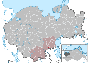
| Location of the community Pingelshagen in the district of Northwest Mecklenburg | ||
  |
||

Pingelshagen is a municipality in the south of the district of Northwest Mecklenburg in Mecklenburg-Western Pomerania (Germany). It is administered by the Lützow-Lübstorf Office based in the Lützow community .
geography
The municipality of Pingelshagen is located on the north-western city limits of the state capital Schwerin , surrounded by forests and fields on the state road from Schwerin to Grevesmühlen . With an area of 2.07 km², Pingelshagen is the smallest municipality in Mecklenburg-Western Pomerania.
Pingelshagen is surrounded by the neighboring communities of Klein Trebbow in the north and east, Schwerin in the south, Brüsewitz in the west and Cramonshagen in the north-west.
history
Pingelshagen was first mentioned in a document in 1283. Agriculture played an important role in the village for many years, initially in the farms and shops , from 1953 to 1990 in the local LPG and its successor farms . Until 1936 Pingelshagen was a district of Warnitz ; However, while Warnitz was incorporated into Schwerin in October 1936 , Pingelshagen was initially added to the neighboring community of Herren Steinfeld , before the place became an independent community after the Second World War and from 1952 belonged to the Schwerin-Land district . After 1990 Pingelshagen became an attractive place to live, especially for the people of Schwerin, thanks to the construction of new residential areas. The population increased from 108 at the beginning (1989) to approx. 600 in 2019. In the last 28 years, over 170 new single-family houses have been built.
politics
coat of arms
|
|
Blazon : "In gold a peasant dressed in red with a belted doublet, gauntlet boots and socks, black hair and a beard, in his right hand holding a fallen black hoe with a leaf turned to the right."
The coat of arms was designed by the Schwerin heraldist Karl-Heinz Steinbruch . It was approved by the Ministry of the Interior on September 20, 2000 and registered under the number 227 of the coat of arms of the state of Mecklenburg-Western Pomerania. |
| Justification of the coat of arms: The symbols in the coat of arms are intended to create a visual reference to the place name, which is made up of the male personal name Pingel and the basic word Hagen. The personal name, which is to be interpreted as a designation of a "strong guy", is given by a strong farmer in typical clothes of the 12th / 13th centuries. Century symbolized. The part of the name "hagen", which indicates a clearing settlement that was created, protected and fenced in by German settlers, is symbolized by a hoe. The red and gold tinging is intended to remind people of Pingelshagen's affiliation to the former county of Schwerin. |
flag
The municipality does not have an officially approved flag .
Official seal
The official seal shows the municipal coat of arms with the inscription "GEMEINDE PINGELSHAGEN • LANDKREIS NORDWESTMECKLENBURG".
literature
- Maike Frey, Wilfried Busse, Karl-Heinz Steinbruch: Chronicle Pingelshagen: 1283–2008. Pingelshagen 2008
Web links
Individual evidence
- ↑ Statistisches Amt MV - population status of the districts, offices and municipalities 2019 (XLS file) (official population figures in the update of the 2011 census) ( help ).
- ↑ Mecklenburgisches Urkundenbuch , Vol. 3: 1281–1296 . Stiller'sche Hofbuchhandlung, Schwerin 1865, No. 1672, pp. 73–74.
- ↑ Hans-Heinz Schütt: On shield and flag - the coats of arms and flags of the state of Mecklenburg-Western Pomerania and its municipalities . Ed .: production office TINUS; Schwerin. 2011, ISBN 978-3-9814380-0-0 , pp. 327-329 .
- ↑ a b main statute § 1 (PDF).

Alt Meteln | Bad little ones | Barnekov | Benz | Bernstorf | Bibow | Blowatz | Bobitz | Boiensdorf | Boltenhagen | Brüsewitz | Carlow | Cramonshagen | Dalberg-Wendelstorf | Damshagen | Dassow | Dechow | Mecklenburg village | Dragun | Gadebusch | Gägelow | Glasin | God's gift | Grambov | Grevesmühlen | Greaves | Large Molzahn | Big Stieten | Hohenkirchen | Tall beasts | Holdorf | Hornstorf | Poel Island | Jesendorf | Kalkhorst | Klein Trebbow | Klütz | Kneese | Koenigsfeld | Krembz | Krusenhagen | Lübberstorf | Luebow | Lübstorf | Lüdersdorf | Lützow | Menzendorf | Metelsdorf | Mills Eichsen | Neuburg | Neukloster | Passee | Perlin | Pingelshagen | Pokrent | Rehna | Rieps | Roduchelstorf | Roggendorf | Rye peat | Rögnitz | Rüting | Schildenal | Schlagsdorf | Schoenberg | Seehof | Selmsdorf | Siemz-Niendorf | Stepenitztal | Testorf-Steinfort | Thandorf | Upahl | Utecht | Veelböken | Ventschow | Warin | Warnow | Wedendorfersee | Wismar | Zickhusen | Zierow | Zurow | Züsow