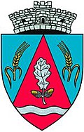
Miheșu de Câmpie
|
Miheșu de Câmpie Bienendorf Mezőméhes |
||||
|
||||
| Basic data | ||||
|---|---|---|---|---|
| State : |
|
|||
| Historical region : | Transylvania | |||
| Circle : | Mureș | |||
| Coordinates : | 46 ° 41 ' N , 24 ° 9' E | |||
| Time zone : | EET ( UTC +2) | |||
| Height : | 355 m | |||
| Area : | 54.00 km² | |||
| Residents : | 2,447 (October 20, 2011) | |||
| Population density : | 45 inhabitants per km² | |||
| Postal code : | 547420 | |||
| Telephone code : | (+40) 02 65 | |||
| License plate : | MS | |||
| Structure and administration (as of 2016) | ||||
| Community type : | local community | |||
| Structure : | Miheșu de Câmpie, Bujor , Cirhagău , Groapa Rădăii , Mogoaia , Răzoare , Șăulița , Ștefanca | |||
| Mayor : | Emil Casoni ( PNL ) | |||
| Postal address : | Mihai Eminescu Street, no. 4 loc. Miheșu de Câmpie, jud. Mureș, RO-547420 |
|||
| Website : | ||||
Miheșu de Câmpie old spelling Miheșu de Cîmpie [ miˈheʃu de ˈkɨmpie ] (outdated Mihășu de Câmpie ; German Bienendorf , Hungarian Mezőméhes or Méhes ) is a municipality in the Mureș district , in the Transylvania region in Romania .
Geographical location
The municipality of Miheșu de Câmpie is located in the Transylvanian Heath (Câmpia Transilvaniei) - part of the Transylvanian Basin . In the west of the Mureș district on Pârâul de Câmpie, a right tributary of the Mureș (Mieresch) , the 94-kilometer-long single-track Luduș – Măgheruș Șieu and the district road (Drum județean) DJ 151, the Miheșu de Câmpie is about 30 kilometers north of the Small town Luduş (Ludasch) and about 45 kilometers northwest of the district capital Târgu Mureş (Neumarkt am Mieresch) .
Located in a heather landscape , the eight community villages are located on an area of around 5400 hectares. Due to the landscape, the heather, in Romanian câmpie , the name of the community center is also given.
history
The place Miheșu de Câmpie was first mentioned in 1293.
Archaeological finds from prehistory on the area called Lăpuș by the locals indicate that the community center was settled .
In the Kingdom of Hungary , the places of today's municipality belonged to the Marosludas chair district in the Torda-Aranyos County , then to the historical Turda district and from 1950 to the present Mureș district.
population
The population of the Miheșu de Câmpie municipality developed as follows:
| census | Ethnic composition | ||||
|---|---|---|---|---|---|
| year | population | Romanians | Hungary | German | other |
| 1850 | 1,773 | 1,555 | 87 | - | 131 |
| 1910 | 2,842 | 2.136 | 506 | 19th | 181 |
| 1956 | 3,985 | 3,418 | 400 | 2 | 165 |
| 2002 | 2,538 | 2,079 | 205 | 1 | 253 |
| 2011 | 2,447 | 1.916 | 160 | - | 371 |
Since 1850, the highest number of inhabitants and that of the Romanians in 1956 have been determined in the area of today's municipality. The highest number of Magyars was registered in 1910, that of Roma (288) in 2011 and that of Romanian Germans (61) in 1900.
Attractions
- Apart from the common reservoirs with the neighboring communities Șăulia and Zau de Câmpie , which are used for fishing and also as a recreational area, there are no noteworthy sights in the community of Miheşu de Câmpie.
Web links
Individual evidence
- ↑ 2011 census in Romania ( MS Excel ; 1.3 MB)
- ↑ Heinz Heltmann, Gustav Servatius (Ed.): Travel Guide Siebenbürgen . Kraft, Würzburg 1993, ISBN 3-8083-2019-2 , p. 517 .
- ↑ Institute Of Archeology - Miheşu de Campie , accessed on 27 June 2019 (Romanian).
- ↑ Censuses 1850–2002, last updated November 2, 2008 (PDF; 1 MB; Hungarian).


