
Petelea
|
Petelea Birk Petele |
|||||
|
|||||
| Basic data | |||||
|---|---|---|---|---|---|
| State : |
|
||||
| Historical region : | Transylvania | ||||
| Circle : | Mureș | ||||
| Coordinates : | 46 ° 44 ' N , 24 ° 42' E | ||||
| Time zone : | EET ( UTC +2) | ||||
| Height : | 358 m | ||||
| Area : | 43.70 km² | ||||
| Residents : | 2,977 (October 20, 2011) | ||||
| Population density : | 68 inhabitants per km² | ||||
| Postal code : | 547460 | ||||
| Telephone code : | (+40) 02 65 | ||||
| License plate : | MS | ||||
| Structure and administration (as of 2016) | |||||
| Community type : | local community | ||||
| Structure : | Petelea, Habic | ||||
| Mayor : | Sorin-Pompei Pădurean ( PNL ) | ||||
| Postal address : | Str. Principală, no. 726 loc. Petelea, jud. Mureș, RO-547460 |
||||
| Website : | |||||


Petelea ( German Birk , Hungarian Petele ) is a municipality in the Mureș County , in the Transylvania region in Romania .
Geographical location

The municipality of Petelea is located in the Reener Ländchen (Ținutul Reghinului) in the northern part of the Transylvanian Basin . At the confluence of the Beica in the upper reaches of the Mureș (Mieresch) , the Târgu Mureș – Gheorgheni railway line and the DN15 national road , Petelea is five kilometers south of the city of Reghin (Saxon Rain) and 28 kilometers north of the district capital of Târgu Mureș (Neumarkt am Mieresch) away. The incorporated village is 14 kilometers (6.5 km as the crow flies) from the community center. The highest mountain in the municipality is Dealul Viilor at 511.7 m .
history
The place Petelea was first mentioned in 1332. An archaeological find on the area of the incorporated village of Habic ( Hétbükk in Hungarian ) was dated to the Neolithic and is in the museum in Alba Iulia (Weißenburg) . A Roman road is marked on the area of the community center and excavations in 1869 found around 200 Dacian coins from the Latène period , some of which are in the museums of Sibiu and Vienna .
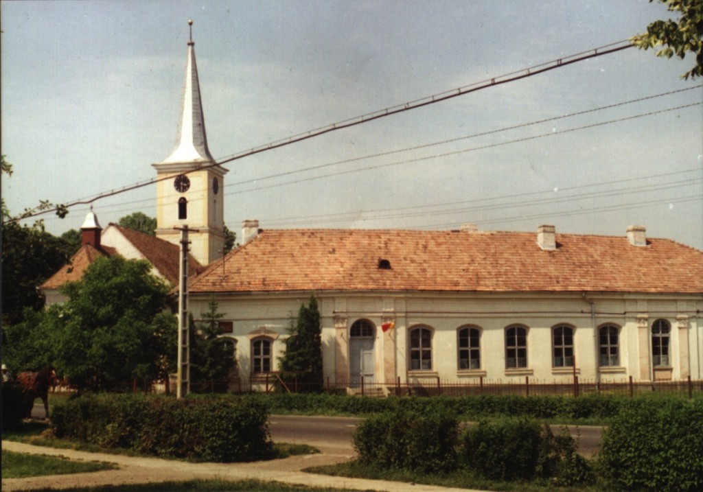
Until 1944, Petelea was mainly inhabited by Romanian Germans. Their Evangelical Church was taken over by the Reformed Church . The church organ was destroyed, the pulpit is still there. The closed house fronts with their arches, the village school, the former rectory, the doctor's house and the town hall can be traced back to the town's population of German origin in the 19th century. In the expropriation of 1945 , the 220 Transylvanian-Saxon families were expropriated from around 1,312 hectares of land; 1,246 hectares of which were distributed among 411 “ beneficiaries ”.
In the Kingdom of Hungary , today's municipality belonged to the Régen alsó (Lower Rain) district in Maros-Torda County , then to the historical Mureș District and, from 1950, today's Mureș District.
population
The population of the municipality of Petelea developed as follows:
| census | Ethnic composition | ||||
|---|---|---|---|---|---|
| year | population | Romanians | Hungary | German | other |
| 1850 | 2,337 | 936 | 8th | 1,155 | 238 |
| 1920 | 2,816 | 1,323 | 102 | 1,164 | 29 |
| 1941 | 2,594 | 1,212 | 134 | 927 | 321 |
| 1956 | 2,612 | 1,873 | 212 | 104 | 423 |
| 1992 | 2,765 | 1,651 | 124 | 45 | 945 |
| 2002 | 2,780 | 1,680 | 119 | 36 | 945 |
| 2011 | 2,977 | 1,398 | 72 | 27 | 1,480 |
The highest number of inhabitants has been registered in the area of today's municipality since 1850 and that of the Roma (1400) in 2011. The highest population of Romanians (2,242) was determined in 1966, that of Romanian Germans in 1920 and that of Magyars in 1956.
Attractions
The wooden church Sf. Arhangheli in the community center, built in 1761 (the bell tower in 1848), and also numerous houses, built by the Transylvanian Saxons from the 18th to the 20th century, are listed as historical monuments.

Wooden church in Petelea

Orthodox Church


Personalities
- Virgil Bercea (* 1957), born in Habic, is a bishop in the diocese of Großwardein
Web links
- Birk at sevenbuerger.de
- Petelea at ghidulprimariilor.ro
- Private web presentation of the place Petelea / Birk
Individual evidence
- ↑ 2011 census in Romania ( MS Excel ; 1.3 MB)
- ↑ a b Heinz Heltmann, Gustav Servatius (Ed.): Travel Guide Siebenbürgen . Kraft, Würzburg 1993, ISBN 3-8083-2019-2 , p. 517 .
- ^ Institute Of Archeology - Habic , accessed July 13, 2018 (Romanian).
- ↑ Institute Of Archeology - Petelea , accessed on July 13, 2018 (Romanian).
- ^ Picture of the church and school in Petelea
- ↑ Information on the Reformed Church in Petelea at biserici.org, accessed on July 13, 2018 (Romanian)
- ↑ Information from the Petelea municipality: Prezentare generală. Retrieved July 13, 2018 (Romanian).
- ↑ Censuses 1850–2002, last updated November 2, 2008 (PDF; 1 MB; Hungarian)
- ↑ List of historical monuments of the Romanian Ministry of Culture, updated 2015 (PDF; 12.7 MB; Romanian)
Acățari | Adămuș | Albeşti | Aluniș | Apold | Ațintiș | Băgaciu | Bahnea | Băla | Bălăușeri | Band | Batoș | Beica de Jos | Bereni | Bichiș | Bogata | Brâncoveneşti | Breaza | Ceuașu de Câmpie | Chețani | Chiheru de Jos | Coroisânmărtin | Corunca | Cozma | Crăciuneşti | Crăiești | Cristești | Cucerdea | Cuci | Daneș | Deda | Hermit | Ernei | Fântânele | Fărăgău | Gălești | Găneşti | Gheorghe Doja | Ghindari | Glodeni | Gorneşti | Grebenișu de Câmpie | Gurghiu | Hodac | Hodoșa | Ibăneşti | Iclănzel | Ideciu de Jos | Livezeni | Lunca | Lunca Bradului | Măgherani | Mica | Miheșu de Câmpie | Nadeș | Neaua | Ogra | Pănet | Papiu Ilarian | Păsăreni | Petelea | Pogăceaua | Râciu | Răstolița | Rușii-Munți | Sâncraiu de Mureș | Sângeorgiu de Mureș | Singer | Sânpaul | Sânpetru de Câmpie | Sântana de Mureș | Saschiz | Sărățeni | Șăulia | Șincai | Solovăstru | Stânceni | Suplac | Suseni | Tăureni | Valea Largă | Vânători | Vărgata | Vătava | Vețca | Viișoara | Voivodeni | Zagăr | Zau de Câmpie