
Crăciunești (Mureș)
|
Crăciuneşti Nyárádkarácson |
|||||
|
|||||
| Basic data | |||||
|---|---|---|---|---|---|
| State : |
|
||||
| Historical region : | Transylvania | ||||
| Circle : | Mureș | ||||
| Coordinates : | 46 ° 29 ' N , 24 ° 34' E | ||||
| Time zone : | EET ( UTC +2) | ||||
| Height : | 325 m | ||||
| Area : | 37.45 km² | ||||
| Residents : | 4,470 (October 20, 2011) | ||||
| Population density : | 119 inhabitants per km² | ||||
| Postal code : | 547175 | ||||
| Telephone code : | (+40) 02 65 | ||||
| License plate : | MS | ||||
| Structure and administration (as of 2016) | |||||
| Community type : | local community | ||||
| Structure : | Crăciuneşti, Budiu Mic , Ciba , Cinta , Corneşti , Foi , Nicoleşti , Tirimioara | ||||
| Mayor : | György Ferenczi ( UDMR ) | ||||
| Postal address : | Str. Principală, no. 166 loc. Crăciuneşti, jud. Mureș, RO-547175 |
||||
| Website : | |||||


Crăciuneşti [ ˈkrət͡ʃiuneʃtʲ ] (outdated Caracionfalău ; Hungarian Nyárádkarácson or Karácsonfalva ) is a municipality in Mureş County , in the Transylvania region in Romania .
Geographical location

The community Crăciuneşti is located north of the Kokel Valley (Podişul Târnavelor) in the southern part of the Mureş district in the so-called Țara Morcovilor (Carrot Land ) . On the Niraj , a left tributary of the Mureş (Mieresch) and the district road (Drum județean) DJ 151D, the place Crăciuneşti is twelve kilometers south of the district capital Târgu Mureş (Neumarkt am Mieresch) .
Until around 2010, a narrow-gauge railway of the original narrow-gauge line from Cristeşti to Sovata (Szováta) operated on the area of the municipality .
history
The place Crăciuneşti, founded by Szekler , was first mentioned in 1444. In the Middle Ages there was a reformed church in the village ; An Orthodox church was built in 1762 . Settlement of the place goes back to the Latène period . Archaeological finds on the Crăciuneştis area were dated to the Neolithic.
In the area of the incorporated village of Budiu Mic (Hagendorf) there is a settlement on the area called Teleac (in Hungarian Telek ) by the locals , in the Latène period and a Roman road . Furthermore, the remains of a castle on the mountain Sălașul Tătarilor and Cetatea lui Lucaci have not yet been assigned to any age . Also on the area of the incorporated village of Foi (Hungarian Folyfalva ), next to the Pârâul mare stream , a mine and urns could not yet be assigned to an era.
In the Kingdom of Hungary , today's municipality belonged to the Maros alsó ("Unter-Maros") district in Maros-Torda County , then to the historical Mureș County and, from 1950, today's Mureș County.
The municipality Crăciuneşti has existed in its current composition since 1968. The present-day places Ciba (Hungarian Csiba ), Foi and Nicoleşti (Hungarian Káposztásszentmiklós ) have only been recognized as villages since 2006.
population
The population of the Crăciuneşti municipality developed as follows:
| census | Ethnic composition | ||||
|---|---|---|---|---|---|
| year | population | Romanians | Hungary | German | other |
| 1850 | 3,530 | 666 | 2,760 | - | 104 |
| 1920 | 3,966 | 773 | 2,985 | 3 | 205 |
| 1977 | 4,972 | 340 | 4.032 | 1 | 599 |
| 2002 | 4,348 | 108 | 3,169 | - | 1,071 |
| 2011 | 4,470 | 110 | 2,827 | - | 1,533 |
Since 1850 the highest number of inhabitants was registered in 1977 in the area of today's municipality. The highest population of the Magyars (4,542) was determined in 1941, that of the Roma (1,086) in 2011, that of the Romanians in 1920 and that of the Romanian Germans (15) in 1900.
Attractions
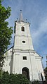
- In the community center the reformed church (according to different information) built around 1622 or 1661 and the wooden church Sf. Arhangheli Mihail și Gavril and its bell tower, built in the 19th century, are a listed building.
- In the incorporated village of Budiu Mic the reformed church, built around 1802, and the wooden bell tower of the Orthodox church .
- In the incorporated village of Corneşti ( Somosd in Hungarian ) the Reformed Church, built in 1797.
- In the incorporated village of Nicoleşti the wooden church Sf. Nicolae , built in the 18th century, is a listed building.

Wooden church in Nicoleşti

Wooden bell tower in Budiu Mic
Reformed Church in Budiu Mic


Town twinning
The municipality of Crăciuneşti maintains a town partnership with the Hungarian municipality of Balatonendréd in the Siófok district .
Web links
Individual evidence
- ↑ 2011 census in Romania ( MS Excel ; 1.3 MB)
- ↑ Trecerile la nivel cu soseaua E60 din Ungheni si Acatari au fost desfiintate at transira.ro, accessed on April 22, 2018 (Romanian)
- ↑ a b c Heinz Heltmann, Gustav Servatius (ed.): Travel Guide Siebenbürgen . Kraft, Würzburg 1993, ISBN 3-8083-2019-2 , p. 517 .
- ^ Institute Of Archeology - Crăciunești , accessed April 22, 2018 (Romanian).
- ↑ a b c List of historical monuments of the Romanian Ministry of Culture, updated 2015 (PDF; 12.7 MB; Romanian)
- ↑ Institute Of Archeology - Budiu Mic , accessed on April 22, 2018 (Romanian).
- ^ Institute Of Archeology - Foi , accessed April 22, 2018 (Romanian).
- ↑ a b Information on the website of the Crăciuneşti municipality , accessed on April 22, 2018 (Romanian).
- ↑ Censuses 1850–2002, last updated November 2, 2008 (PDF; 1 MB; Hungarian)
- ↑ Information on the Reformed Church in Crăciuneşti at biserici.org, accessed on April 22, 2018 (Romanian)
- ↑ Information on the wooden church Church in Crăciunești at biserici.org, accessed on April 22, 2018 (Romanian)
- ↑ Information on the Reformed Church in Budiu Mic at biserici.org, accessed on April 22, 2018 (Romanian)
- ↑ Information on the wooden bell tower in Budiu Mic at biserici.org, accessed on April 22, 2018 (Romanian)
- ↑ Information on the Reformed Church in Corneşti at biserici.org, accessed on April 22, 2018 (Romanian)
- ↑ Information on the wooden church in Nicolești at biserici.org, accessed on April 22, 2018 (Romanian)
Acățari | Adămuș | Albeşti | Aluniș | Apold | Ațintiș | Băgaciu | Bahnea | Băla | Bălăușeri | Band | Batoș | Beica de Jos | Bereni | Bichiș | Bogata | Brâncoveneşti | Breaza | Ceuașu de Câmpie | Chețani | Chiheru de Jos | Coroisânmărtin | Corunca | Cozma | Crăciuneşti | Crăiești | Cristești | Cucerdea | Cuci | Daneș | Deda | Hermit | Ernei | Fântânele | Fărăgău | Gălești | Găneşti | Gheorghe Doja | Ghindari | Glodeni | Gorneşti | Grebenișu de Câmpie | Gurghiu | Hodac | Hodoșa | Ibăneşti | Iclănzel | Ideciu de Jos | Livezeni | Lunca | Lunca Bradului | Măgherani | Mica | Miheșu de Câmpie | Nadeș | Neaua | Ogra | Pănet | Papiu Ilarian | Păsăreni | Petelea | Pogăceaua | Râciu | Răstolița | Rușii-Munți | Sâncraiu de Mureș | Sângeorgiu de Mureș | Singer | Sânpaul | Sânpetru de Câmpie | Sântana de Mureș | Saschiz | Sărățeni | Șăulia | Șincai | Solovăstru | Stânceni | Suplac | Suseni | Tăureni | Valea Largă | Vânători | Vărgata | Vătava | Vețca | Viișoara | Voivodeni | Zagăr | Zau de Câmpie