Bălăușeri
|
Bălăușeri Bladenmarkt Balavásár |
||||
|
||||
| Basic data | ||||
|---|---|---|---|---|
| State : |
|
|||
| Historical region : | Transylvania | |||
| Circle : | Mureș | |||
| Coordinates : | 46 ° 25 ′ N , 24 ° 42 ′ E | |||
| Time zone : | EET ( UTC +2) | |||
| Height : | 343 m | |||
| Area : | 39.36 km² | |||
| Residents : | 4,889 (October 20, 2011) | |||
| Population density : | 124 inhabitants per km² | |||
| Postal code : | 547100 | |||
| Telephone code : | (+40) 02 65 | |||
| License plate : | MS | |||
| Structure and administration (as of 2016) | ||||
| Community type : | local community | |||
| Structure : | Bălăușeri, Agrișteu , Chendu , Dumitreni , Filitelnic , Senereuș | |||
| Mayor : | István Sagyebó ( UDMR ) | |||
| Postal address : | Str. Principală, no. 42 loc. Bălăușeri, jud. Mureș, RO-547100 |
|||
| Website : | ||||
Bălăuşeri [ ˈbələuʃerʲ ] (outdated Balavaşar or Balauşeri ; German Bladenmarkt or Bladen , Hungarian Balavásár also Balavására ) is a municipality in the Mureş County , in the Transylvania region in Romania .
Geographical location
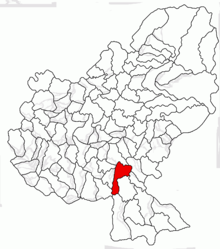
The municipality of Bălăușeri is located in the Kokel Valley (Podișul Târnavelor) in the southern part of the Mureș County. On the upper reaches of the Târnava Mică (Little Kokel) , the national road Drum național 13 - part of the European route 60 - and the railway line Blaj – Târnăveni – Praid is the place Bălăușeri 12 kilometers west of the small town Sângeorgiu de Pădure and 24 kilometers south of the county capital Târgu Mureș (Neumarkt am Mieresch) away.
history
The place Bălăușeri was first mentioned in a document in 1247 or 1325, according to different information.
The remains of a watchtower in the area of the incorporated village of Dumitreni ( Szentdemeter in Hungarian ) point to a settlement of the area of today's municipality back to Roman times . Archaeological finds from the Neolithic Age were found near Chendu (Großkend) and in Senereuș (Zendersch) , on the so-called Reissenberg , numerous archaeological objects that can be assigned to different ages. These are in the Sibiu Museum . In the Kingdom of Hungary , today's municipality belonged to the Dicsőszentmárton chair district (today Târnăveni ) in the Klein-Kokelburg County , then to the historic Târnava-Mică district and, from 1950, to today's Mureş district.
population
The population of the municipality developed as follows:
| census | Ethnic composition | ||||
|---|---|---|---|---|---|
| year | population | Romanians | Hungary | German | other |
| 1850 | 4,473 | 424 | 2,293 | 1,471 | 285 |
| 1920 | 5,076 | 409 | 2,872 | 1,602 | 193 |
| 1941 | 6.361 | 333 | 3,889 | 1898 | 241 |
| 1977 | 5,923 | 1,049 | 3,961 | 495 | 418 |
| 1992 | 5,214 | 861 | 3,772 | 31 | 550 |
| 2002 | 5,064 | 905 | 3,404 | 13 | 742 |
| 2011 | 4,889 | 835 | 3,174 | 10 | 870 (Roma 662) |
Since 1850 the highest number of inhabitants and that of the Romanian Germans were registered in the area of today's municipality in 1941. The highest population of the Magyars (4006) and that of the Romanians (1417) was determined in 1966 and that of the Roma (742) in 2002.
The main occupation of the population is agriculture.
Attractions
- In the incorporated village of Agrișteu ( Alder Forest ), the reformed church built in the 13th century, renewed in the 18th and the wooden bell tower built at the same time, are under monument protection.
- In the incorporated village of Chendu, the property of a former Herrhof was built in the 19th century, is today in a desolate condition and is a listed building.
- In the incorporated village of Dumitreni, the Roman Catholic church built in the late 17th and early 18th century is a listed building. Other sources date the church with the late Gothic reticulated vault to the 15th century. This was a reformed church from 1560 to 1723.
- In the incorporated village of Filitelnic (Felldorf) the evangelical church built in the 15th century, rebuilt in the 18th century, and the rectory built in the 17th century, are now in poor condition and are under monument protection.
- In the incorporated village of Senereuș, the evangelical fortified church was built in the 16th century, renovated in the 19th century, and the now well-preserved church was built between 1870 and 1873 and is a listed building.
Town twinning
The villages of the municipality of Bălăușeri maintain city partnerships with the Dutch district Kudelstaart of the municipality of Aalsmeer and the Hungarian towns of Aldebrő , Fót , Kisbárapáti , Somogyvár and Tápiószentmárton .
Web links
Individual evidence
- ↑ 2011 census in Romania ( MS Excel ; 1.3 MB)
- ↑ Arcanum Kézikönyvtár: Historical-administrative book of place names of Transylvania, Banat and Partium. Retrieved February 3, 2018 (Hungarian).
- ↑ community Balauseri: Informaţii generale. ms.ovelo.ro, accessed March 2, 2018 (Romanian).
- ↑ a b Heinz Heltmann, Gustav Servatius (Ed.): Travel Guide Siebenbürgen . Kraft, Würzburg 1993, ISBN 3-8083-2019-2 , p. 517 .
- ↑ Institute Of Archeology - Dumitreni , accessed on March 2, 2018 (Romanian).
- ^ Institute Of Archeology - Chendu , accessed March 2, 2018 (Romanian).
- ↑ Institute Of Archeology - Senereuș accessed on March 2, 2018 (Romanian)
- ↑ Censuses 1850–2002, last updated November 2, 2008 (PDF; 1 MB; Hungarian)
- ↑ a b c d e List of historical monuments of the Romanian Ministry of Culture, updated 2015 (PDF; 12.7 MB; Romanian)
- ^ Picture of the fortified church in Zendersch (2011)
- ↑ community Balauseri: Localităţi înfrăţite. balauseri.ro, accessed March 2, 2018 (Romanian).


