
Phetchabun Province
| Phetchabun | |
|---|---|
| เพชรบูรณ์ | |

|
|
| statistics | |
| Capital: | Phetchabun |
| Telephone code: | 056 |
| Surface: |
12,668.4 km² 9. |
| Residents: |
995.125 (2009) 20. |
| Population density : | 79 E / km² 58. |
| ISO 3166-2 : | |
| Governor : | Suebsak Iamvicharn (since 2017) |
| map | |
  |
|
Phetchabun ( Thai : เพชรบูรณ์ ) is a province ( Changwat ) in the southeastern part of the northern region of Thailand . The capital of Phetchabun Province is also called Phetchabun .
etymology
The word Phetcha comes from the Sanskrit word vajra , " diamond " (it is the weapon of the Hindu god Indra ). The word bun from the Sanskrit word purna , which means “ full ”, “perfect” or “complete”. So the name of the province means “perfect diamond”.
geography
Phetchabun is located in the northern region of Thailand on the border with the so-called Isan . The province is determined by the extensive valley of the Mae Nam Pa Sak ( Pa-Sak River ), which forms a fertile plain and is bordered by mountain ranges of medium height ( Phetchabun Mountains ) to the east and west. The distance to the capital Bangkok is about 350 kilometers.

| Neighboring provinces: | |
|---|---|
| north | Loei |
| east | Khon Kaen and Chaiyaphum |
| south | Lop Buri |
| west | Nakhon Sawan , Phichit and Phitsanulok |
Important rivers
Important cities
climate
The province's climate is tropical - monsoonal , but somewhat temperate due to the mountainous area. The maximum temperature in 2008 was 39.7 ° C, the lowest temperature was measured at 10.5 ° C. On 121 rainy days fell 1026.2 mm of precipitation in the same year .
Economy and Importance
In 2011, the "Gross Provincial Product" (was GDP ) of the province 57.856 billion baht . The official minimum wage in the province is 232 baht per day (around € 5; effective April 1, 2012).
Data
The table below shows the share of the economic sectors in the gross provincial product in percent:
| Industry | 2006 | 2007 | 2008 | 2009 |
|---|---|---|---|---|
| Agriculture | 46.2 | 44.7 | 45.4 | 43.1 |
| Mining, open pit mining | 1.9 | 4.0 | 9.3 | 9.0 |
| Industry | 12.1 | 11.2 | 9.5 | 11.8 |
| Other | 39.8 | 40.1 | 35.8 | 36.1 |
The industry that contributed most to the province's economic output in 2011 was agriculture with 18.210 billion baht, followed by manufacturing with 8.837 billion baht, education with 5.776 billion baht and wholesale and retail with 5.482 billion baht.
Land use
The following land use is documented for the province:
- Forest area: 2,544,053 Rai (4,070.5 km²), 32.1% of the total area
- Agricultural area: 3,705,747 Rai (5,929.2 km²), 46.8% of the total area
- Unclassified area: 1,667,960 rai (2,668.7 km²), 21.1% of the total area
The main production is tamarind , fruit , rice and sugar cane . The numerous lakes and rivers also offer a variety of fishing opportunities .
dam
- Huai Pa Daeng Reservoir - irrigation reservoir, popular recreational area
traffic

Airport
- Phetchabun Airport
- Sak Long Airport (closed)
Streets
- Route 12 (National Road 12), from Tak to Khon Kaen , 457 km
- Route 21 (National Road 21), from Saraburi to Loei , 415 km
- Route 225 (National Road 225), from Nakhon Sawan to Chayaphum , 342 km
history

In the extreme south of the province, in Amphoe Si Thep , is the Si Thep historical park , in which a predominantly Hindu town from the 5th to 9th centuries was excavated. It was probably the center of an important community in its day, with historians puzzling and arguing which it was. From the 9th century the area was an important base in the Khmer Empire . The Khmer Empire of Angkor ruled large parts of Southeast Asia until the 13th century . An outpost was held in Sukhothai and was led by military leader Khom Samat Klon Lamphong.
From the 12th century, the immigration of Tai peoples is documented. They founded city-states ( mueang ). In some of these areas, the Khmer tribal princes of the Tai were installed as governors . Two of these governors were Bang Klang Thao, ruler of the city-state of Mueang Bang Yang (whose location is unknown) and Pha Mueang, ruler of the city-state of Mueang Rat. Here it is assumed that Mueang Rat can be found in the valley of Mae Nam Pa Sak , possibly today's Lom Sak . Around 1238 they united their armies and marched against Sukhothai. A battle broke out at the gates of the city in which the Khmer troops were completely defeated. The victors established the Sukhothai Kingdom . Bang Klang Thao was proclaimed the first king. From then on he called himself Sri Indraditya . The establishment of the Sukhothai Kingdom is considered to be the cornerstone of the Siamese and later the Thai state.
During the Second World War and the de facto occupation of Thailand by Japanese armed forces, the then Prime Minister Plaek Phibunsongkhram planned to move the Thai capital from Bangkok to Phetchabun Province. However, he was unable to assert himself in parliament, which expressed its distrust on this occasion and ended his rule for the time being. However, construction work for the capital had already started earlier. Up to 100,000 workers, who often came from the poor northeast region , were forced to do this. Many died from the difficult working conditions and rampant malaria . An opposition MP estimated that around 10,000 people died. It is unclear whether the project was an expression of Phibunsongkhram's megalomania or - as he himself later claimed - was intended to make Thailand independent of Japanese influence again.
From 1978 to 1982 communist guerrillas fought against the armed forces of the central government from the forested mountains of Phetchabun Province.
Symbols
The seal shows an oversized diamond on a mountain top, in the foreground are tobacco plants . The local tree is the tamarind ( Tamarindis indica )
Attractions
- Si Thep Historical Park - many archeological objects and ruins from the Khmer period
- Wat Nasai (also Wat Simongkol) - Buddhist temple complex ( Wat ) in Ban Nasai (Amphoe Lom Kao, Tambon Wangban) with old wall paintings from the life of the Buddha
- Shrine of King Naresuan - dedicated to the defender against the Khmer (in Tha Rong, Wichian Buri )
- Khao Ko Palace - built for King Bhumibol Adulyadej as a unique, semicircular complex with a garden showing plants of the temperate climate
- National parks:
- Phu Hin Rong Kla National Park
- Nam Nao National Park - large area with forest landscape, savannah and primeval jungle, many caves and the Sai Thong waterfall offer nature lovers interesting experiences
- Tat Mok National Park - very idyllic - only accessible by off-road car
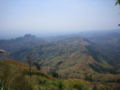
Phu Hin Rong Kla National Park

Nam Nao National Park, dry Haew Sai Waterfall

Nam Nao National Park, bamboo forest

Tat Mok National Park


Administrative units
Provincial Administration
The province is divided into eleven Amphoe ("districts" or "counties"). These are further subdivided into 117 tambon ("subdistricts" or "municipalities") and 1261 muban ("villages").
|

Local administration
A provincial administrative organization ( บริหาร ส่วน จังหวัด , อบ จ for short , Ongkan Borihan suan Changwat ; English Provincial Administrative Organization , PAO) exists for the entire area of the province .
There are three cities ( เทศบาล เมือง - Thesaban Mueang ) in the province : Wichian Buri ( เทศบาล เมือง วิเชียรบุรี ), Lom Sak ( เทศบาล เมือง หล่มสัก ) and Phetchabun ( เทศบาล เมือง เพชรบูรณ์ ).
There are also 19 small towns ( เทศบาล ตำบล - Thesaban Tambon ).
Individual evidence
- ↑ Governor of the Province: Phetchabun Information Province . Retrieved November 17, 2019
- ^ A b Gross Provincial Product at Current Market Prices: Northern Provinces, National Economic and Social Development Board, 2011.
- ↑ a b Thailand in Figures (2012), p. 261; Data according to "Office of the National Economic and Social Development Board, Office of the Prime Minister".
- ↑ "Industry" includes: Manufacturing; Electricity, gas and water supply; Construction .
- ^ "Others" include: Wholesale and retail trade; Hotels and restaurants; Transport, storage and communication; Real estate; Education; Health and social work, ...
- ↑ Wikivoyage: Phetchabun Province . Retrieved November 17, 2019
- ^ David K. Wyatt: Thailand. A short history. 2nd edition, Silkworm Books, Chiang Mai 2003, p. 249.
- ^ Benjamin A. Batson: The Fall of the Phibun Government. In: Journal of the Siam Society , Vol. 62 (1974), No. 2, pp. 89-120, at p. 101, footnote 24.
- ^ Benjamin A. Batson: The Fall of the Phibun Government. In: Journal of the Siam Society , Vol. 62 (1974), No. 2, pp. 89-120, at pp. 99-100.
- ↑ Information Province: symbol of the province . Retrieved November 19, 2019
- ^ Department of Provincial Administration: Statistical report (in Thai) on population and housing in each district and sub-district. As of December 2012. Divided into: Male, Female, Total, Number of houses. Retrieved November 17, 2019
literature
- Thailand in Figures, Vol.II: Region and Province . 16th edition 2012-2013, Alpha Research Co., Ltd., Nonthaburi, Thailand 2012, ISBN 978-616-7256-12-6
- Thung Salaeng Luang, Phu Hin Rong Kla. Pine forest, Grassland, and Rocky Hardpan of the Phetchabun Range. Tourism Authority of Thailand, 2000, ISBN 974-8252-74-4 .
Web links
- Province website (in Thai)
- Province map
- Phetchabun Province Tourist Information - Tourism Authority of Thailand TAT website
North : Chiang Mai | Chiang Rai | Kamphaeng Phet | Lampang | Lamphun | Mae Hong Son | Nakhon Sawan | Nan | Phayao | Phetchabun | Phichit | Phitsanulok | Phrae | Sukhothai | Tak | Uthai Thani | Uttaradit
Northeast : Amnat Charoen | Bueng Kan | Buri Ram | Chaiyaphum | Kalasin | Khon Kaen | Loei | Maha Sarakham | Mukdahan | Nakhon Phanom | Nakhon Ratchasima | Nong Bua Lam Phu | Nong Khai | Roi Et | Sakon Nakhon | Si Sa Ket | Surin | Ubon Ratchathani | Udon Thani | Yasothon
Central : Ang Thong | Ayutthaya | Bangkok | Chachoengsao | Chai Nat | Chanthaburi | Chon Buri | Kanchanaburi | Lop Buri | Nakhon Nayok | Nakhon Pathom | Nonthaburi | Pathum Thani | Phetchaburi | Prachin Buri | Prachuap Khiri Khan | Ratchaburi | Rayong | Sa Kaeo | Samut Prakan | Samut Sakhon | Samut Songkhram | Saraburi | Sing Buri | Suphan Buri | Stepped
South : Chumphon | Krabi | Nakhon Si Thammarat | Narathiwat | Pattani | Phang-nga | Phatthalung | Phuket | Ranong | Satun | Songkhla | Surat Thani | Trang | Yala
Coordinates: 16 ° 26 ' N , 101 ° 9' E