Romery (Aisne)
| Romery | ||
|---|---|---|
|
|
||
| region | Hauts-de-France | |
| Department | Aisne | |
| Arrondissement | Vervins | |
| Canton | Guise | |
| Community association | Thiérache Sambre et Oise | |
| Coordinates | 49 ° 54 ' N , 3 ° 44' E | |
| height | 102-168 m | |
| surface | 3.96 km 2 | |
| Residents | 82 (January 1, 2017) | |
| Population density | 21 inhabitants / km 2 | |
| Post Code | 02120 | |
| INSEE code | 02654 | |
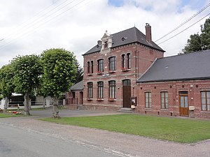
 Town hall (Mairie) by Romery |
||
Romery is a French commune with a population of 82 (as at 1st January 2017) in the department of Aisne in the region of Hauts-de-France . It belongs to the Arrondissement of Vervins , the Canton of Guise and the municipal association Thiérache Sambre et Oise .
geography
Romary is surrounded by the neighboring communities Monceau-sur-Oise (point of contact) in the north-west, Malzy in the north, Proisy in the east and the communes of Le Sourd in the canton of Marle in the south-east and Wiège-Faty in the south-west and west.
Population development
| year | 1962 | 1968 | 1975 | 1982 | 1990 | 1999 | 2007 | 2015 |
| Residents | 91 | 108 | 65 | 56 | 58 | 63 | 79 | 88 |
| Source: Cassini and INSEE | ||||||||
Web links
Commons : Romery - collection of images, videos and audio files
