Clairfontaine
| Clairfontaine | ||
|---|---|---|
|
|
||
| region | Hauts-de-France | |
| Department | Aisne | |
| Arrondissement | Vervins | |
| Canton | Vervins | |
| Community association | Thiérache du Center | |
| Coordinates | 49 ° 59 ′ N , 3 ° 59 ′ E | |
| height | 152-239 m | |
| surface | 14.31 km 2 | |
| Residents | 552 (January 1, 2017) | |
| Population density | 39 inhabitants / km 2 | |
| Post Code | 02260 | |
| INSEE code | 02197 | |
| Website | www.clairfontaine.fr | |
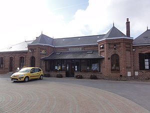
 Clairfontaine Town Hall ( Mairie ) |
||
Clairfontaine is a French municipality with 552 inhabitants (as of January 1 2017) in the department of Aisne in the region of Hauts-de-France (before 2016: Picardy ); it belongs to the arrondissement of Vervins and the canton of Vervins (until 2015: canton of La Capelle ).
geography
Clairfontaine is located about 51 kilometers east-northeast of Saint-Quentin in the Thiérache landscape .
| Rocquigny | Wignehies | Fourmies |
| La Flamengrie |

|
Mondrepuis |
| Sommeron , La Capelle | Luzoir | Wimy |
Population development
| year | 1962 | 1968 | 1975 | 1982 | 1990 | 1999 | 2006 | 2013 |
| Residents | 609 | 597 | 519 | 556 | 514 | 497 | 528 | 558 |
| Source: Cassini and INSEE | ||||||||
Attractions
- Church of Sainte-Ursule
- Clairfontaine Monastery
Web links
Commons : Clairfontaine - collection of images, videos and audio files

