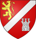
Etreux
| Etreux | ||
|---|---|---|

|
|
|
| region | Hauts-de-France | |
| Department | Aisne | |
| Arrondissement | Vervins | |
| Canton | Guise | |
| Community association | Thiérache Sambre et Oise | |
| Coordinates | 50 ° 0 ′ N , 3 ° 39 ′ E | |
| height | 115-160 m | |
| surface | 10.36 km 2 | |
| Residents | 1,459 (January 1, 2017) | |
| Population density | 141 inhabitants / km 2 | |
| Post Code | 02510 | |
| INSEE code | 02298 | |
| Website | http://www.etreux.fr/ | |
 Town hall of Etreux |
||
Étreux is a French commune with 1,459 inhabitants (as of January 1 2017) in the department of Aisne in the region of Hauts-de-France . It belongs to the Vervins arrondissement , the Thiérache Sambre et Oise municipal association and the Guise canton (until 2015: Wassigny canton ).
geography
Étreux is located in the north of France in the Thiérache at the confluence of the Noirrieu with the Morteau . Here the Canal de la Sambre à l'Oise ends . Étreux is surrounded by the neighboring communities of Oisy in the north, Boué in the northeast, La Neuville-lès-Dorengt in the south and east, Vénérolles in the west and southwest and Wassigny in the northwest.
history
At the beginning of the First World War , the British expeditionary forces managed to hold Étreux until August 27, 1914. The 2nd Royal Munster Fusiliers were almost completely wiped out as a battalion. Even the German troops, which with about 5,000 men outnumbered them sixfold, paid a high price with 1,500 dead.
Population development
| year | 1962 | 1968 | 1975 | 1982 | 1990 | 1999 | 2006 | 2012 |
| Residents | 1,489 | 1,588 | 1,655 | 1,839 | 1,754 | 1,670 | 1,642 | 1,481 |
| Source: Cassini and INSEE | ||||||||
Attractions
- Notre-Dame de la Nativité-de-la-Sainte-Vierge church

