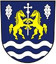
Rychnovek
| Rychnovek | ||||
|---|---|---|---|---|
|
||||
| Basic data | ||||
| State : |
|
|||
| Region : | Královéhradecký kraj | |||
| District : | After that | |||
| Area : | 1133 ha | |||
| Geographic location : | 50 ° 21 ' N , 15 ° 58' E | |||
| Height: | 264 m nm | |||
| Residents : | 643 (Jan. 1, 2019) | |||
| Postal code : | 552 03 - 552 25 | |||
| License plate : | H | |||
| traffic | ||||
| Street: | Nové Město nad Metují - Jaroměř | |||
| Railway connection: | Jaroměř – Trutnov | |||
| structure | ||||
| Status: | local community | |||
| Districts: | 3 | |||
| administration | ||||
| Mayor : | Veronika Velacková (as of 2011) | |||
| Address: | Rychnovek 50 552 25 Rychnovek |
|||
| Municipality number: | 574406 | |||
Rychnovek (German Reichenhof ) is a municipality in the Czech Republic . It is located three kilometers east of Jaroměř and belongs to the Okres Náchod .
geography
Rychnovek is located between the rivers of Úpa and Metuje ( Mettau ) in Eastern Bohemia. The Zvolský vrch (298 m) rises to the east and the Prásilka (276 m) to the southeast . The village is crossed by the Jaroměř – Trutnov railway and the road between Nové Město nad Metují and Jaroměř .
Neighboring towns are Dolany in the north, Zvole in the north-east, Volovka and Velká Jesenice in the east, Vinice, Šestajovice and Jasenná in the south-east, Kopeček and Starý Ples in the south, Josefov and Jaroměř in the south-west, Jakubské Předměstí in the west and Čáslavky in the north-west.
history
Rychnovek was first mentioned in a document in 1497. The district of Zvole, which can be traced back to 1283, is significantly older. Doubravice has been documented in writing since 1404.
In 1780 the construction of the fortified town of Ples , which was named Josefstadt in 1793, began southwest of Rychňovek in the area of the village of Ples . After the abolition of patrimonial Rychňovek / Reichenhof formed a municipality in the Dvůr Králové nad Labem district from 1850. With the construction of the railway from Josefstadt to Schwadowitz , the village received a railway connection in 1859. The place name has been written as Rychnovek since the end of the 19th century . After the Second World War, the community was reclassified to Okres Jaroměř. In 1955 the construction of a military area began in Rychnovek. The Okres Jaroměř was dissolved on January 1, 1961 and the village came to Okres Náchod. At the same time, Zvole and Doubravice were incorporated. In 1998 the military area was given up and after its clearing of the military legacies, the construction of an industrial area began in 2006.
Districts
The municipality Rychnovek consists of the districts Doubravice u České Skalice ( Daubrawitz near Böhmisch Skalitz ), Rychnovek ( Reichenhof ) and Zvole ( Zwoll ).
Attractions
- Church of St. Justus in Zvole

