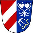
Bohuslavice nad Metují
| Bohuslavice | ||||
|---|---|---|---|---|
|
||||
| Basic data | ||||
| State : |
|
|||
| Region : | Královéhradecký kraj | |||
| District : | After that | |||
| Area : | 1412 ha | |||
| Geographic location : | 50 ° 18 ' N , 16 ° 5' E | |||
| Height: | 284 m nm | |||
| Residents : | 1,016 (Jan 1, 2019) | |||
| Postal code : | 549 06 | |||
| License plate : | H | |||
| traffic | ||||
| Railway connection: | Opočno – Náchod | |||
| structure | ||||
| Status: | local community | |||
| Districts: | 1 | |||
| administration | ||||
| Mayor : | Bohumil Kutina (as of 2007) | |||
| Address: | Bohuslavice 175 549 06 Bohuslavice nad Metují |
|||
| Municipality number: | 573892 | |||
| Website : | www.bohuslavice.com | |||
Bohuslavice has 950 inhabitants and is located between the rivers of Zlátý potok and Metuje ( Mettau ) in Okres Náchod ( Czech Republic ).
location
The place through which three streets lead is in an area that is used intensively for agriculture. It is characterized by agricultural buildings and the Church of St. Nicholas. The stream flowing through Bohuslavice from north to south caused several floods.
history
The first written mention of Bohuslavice comes from 1361, when it was owned by Sezema of Dobruška . In 1409 Vitek von Černčice owned the village. After Johann Černčický von Kácov founded the town of Nové Město nad Metují in 1501 and moved his seat there, Bohuslavice became part of the Nové Město nad Metují estate.
Attractions
- Building of the rectory
- Catholic and Protestant Church
- Old Protestant school
Individual evidence
- ↑ Český statistický úřad - The population of the Czech municipalities as of January 1, 2019 (PDF; 7.4 MiB)
Web links
- Homepage Czech
Commons : Bohuslavice nad Metují - collection of images, videos and audio files


