Nový Ples
| Nový Ples | ||||
|---|---|---|---|---|
|
||||
| Basic data | ||||
| State : |
|
|||
| Region : | Královéhradecký kraj | |||
| District : | After that | |||
| Area : | 712.2787 ha | |||
| Geographic location : | 50 ° 19 ' N , 15 ° 57' E | |||
| Height: | 269 m nm | |||
| Residents : | 346 (Jan. 1, 2019) | |||
| Postal code : | 551 01 | |||
| License plate : | H | |||
| traffic | ||||
| Street: | Jaroměř - Třebechovice pod Orebem | |||
| structure | ||||
| Status: | local community | |||
| Districts: | 1 | |||
| administration | ||||
| Mayor : | Miroslav Novák (as of 2017) | |||
| Address: | Nový Ples 28 551 01 Nový Ples |
|||
| Municipality number: | 574295 | |||
| Website : | www.novyples.cz | |||
Nový Ples (German Neu Ples , also Neu Pleß ) is a municipality in the Czech Republic . It is located 15 kilometers northeast of the city center of Hradec Králové and belongs to the Okres Náchod .
geography
Nový Ples is located on the left side of the Elbe and Metuje ( Mettau ) in their river level. The village is located on the northern edge of the Plesský les forest in the headwaters of the Novopleský potok. The fortress Josefstadt lies in the northwest .
Neighboring towns are Starý Ples in the north, Kopeček in the north-east, Jasenná in the east, Králova Lhota in the south-east, Libřice and Lejšovka in the south, Smržov and Vlkov in the south-west, Rasošky in the west and Dolní Ples and Josefov in the north-west.
history
The village of Nový Ples was created during the construction of the Ples fortress, which began in 1780. The middle part of the elongated village of Ples had to be torn down to build the fortress. To relocate the residents, the new villages Rasošek and Nový Ples were built on the edge of the fortress area within a year in 1782 . These were built using wood construction, individual buildings were relocated and some of the wood from the demolished houses was also reused. Nový Ples was created on the road leading through the Rasoška or Esterházy forest to Libřice and belonged to the kk cameraman Smiřitz - Hořeniowes . The first settlers were 15 families. When parts of the residents of Ples were supposed to be relocated to Rozběřice , they asked the emperor to relocate in the vicinity of their old village.
From the old village of Ples only Starý Ples and Dolní Ples have survived, between which the fortress, renamed Josefstadt since 1793, stood. Together with Nový Ples and Rasošek, Starý Ples and Dolní Ples formed the cadastre Ples.
In 1836 the village of Neu-Pleß or Nowy Ples in the Königgrätzer Kreis consisted of 26 houses in which 207 people lived. There was an inn in the village. The Rasoschek hunter's house was south of the village. The parish was Jasena . In 1843 there were 208 people in 30 houses in Neu-Pless . The kk camera rule Smiřitz-Hořeniowes remained crown property until 1848 and then became an imperial domain, the management of which was transferred to the kk privileged Credit Institution .
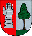
After the abolition of patrimonial Nový Ples formed from 1849 a district of the municipality Ples in the judicial district Jaroměř . From 1868 the village belonged to the Koeniginhof district on the Elbe . In 1890 the municipality of Ples was dissolved into three municipalities; in addition to Nový Ples, these were Rasošky (with the district Dolní Ples t. Vodní Ples ) and Starý Ples . At that time Nový Ples consisted of 60 houses with 539 inhabitants; in the vicinity of the village were the military firing range and a forester's house. In 1900, 488 people lived in 61 houses in Noyý Ples. The school location was Starý Ples. 1949 Nový Ples was assigned to the newly formed Okres Jaroměř; this was repealed in the course of the territorial reform of 1960, since then the community has belonged to Okres Náchod. The community has had a coat of arms since 2003.
Community structure
No districts are designated for the municipality of Nový Ples.
Web links
Individual evidence
- ↑ http://www.uir.cz/obec/574295/Novy-Ples
- ↑ Český statistický úřad - The population of the Czech municipalities as of January 1, 2019 (PDF; 7.4 MiB)
- ^ Johann Gottfried Sommer , Franz Xaver Maximilian Zippe: The Kingdom of Böhmen. Statistically and topographically presented, vol. 4 Königgrätzer Kreis , Prague 1836, p. 59
- ↑ Ottův slovník naučný. Devatenáctý díl. Praha: J. Otto, 1902. p. 898. Online version
- ↑ http://www.smirice.eu/dokumenty/adresar.htm
- ↑ http://www.novyples.cz/cs/leve-menu/obecni-urad/znak-obce/


