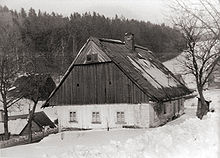
Suchý Důl
| Suchý Důl | ||||
|---|---|---|---|---|
|
||||
| Basic data | ||||
| State : |
|
|||
| Region : | Královéhradecký kraj | |||
| District : | After that | |||
| Area : | 1328 ha | |||
| Geographic location : | 50 ° 32 ' N , 16 ° 16' E | |||
| Height: | 489 m nm | |||
| Residents : | 418 (Jan. 1, 2019) | |||
| Postal code : | 549 54 - 549 62 | |||
| License plate : | H | |||
| traffic | ||||
| Street: | Police nad Metují - Suchý Důl | |||
| structure | ||||
| Status: | local community | |||
| Districts: | 2 | |||
| administration | ||||
| Mayor : | Vítězslav Vítek (as of 2017) | |||
| Address: | Suchý Důl 145 549 62 Suchý Důl |
|||
| Municipality number: | 574490 | |||
| Website : | www.suchydul.cz | |||
Suchý Důl (German Dörrengrund ) is a municipality in the Czech Republic . It is located 16 kilometers northeast of Náchod and belongs to the Okres Náchod .
geography
Suchý Důl extends at the western foot of the main ridge of the Falcon Mountains along the Ledhujka river . The north Klůček (614 m nm) and the Supí hnízdo rise ( Geier basket , 702 m nm), in the western Modrý kámen (686 m nm) and southwest the Velká Kupa (708 m nm).
Neighboring towns are Hlavňov in the north, Křinice in the northeast, Martínkovice in the east, Slavný in the southeast, Bělý in the south, Velká Ledhuje in the southwest, Police nad Metují in the west and Bukovice in the northwest.
history
The place, which was founded by German colonists around 1253 during the reclamation of the area by the Břevnov Monastery , was first mentioned in a document in 1395. Dörrengrund was the largest village of the Propstei Politz belonging to the Braunau monastery . The place was administered by the Scholtissei (šolcovna), a hereditary court. In 1561 the Braunau abbot Jan Chotovský founded the village of Klein Labnay. After the abolition of the Politz Propstei by Emperor Joseph II in 1775, the Politz monastery was formed from it; on condition that an annual lump sum was paid from the income to the religious fund, it remained in the possession of the Braunau- Breunau double abbey .
In 1836 the village of Dürrengrund or Suchodol in the Königgrätzer Kreis consisted of 90 houses in which 682 people lived. There was a school in the village where the children from Klein Labnay were also taught, and two mills. The parish was Politz. Until the middle of the 19th century, the village remained subject to the Politz monastery.
After the abolition of patrimonial Dörrengrund / Suchý Důl formed a municipality in the judicial district of Politz from 1849 . In 1868 Suchý Důl was assigned to the Braunau district . After the Munich Agreement remained Suchý Důl / Dried ground in the "Resttschechei" and the náchod district has been assigned. Until 1945 the village was the border point to the German Reich, the border ran north and east over the Falkengebirge ridge. After the end of the Second World War, Suchý Důl came back to Okres Broumov. In 1961 the Okres Broumov was abolished; Suchý Důl was incorporated into the Okres Náchod and at the same time Slavný was incorporated. In 1986 Suchý Důl lost its independence and became part of Police nad Metují . The parish has existed again since September 1, 1990.
Districts
The municipality Suchý Důl consists of the districts Slavný ( Klein Labnay ) and Suchý Důl ( Dörrengrund ), which also form cadastral districts.
Partner municipality
- Wambierzyce , Poland
Attractions
- Group of statues of the Holy Trinity
- Maria Lourdes chapel in the Ochozský les forest north-west of the village, built between 1883 and 1884
- Wooden pilgrimage chapel in the Ticháčký les forest north-west of the village. It was built in 1897 after 14-year-old Christina Ringl is said to have appeared there 23 times to the Virgin Mary between 1892 and 1895. After a fire in 2010 it was rebuilt and consecrated on July 8, 2012 by Archbishop Dominik Duka of Prague with the assistance of Bishop Jan Vokál .
- Way of the Cross with rosary steps at a spring, created in 1893
- Devil's Stone ( Čertova skála ), at the upper chapel, lookout point
- Albendorfer Weg with memorial stones and crosses, south of the village
- 300-year-old linden tree in the village
- Canyons Hruškova rokle, Liščí rokle and Hájkova rokle east of the village; in the latter is the Suchodolská Niagára waterfall
Web links
Individual evidence
- ↑ http://www.uir.cz/obec/574490/Suchy-Dul
- ↑ Český statistický úřad - The population of the Czech municipalities as of January 1, 2019 (PDF; 7.4 MiB)
- ^ Johann Gottfried Sommer , Franz Xaver Maximilian Zippe: The Kingdom of Böhmen. Statistically and topographically presented, vol. 4 Königgrätzer Kreis , Prague 1836, p. 188
- ↑ http://www.uir.cz/casti-obce-obec/574490/Obec-Suchy-Dul
- ↑ http://www.uir.cz/katastralni-uzemi-obec/574490/Obec-Suchy-Dul
- ↑ Kladské Pomezí, Léto 2012, p. 18


