Svatoslav u Třebíče
| Svatoslav | ||||
|---|---|---|---|---|
|
||||
| Basic data | ||||
| State : |
|
|||
| Region : | Kraj Vysočina | |||
| District : | Třebíč | |||
| Area : | 1929 ha | |||
| Geographic location : | 49 ° 20 ' N , 15 ° 50' E | |||
| Height: | 544 m nm | |||
| Residents : | 245 (Jan. 1, 2019) | |||
| Postal code : | 675 06 | |||
| License plate : | J | |||
| traffic | ||||
| Street: | Měřín - Čechtín | |||
| structure | ||||
| Status: | local community | |||
| Districts: | 1 | |||
| administration | ||||
| Mayor : | Miroslav Dočekal (as of 2008) | |||
| Address: | Svatoslav 29 675 07 Čechtín |
|||
| Municipality number: | 591793 | |||
| Website : | www.obecsvatoslav.cz | |||
Svatoslav (German Swatoslau ) is a municipality in the Czech Republic . It is located twelve kilometers north of Třebíč and belongs to the Okres Třebíč .
geography
Svatoslav is located in a basin formed by the Svatoslavský creek and a left tributary in the Krischanauer Uplands ( Křižanovská vrchovina ) in the south of the Bohemian-Moravian Highlands . To the north rise the Vořenov (620 m) and Hradiště (661 m), the Červený kopec (617 m) and Skalníky (642 m) in the southeast and the Smrček (674 m) in the southwest.
Neighboring towns are Pouště and Brodek in the north, Pavlínov and Horní Radslavice in the northeast, Bochovice and Batouchovice in the east, Hroznatín in the southeast, Benetice and Čechtín in the south, Kouty and Horní Smrčné in the west and Radošov and Zátiší in the northwest.
history
The village was first mentioned in a document in 1290, when Abbot Martin II of the Benedictine monastery in Třebíč bought a farm from the Tempelstein Commander Syfrid de Bruno. In 1465 the abbot Matthew pledged the farm to the feudal man Vidlák. His descendants held the property until 1490, when Wilhelm II of Pernstein redeemed the pledge and Svatoslav became part of the Třebíč rule . In the second half of the 16th century there were two man fiefs in Svatoslav, which were held by the lords of Vidlák until 1654, then by Jiří Kotrba. In 1678 two farms were built instead of the Mannslehngüter.
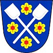
After the abolition of patrimonial Svatoslav formed from 1850 a district of the political municipality Bochovice in the Třebíč district. In 1869 the municipality of Svatoslav was established, which in 1870 had 445 inhabitants. At the transition from the 19th to the 20th century, the municipality was temporarily called Svatoslava . In 1900 there were 450 people living in Svatoslav. In 1925, the Waldsteinruh manor was separated from the large estate in Třebíč and joined the management in Čechtín . Owners were the lords of Waldstein-Wartenberg, Montlong and Krečen. In 1991 the village had 268 inhabitants. The community has had a coat of arms and a banner since 2003. The Svatoslav community today consists of 98 houses.
Community structure
No districts are shown for the municipality of Svatoslav. Svatoslav to include monolayer Žákův Mlyn ( Swatoslauer mill ) and Zátiší ( Waldsteinruh ).
Attractions
- Summer palace Valdštejnovo Zátiší, also called Seč ( Waldsteinruh ) in Zátiší, built in the second half of the 19th century for the Counts von Waldstein -Wartenberg from a fortress built in the 14th century. In 1945 the castle was expropriated and a children's holiday camp was set up there. In the 1970s and 1980s, renovations in the style of "socialist realism" made the castle less attractive.
- Chapel of St. Benedict, built between 2005 and 2006 according to plans by architects Eva Uchytilová and Karel Vaverka from Třebíč
- Listed farms in folk architecture
literature
- Oldřich Hnízdil: Svatoslav. History a současnost. Obecní úřad, Svatoslav 2005, ISBN 80-239-9561-8 .
- Jan Sucharda: Pohlednice obce Svatoslav. 2006
Individual evidence
- ↑ Český statistický úřad - The population of the Czech municipalities as of January 1, 2019 (PDF; 7.4 MiB)


