Radošov
| Radošov | ||||
|---|---|---|---|---|
|
||||
| Basic data | ||||
| State : |
|
|||
| Region : | Kraj Vysočina | |||
| District : | Třebíč | |||
| Area : | 641 ha | |||
| Geographic location : | 49 ° 20 ' N , 15 ° 47' E | |||
| Height: | 581 m nm | |||
| Residents : | 172 (Jan 1, 2019) | |||
| Postal code : | 675 08 | |||
| License plate : | J | |||
| traffic | ||||
| Street: | Čechtín - Kamenice | |||
| structure | ||||
| Status: | local community | |||
| Districts: | 1 | |||
| administration | ||||
| Mayor : | Pavel Pařízek (as of 2018) | |||
| Address: | Radošov 38 675 07 Čechtín |
|||
| Municipality number: | 591564 | |||
| Website : | www.obecradosov.cz | |||
Radošov (German Radeschow , 1939-1945 Radeschau ) is a municipality in the Czech Republic . It is located 15 kilometers northwest of Třebíč and is the northernmost municipality of the Okres Třebíč .
geography
Radošov is located in the Krischanauer Uplands ( Křižanovská vrchovina ) in the south of the Bohemian-Moravian Highlands . The village lies at the source of the Chlumský creek; The Waldried extends to the east. State road II / 351 runs east of the village between Čechtín and Kamenice . In the northeast rise the Holubka (604 m nm) and the Panský kopec (668 m nm), to the east the Hradiště (662 m nm), in the southeast the Vořanov (620 m nm) and the Smrček (674 m nm) and northwest the Bílá hora (659 m nm). The Okres Třebíč, Okres Jihlava and Okres Žďár nad Sázavou meet five kilometers northeast .
Neighboring towns are Kamenice and Kamenička in the north, Urbánkova Samota, Pouste, U Čížků, Zahrada, U Buku and Pavlínov in the Northeast, CIPY and Zátiší in the east, Svatoslav , Smrček and Benetice in the southeast, Kouty in the south, Pavlovský Mlyn, Chlum and Horni Smrčné in the southwest, V Šavlátě and Přímělkov in the west and Pruknerova Samota and Vržanov in the northwest.
history
The village probably originated in the 12th century. It was first mentioned in writing in 1365, when Vojslav Bytovčic bought the Radošov estate from Vyšemír von Radošov as a pledge. Wilhelm von Pernstein , who had received the goods of the Třebíč monastery as a pledge in 1490 , expanded them through further acquisitions to a great lordship. He released the pledged Radošov estate in 1490 and united it with the Třebíč rule. The village of Radošov at that time consisted of 16 houses. Later the Counts of Waldstein on Pirnitz also acquired the Třebíč rule. The residents of Radošov lived from agriculture and animal husbandry; some of them worked in the woods of the Counts of Waldstein in winter. The parish and school location was Chlum .
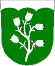
After the abolition of patrimonial Radošov formed a political municipality in the judicial district Trebitsch from 1850. From 1868 the community belonged to the Trebitsch district . In 1869 Radošov had 311 inhabitants. In 1888 a school was opened in Radošov. The volunteer fire brigade was founded in 1929. In 1937 Radošov was electrified. Between 1961 and 1990 Horní Smrčné was incorporated. In 1996 a multi-purpose building was completed, in which the library, the fire department, the municipal office, a meeting room and a doctor's office are housed. The former school building is now used as a cultural center. Since 2008 the community has had a coat of arms and a banner.
Community structure
No districts are shown for the municipality of Radošov.
Attractions
- Two stone wayside crosses, created in 1887 and 1901
- Cast iron wayside cross from 1876
- Memorial stone for the fallen of both world wars


