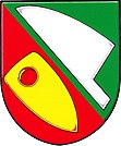
Sudice u Náměště nad Oslavou
| Sudice | ||||
|---|---|---|---|---|
|
||||
| Basic data | ||||
| State : |
|
|||
| Region : | Kraj Vysočina | |||
| District : | Třebíč | |||
| Area : | 612 ha | |||
| Geographic location : | 49 ° 11 ' N , 16 ° 14' E | |||
| Height: | 435 m nm | |||
| Residents : | 349 (Jan 1, 2019) | |||
| Postal code : | 675 73 | |||
| License plate : | J | |||
| traffic | ||||
| Street: | Kralice nad Oslavou - Ketkovice | |||
| structure | ||||
| Status: | local community | |||
| Districts: | 1 | |||
| administration | ||||
| Mayor : | Jaroslav Doležal (as of 2020) | |||
| Address: | Sudice 11 675 73 Rapotice |
|||
| Municipality number: | 591785 | |||
| Website : | www.sudice.eu | |||
Sudice (German Suditz ) is a municipality in the Czech Republic . It is located seven kilometers southeast of Náměšť nad Oslavou and belongs to the Třebíč .
geography
Sudice is located on the Sudický creek in the Jevišovická pahorkatina ( Jaispitzer hill country ), a subsystem of the Bohemian-Moravian Highlands . On the northern edge of the village, the Střelice – Okříšky railway passes Sudice; State road I / 23 runs one and a half kilometers away . To the west lies the Chvojnice valley . In the south rise the Kozí hřbety (430 m nm), southwest of the Příčný (445 m nm) and in the northwest the Černá hora (452 m nm). The Oslava Nature Park extends to the south.
Neighboring towns are Horní Lhotice and Lesní Jakubov in the north, Rapotice in the northeast, Vysoké Popovice and Zakřany in the east, Lukovany and Ketkovice in the southeast, Kuroslepy in the southwest, Březník in the west and Kralice nad Oslavou in the northwest.
history
The first written mention of Sudicz was in 1101 in the founding document of the Benedictine monastery of the Assumption of Mary in Třebíč . In 1225 the Cistercian convent Vallis sanctae Mariae in Oslavany became the owner of Sudice in the course of an exchange of goods. In the middle of the 13th century, the Knights Templar acquired the village and gave it to his commander Jamolice , and later to the Tempelstein Castle . Levnov Castle was probably built around this time . After the destruction of the Knights Templar, the lords of Leipa can be proven as owners from 1346 , who attached the goods to the Krumlov rule . The Lewnow dynasty has been the owner of the Levnov Castle since 1358. It is believed that the surrounding villages Sudice, Čučice , Ketkovice and Rapotice , which were previously subject to the Templars, also belonged to the castle rule . After the Lewnow family died out, the castle also fell to the lords of Leipa, who reunited the estates with the Krumlov rule. After the Battle of White Mountain in 1621, the property of Bohuslaw von Leipa, who was a leader of the Moravian estates, was confiscated. In 1624 Gundaker von Liechtenstein bought the rule.
In 1835 the village of Suditz or Sudice in the Znojmo district consisted of 47 houses in which 265 people lived. There was a school in the village. To one side was a mill. Most of the residents worked in the Namieschter cloth factory. The parish was Czutschitz . In 1848 a new school building was built. Until the middle of the 19th century Suditz remained subject to the Fideikommiss-Primogeniturherrschaft Moravian-Krummau .
After the abolition of patrimonial formed Sudice / Suditz 1849 with the hamlet Rapotice a municipality in the judicial district Namiest . From 1869 the community belonged to the Trebitsch district. At that time Sudice had 359 inhabitants and consisted of 52 houses. In 1882 Rapotice broke up and formed its own municipality. Between 1883 and 1885 the secondary railway Segen Gottes – Okříschko was built north of the village ; however, Sudice did not get a train station. In 1900 there were 412 people in Sudice; In 1910 there were 462. In the 1921 census, 565 people lived in the community's 87 houses, including 564 Czechs. In 1930 Sudice consisted of 115 houses and had 541 inhabitants. From 1939 to 1945 Sudice / Suditz belonged to the Protectorate of Bohemia and Moravia . In 1948 the municipality was assigned to the Okres Velká Bíteš. In 1950 Sudice had 543 inhabitants. In the course of the territorial reform and the repeal of the Okres Velká Bíteš, the municipality was reassigned to the Okres Třebíč on July 1, 1960 . In the 2001 census, 327 people lived in the community's 163 houses.
Community structure
No districts are shown for the municipality of Sudice. The one-layer Olšinský Mlýn ( Alder Mill ) belongs to Sudice .
The municipality forms the cadastral district Sudice u Náměště nad Oslavou .
Attractions
- Chapel of St. Medardus
- Memorial stone for the fallen of the First World War
- Memorial to the victims of World War II
- several hall crosses
literature
- Historický lexikon obcí České republiky 1869–2005 , part 1, p. 592
Individual evidence
- ↑ Obec Sudice: podrobné informace , uir.cz
- ↑ Český statistický úřad - The population of the Czech municipalities as of January 1, 2019 (PDF; 7.4 MiB)
- ^ Gregor Wolny : The Margraviate of Moravia, presented topographically, statistically and historically . Volume III: Znojmo District, Brno 1837, p. 351
- ↑ Chytilův místopis ČSR, 2nd updated edition, 1929, p. 1186 Sťaté - Suchá
- ↑ Katastrální území Sudice u Náměště nad Oslavou: podrobné informace , uir.cz


