
Grafenrheinfeld
| coat of arms | Germany map | |
|---|---|---|

|
Coordinates: 50 ° 0 ' N , 10 ° 12' E |
|
| Basic data | ||
| State : | Bavaria | |
| Administrative region : | Lower Franconia | |
| County : | Schweinfurt | |
| Height : | 208 m above sea level NHN | |
| Area : | 11.35 km 2 | |
| Residents: | 3426 (Dec. 31, 2019) | |
| Population density : | 302 inhabitants per km 2 | |
| Postal code : | 97506 | |
| Area code : | 09723 | |
| License plate : | SW , GEO | |
| Community key : | 09 6 78 136 | |
| LOCODE : | DE GHE | |
| Community structure: | 1 district | |
| Address of the municipal administration: |
Am Marktplatz 1 97506 Grafenrheinfeld |
|
| Website : | ||
| Mayor : | Christian Keller ( CSU ) | |
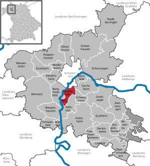
| Location of the municipality Grafenrheinfeld in the district of Schweinfurt | ||
  |
||

Grafenrheinfeld ( East Franconian Rafeld ) is a municipality and a place in the Lower Franconian district of Schweinfurt . It is located on the eastern (left) bank of the Main and borders directly on the northern city of Schweinfurt and is a preferred residential suburb. The community is located in a flat landscape that is untypical for Lower Franconia and is characterized by bodies of water and dykes .
The place is known nationwide because of the Grafenrheinfeld nuclear power plant, which was shut down in 2015, and as a planned end of the Suedlink power line . The important German power line junction, however, is far away from the village and partly on the opposite bank of the Main, in the Bergrheinfeld area. Landmarks that can be seen from afar are the twin towers of the parish church Kreuzauffindung and the two cooling towers of the decommissioned nuclear power plant, which are visible up to 50 kilometers .
Grafenrheinfeld is the western gate of the Intercommunal Alliance Schweinfurt Mainbogen , a local recreation area with several bathing lakes and an equestrian center, where the Franconian show jumping championships are often held by the Grafenrheinfeld riding and driving club .
geography
Location on the Main
The community is located in the Main Valley, which extends for miles south of Schweinfurt as a flat plain. The place is mostly from old arms framed the River Main, the Altmainschleife North and Altmainschleife South . A natural and recreational landscape with a total of four bathing lakes, some in the Bergrheinfeld area.
Main and dyke history

Grafenrheinfeld used to be protected by the Maindamm , a historic ring dike . A dike promenade is to be created on the northern section . According to tradition, the boatmen are said to have seen the church towers of the village for a day when they passed through the Main Loops, which continued in the northern connection to the Schweinfurt area.
In 1823 the Main was straightened by the Main Correction of the Bavarian State Government with a total of five successive punctures. The danger of constant flooding in the village was averted, the flow speed of the Main increased and the independent flushing of the river bed ensured. Since then, the Main has only touched the town for a short distance in the northwest. Since 1947 the corridors around the historic ring dike up to the Schwebheimer Wald have no longer been a floodplain .
In the 1960s, the Main was expanded to become the Main-Danube Canal , a large shipping route. As part of this major project, today's main dike was built for the first time along the Main between 1967 and 1969.
In 2008 the renovation of these dikes was completed. The walls were widened by six meters and the top of the dam was raised by 70 cm to 3.50 m. The calculations took into account global warming and added 15% of water masses to the largest flood that occurs statistically every 100 years (most recently in 1909). The core of the dykes was also provided with a 40 cm thick concrete wall, which was anchored eight to ten meters below the ramparts so that flood protection remains in place even if the embankment is washed away on the river side. New, publicly accessible maintenance routes on the top of the dike and behind the ramparts have been created.
In order to allow more space for the flood to spread again, preliminary planning has been underway since 2003 until now (2018) to build a flood polder between the straightened Main and the Altmainschleife Süd. This area is called Bergrheinfelder Insel because, due to the historical course of the Main, it was on the right-Main Main until 1823 on the Bergrheinfeld side and is still part of the neighboring community today.
Both communities have been connected by the Main Bridge Bergrheinfeld since 1901 . The new tied arch bridge was built in 2008/2009 . Originally a ferry operated here , which is still indicated today by the ferry house 600 m north (up the Main). A landing stage is planned north of the Main Bridge.
natural reserve


The Altmainschleife Süd forms the Alter Main nature reserve near Bergrheinfeld and Grafenrheinfeld . With its reeds , tall herbaceous vegetation , willow bushes and riparian trees, it is an important breeding and resting place for water birds. In the south of the municipality, on the western outskirts of Röthlein, there is the Elmuß nature reserve , an alluvial forest through which the Unkenbach flows .
About one kilometer east of Grafenrheinfeld is the protected landscape component "Sauerstücksee and Hirtenbachaue". The approximately 40 hectare area includes former sand and gravel mining areas and, with its diverse biotopes, offers habitats for numerous protected animal and plant species. In the winter half of the year, the Sauerstücksee in particular, with the meadows and fields next to it, is a resting and wintering area for numerous migratory birds.
Senftenhofsee
The Senftenhofsee can be found in the north of the municipality, on the border with Schweinfurt. His name refers to the Senftenhof deserted area (see: History ) .
Neighboring communities
Grafenrheinfeld has five neighboring communities, all of which, with the exception of the independent city of Schweinfurt in the north, are located in the district of Schweinfurt . In the northeast, the municipality of Gochsheim borders on Grafenrheinfeld on a short, only 200 m long section, in the east lies Schwebheim , in the southeast Röthlein and in the west, on the other side of the Main, Bergrheinfeld .
The municipal boundaries are still based on the course of the Altmain, so that northern Main municipalities have shares south of the Main and vice versa. With the exception of the Glöckle See , where Grafenrheinfeld (today) has an area north of the historic Main River and the border between Berg- and Grafenrheinfeld runs right through the lake. Orientation is extremely difficult, as there was no reorganization of the areas, with one exception, in the course of the regional reform in Bavaria around the city of Schweinfurt due to the lack of incorporation.

Church square with rococo church

history
Until the church is planted
On April 21, 741 the royal estate "Roumfeld" was mentioned for the first time at the first German synod in Mainz in a deed of gift from King Karlmann to the diocese of Würzburg . In 1688 Grafenrheinfeld was granted market rights .

In 780 "Ronefeld" was mentioned as one of the localities of the "Gozfeld". In 1094 and 1113 "Rounvelt", "Ronefelt", "Ronfeld" or "Ranvfelt" belonged to the Werngau . Another place name was "Raunvelt" (1304). In 1318, for the first time, “Ravelt” is an equivalent of today's local dialect name for the place “Rafeld”. In 1327 the name was "Rainfelt" and in 1419 "Reinfelt", from which the later name Rheinfeld arose. All of these names were used as a common name for today's places Bergrheinfeld, Röthlein , Grafenrheinfeld and Oberndorf (now part of Schweinfurt ). Later the name changed from "Grauenrheinfeld" (1554) to "Greuenrheinfeld" (1557), "Gräuenrheinfeld" (1601) and "Gräfenrheinfeld" (1627) and "Grävenrainfeld" (1635) to Grafenrheinfeld. There was also the designation "Niederrhanfeld" or "Graben reinvelt". The name is derived from Graben, Niederung (Old High German graban ): the Rheinfeld located in a valley. The neighboring town of Bergrheinfeld , on the other hand, was dubbed “Ranfelt uf dem Berge”. The origin of the name from a count is unlikely, since no count had his castle seat there.

Yellow: Reichsstadt Schweinfurt (Protestant).
Beige: Reichsdörfer (Protestant).
Braun: Imperial Knightships (Protestant).
Green: Counts of Schönborn (Catholic).
Red: German Order ( Brönnhof ).
Rosa: Hochstift Würzburg and various mandates
Grafenrheinfeld with its sizeable spiritual center on Kirchplatz and Bergrheinfeld were the Catholic places of the Würzburg monastery that were closest to the Protestant region around Schweinfurt in the southwest. In the Counter-Reformation , the Würzburg prince-bishops also promoted these outposts by setting up wayside shrines out of concern for Lutheran doctrine , for example with the Grafenrheinfeld crucifixion shrine from 1619. However, from the perspective of the bishopric, Grafenrheinfeld in particular was strategically less favorable and more difficult to reach than the third Catholic outpost the western periphery of the imperial city, Geldersheim . The latter was on the Würzburg – Meiningen road , which was completed in 1796 to bypass Schweinfurt in the area of the Hochstift (the western bypass on the map opposite).
At the Altmainschleife North still on the cards began the 19th century drawn Schmachtenberg path , which mentioned the first documented in 1425 Wüstung Schmachtenberg led. It was on the former border with the imperial city of Schweinfurt and was probably abandoned in the 15th century . 2 km northeast of Grafenrheinfeld, at the Schwebheimer Wald , lies the Senftenhof desert on the Senftenhofsee . She is now in the border area of the district s of Grafenrheinfeld, Gochsheim and Schweinfurt. The village was probably the successor settlement of Schmachtenberg and was inhabited until the 17th century . After that, the place was probably also abandoned.
19th and 20th centuries
In 1818 the political municipality was established. In 1823 the Main was straightened by the Main Correction and the danger of constant flooding averted (see: Main and dyke history ).
A cadastral plan from the 19th century contains six street names: Unteres Thor (today: Hauptstraße), Oberes Thor (today: Marktplatz and Schweinfurter Straße), Bühl (today: in the south Bühlstraße and in the north Kirchplatz) and the three names Maingasse, which have not changed until today , Herrngasse and Linsengasse in the north of the old village center.

The local system was originally designed as a Rundling . In 1928, the ring dike surrounding the place was largely preserved as protection against Main floods, with hedges, ditches and a path (named after the hedge Hag ) around the place. In the dike there were three entrances with wooden gates and a two-story tower each. The last two towers were demolished in 1870. On the extension of Maingasse, the ferry house, which still exists today , was where the ferry was located . Before the Main Bridge was built, it was the only way across the river. In 1927 the houses were renumbered and signed.
During the Second World War , the place was largely destroyed by bombing . On the afternoon of February 24th and on the night of February 25th, 1944, Grafenrheinfeld was hit by numerous liquid bombs , high- explosive bombs , aerial mines and a vast number of stick bombs as part of Big Week . The two attacks resulted in 35 deaths. 71 houses burned down, 65 houses were badly damaged, 106 houses slightly damaged, 136 barns and 116 outbuildings were destroyed by flames.
In the attacks on the places in the vicinity of Schweinfurt, as well as on Sennfeld , the apartments of commuters in the Schweinfurt large industry, the European center of the rolling bearing industry, a key industry that was extremely important to the war effort . In both attacks Grafenrheinfeld was destroyed to 80%, while in 22 attacks Schweinfurt, which had the best air defense in Germany, only 45% was destroyed. In contrast to Grafenrheinfeld, the Allies did not manage to ignite a firestorm here either , but experienced their worst air defeats here.
Population development
Grafenrheinfeld has developed into a residential suburb of Schweinfurt, especially since the post-war decades. In recent times Grafenrheinfeld has become increasingly popular, which is why the number of inhabitants, in contrast to some other Schweinfurt suburbs, continued to rise slightly despite the demographic change .

- 1991: 3096 inhabitants
- 1995: 3237 inhabitants
- 2005: 3345 inhabitants
- 2010: 3361 inhabitants
- 2015: 3440 inhabitants
- 2018: 3396 inhabitants
politics
mayor
Christian Keller (* 1979, CSU ) has been mayor since September 30, 2019. With a turnout of 74.1%, he was elected with 66.9% of the vote on September 29, 2019. In the runoff election on March 30, 2014, he was still 47% inferior to the incumbent. His predecessor Sabine Lutz (* 1960, Rafelder responsible citizen), in office since May 1, 2008, retired in the summer of 2019 due to health restrictions; in the meantime, 2nd mayor Gerhard Riegler was in charge of the community
Municipal council
The municipal council has 16 seats. The local elections in 2002, 2008, 2014 and 2020 resulted in the following allocation of seats:
| 2002 | 2008 | 2014 | 2020 | Share of votes 2020 |
|
|---|---|---|---|---|---|
| CSU | 8th | 8th | 8th | 6th | 37.52% |
| SPD / Free Voters | 4th | 3 | 3 | 3 | 18.42% |
| Green | - | - | - | 3 | 25.59% |
| FBL | 4th | 5 | 5 | 4th | 18.46% |
| total | 16 | 16 | 16 | 16 | 100.00% |
(FBL = non-party voter group "Freie Bürgerliste Grafenrheinfeld")
coat of arms
|
|
Blazon : "In blue over a label, in it three shortened silver tips in red, the growing silver half-figure of Saint Helena with a golden crown, who holds a golden scepter in her right hand and a golden cross in her left."
Introduced in 1980 |
Culture and sights
In the middle of the historic town center there are two squares. The streets from the neighboring towns converge at the market square. Not far to the south is the quiet church square with many monuments, including the old district bailiwick , today a Franconian inn with a beer garden.
Architectural monuments
Soil monuments
- church Square

Parish Church
Finding the Cross
Eastern church portal

Marian column

Benefit house

Alte Amtsvogtei
(today an inn)
Pflegerhaus
(today a pizzeria)
.JPG)


|
|
.jpg)
Recreation
- Natural bathing lake in the Altmainschleife Nord leisure facility on the northeastern edge of the town on Gochsheimer Strasse. Furthermore with hiking trails, tennis courts and riding arena.
- Bathing lakes on the Altmainschleife Süd , right on the edge of the village, but located in the municipality of Bergrheinfeld .
Economy and Infrastructure


Nuclear power plant
The Grafenrheinfeld nuclear power plant (KKG), which was decommissioned on June 27, 2015, is located two kilometers south-southwest of the old village center. It is located on the south bank of the Altmainschleife South , with outbuildings, reactor dome , cooling ponds , temporary storage , two 143 meter high cooling towers and a substation for connection to the 380 kV grid.
The construction work, in which 14,000 people were involved, began in 1974 by Bayernwerk AG . Two 143 m high cooling towers were erected, which can be seen over 50 km away as far as Middle Franconia . On December 9, 1981, the power plant went into operation with a pressurized water reactor and a gross electrical output of 1345 megawatts , worked almost without any disruptions and was hardly noticed nationwide. There was one incident at INES level 1 on the seven-digit rating scale, all other incidents were below this lowest level. In its first full year of operation, 1983, the KKG produced 9.96 billion kilowatt hours of gross electricity, more than any other system in the world. The E.ON plan provides for the dismantling to begin in 2018. First, the radioactive material is to be removed from the controlled area. The dismantling should be completed by 2028 , so that only the buildings are still standing and the plant is formally no longer subject to nuclear supervision. The demolition of the buildings and the cooling towers should then begin and be completed according to the plan by 2030/31. The highly radioactive waste is to be sent to the neighboring BELLA interim storage facility as long as there is no central repository . The operating license for BELLA is valid until 2046. The Konrad mine near Salzgitter is to absorb the medium and low-level radioactive substances . Since it is not yet available, a BeHa supply hall is being built at the KKG. Dismantling and demolition are expected to cost 1.2 billion euros.
Line node

In the immediate vicinity of the decommissioned nuclear power plant, which is about 2 km south of the village center and also extends to Bergrheinfeld area, there is one of the most important German pipeline nodes that will remain in place; with a 380/220/110 kV substation , which is connected to the switchgear of the nuclear power plant via four circuits (two 220 kV and two 380 kV).
The Grafenrheinfeld line node will be expanded from 2015 to 2019 by the new Bergrheinfeld West substation from the transmission system operator Tennet TSO for around 100 million euros and is to become an end point of Suedlink . The exact power line has not yet been determined (2017), but underground cables as a cable type.
Companies
On the southern outskirts of the town there is an industrial park with various companies on the state road 2277 to Röthlein .
The focus of FIS Informationssysteme und Consulting GmbH lies in the consultation and implementation of SAP projects for trade and industry. In the field of technical wholesale, FIS is the market leader in the DA-CH region . FIS emerged from the former SAP department of the Schweinfurt rolling bearing manufacturer FAG Kugelfischer (today part of the Schaeffler Group ) and was founded in 1992 as a subsidiary. In 1993 FIS GmbH became an independent company and from 1996 the location was relocated from Schweinfurt to the current headquarters in Grafenrheinfeld. Today FIS GmbH and its subsidiaries employ a total of over 750 people (as of 2019).
The Trips Group is an engineering service provider with headquarters in Grafenrheinfeld. It was founded in 1980 and currently (2020) has a total of 250 employees.
Jobs
In 2017 there were 1,612 jobs subject to social security contributions in the municipality. Of the resident population, 1,514 people were in an occupation subject to compulsory insurance, so that the number of in-commuters was 98 higher than that of out-commuters. 42 residents were unemployed.
Public facilities
|
|
societies
|
|
traffic
Since 1901, that connects Main Bridge Bergrheinfeld Grafenrheinfeld with Bergrheinfeld, the 2008/2009 deck arch bridge was rebuilt (see picture: Main and dykes ) .
Street
- A 70 / E 48 Schweinfurt - Bamberg - Bayreuth , with junctions (West) No. 5 Schweinfurt / Bergrheinfeld and (East) No. 6 Schweinfurt-Hafen
- from here after 2 km (in a westerly direction) connection to the A 71 triangle Südharz - Erfurt –Schweinfurt
- after a further 6 km (in a westerly direction) connection to the A 7 / E 45 Kassel - Ulm
- and connection to the B 26a in the direction of Karlstadt
Berlin can be reached via two equally long motorway routes via the A 70 and A 71
rail
- Nearest train station: Schweinfurt main station (5 km)
Public transport

Connection to the bus network of:
wheel
- The Main cycle path leads through Grafenrheinfeld
- The Main-Werra cycle path begins on the opposite bank
water
- Location right on the Main, mooring in planning
Personalities
- Moritz Schmid (1733-1818), the last provost of Heidenfeld before secularization, probably grew up in Grafenrheinfeld and died here in 1818
- Nikolaus II. Scholl (1474–1551), abbot of the monastery in Münsterschwarzach
Others
The Dutch composer Jacob de Haan wrote the piece Kraftwerk (2006), which is about the destruction of the place during the Second World War.
The book Die Wolke by the author Gudrun Pausewang is about a worst-case scenario in the Grafenrheinfeld nuclear power plant and its consequences.
Web links
Individual evidence
- ↑ "Data 2" sheet, Statistical Report A1200C 202041 Population of the municipalities, districts and administrative districts 1st quarter 2020 (population based on the 2011 census) ( help ).
- ^ The members of our parish council. In: Municipal Council. From Grafenrheinfeld.de, accessed on October 8, 2019.
- ↑ Stefanie Reichert: A five-day mecca for riders. In: Mainpost. Mainpost.de, August 23, 2019, accessed on October 8, 2019 .
- ↑ a b Zukunftswerkstatt Grafenrheinfeld 2010. (PDF) Retrieved on November 29, 2017 .
- ^ A b Municipality of Grafenrheinfeld: "The Main and its significance for Grafenrheinfeld". Retrieved January 6, 2018 .
- ^ Revista Verlag Schweinfurt: "Sauerstücksee with the Hirtenbachaue". Retrieved January 7, 2018 .
- ^ Bad Kissingen Water Management Office: "Maindeiche bei Schweinfurt". Retrieved January 7, 2018 .
- ↑ District of Schweinfurt: "The renovation of the Maindeiche in the Schweinfurt area". Retrieved January 7, 2018 .
- ^ Bad Kissingen Water Management Office: "Flutpolder Bergrheinfeld". (No longer available online.) Archived from the original on January 7, 2018 ; accessed on January 7, 2018 . Info: The archive link was inserted automatically and has not yet been checked. Please check the original and archive link according to the instructions and then remove this notice.
- ↑ result of the query - www.ornitho.de. Retrieved December 17, 2019 .
- ↑ a b c d e f g h J. Freppon: From Grafenrheinfeld's old and new times. Verlag Deutsche Gaue, Kaufbeuren 1928
- ↑ BayernAtlas , land register plan from the 19th century.
- ↑ Schweinfurter Tagblatt of February 24, 1984
- ↑ Population figures on December 31, 2018. Bavarian State Office for Statistics, accessed on May 24, 2020 .
- ^ Anniversary service of the former mayor Lutz , accessed on July 4, 2020
- ↑ Main-Post from May 20, 2019 , accessed on July 4, 2020
- ^ Bavarian State Office for Statistics / Elections. Retrieved August 6, 2019 .
- ↑ 2020 municipal council election , accessed on July 4, 2020
- ↑ Entry on the Grafenrheinfeld coat of arms in the database of the House of Bavarian History
- ↑ The cooling towers can be seen from the road from Uffenheim in the direction of Rothenburg ob der Tauber 3 km after crossing the A 7.
- ↑ Federal Office for Radiation Protection: Nuclear Power Plants in Germany - Reportable Events, as of April 13, 2015.
- ↑ Press release from February 14, 2001 at kernenergie.de.
- ↑ Schweinfurter Tagblatt: This is how E.on wants to tear down the Grafenrheinfeld nuclear power plant. May 8, 2016.
- ↑ tv touring Schweinfurt: Video on the dismantling of the Grafenrheinfeld nuclear power plant. Retrieved February 26, 2017 .
- ↑ Nicolai Kwasniewski: DC line south. Link: This is where the new energy highway should run. In: Spiegel Online. February 5, 2014. From Spiegel.de, accessed on January 14, 2019.
- ↑ Security of supply for Northern Bavaria: TenneT transformer reaches substation Bergrheinfeld West. In: Tennet.eu. June 21, 2017. Retrieved January 14, 2019 .
- ↑ history. In: www.fis-gmbh.de. Retrieved October 31, 2016 .
- ^ Economy in Mainfranken: Bayerns Best 50 awarded , August 2019, p. 6 f.
- ↑ Wirtschaft in Mainfranken, June 2020 issue, p. 20

Bergrheinfeld | Dingolshausen | Dittelbrunn | Donnersdorf | Euerbach | Frankenwinheim | Geldersheim | Gerolzhofen | Gochsheim | Grafenrheinfeld | Grettstadt | Kolitzheim | Lülsfeld | Michelau im Steigerwald | Niederwerrn | Oberschwarzach | Poppenhausen | Röthlein | Sparing | Swan field | Schwebheim | Sennfeld | Stadtlauringen | Sulzheim | Üchtelhausen | Waigolshausen | Waterless | Werneck | Wipfeld
Unregulated areas in the district of Schweinfurt
Bürgerwald |
Geiersberg |
Hundelshausen |
Nunnery |
Stollbergerforst |
Vollburg |
Wustvieler forest