Vendranges
| Vendranges | ||
|---|---|---|

|
|
|
| region | Auvergne-Rhône-Alpes | |
| Department | Loire | |
| Arrondissement | Roanne | |
| Canton | Le Coteau | |
| Community association | Pays Entre Loire et Rhône | |
| Coordinates | 45 ° 57 ' N , 4 ° 8' E | |
| height | 305-562 m | |
| surface | 11.14 km 2 | |
| Residents | 371 (January 1, 2017) | |
| Population density | 33 inhabitants / km 2 | |
| Post Code | 42590 | |
| INSEE code | 42325 | |
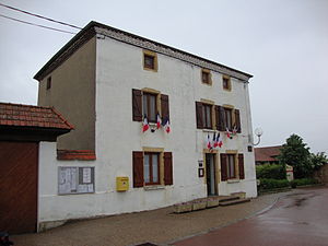
 Town hall (Mairie) of Vendranges |
||
Vendranges is a French municipality with 371 inhabitants (at January 1, 2017) in the department of Loire in the region Auvergne Rhône-Alpes (before 2016 Rhône-Alpes ). The municipality belongs to the Arrondissement of Roanne and the canton of Le Coteau (until 2015 Saint-Symphorien-de-Lay ). The inhabitants are called Vendrangeois .
geography
Vendranges is about 13 kilometers south-southeast of Roanne . Vendranges is surrounded by the neighboring communities of Saint-Cyr-de-Favières in the north and north-west, Neaux in the north and east, Neulise in the south and east and Saint-Priest-la-Roche in the west and south-west.
The national route 82 runs through the municipality .
In the municipality of Saint-Priest-la-Roche was the station Vendranges-Saint-Priest on the railway line Moret-Veneux-les-Sablons and Lyon-Perrache is which nowadays no longer served.
Population development
| 1962 | 1968 | 1975 | 1982 | 1990 | 1999 | 2006 | 2013 |
|---|---|---|---|---|---|---|---|
| 230 | 223 | 201 | 205 | 226 | 237 | 255 | 348 |
| Source: Cassini and INSEE | |||||||
Attractions
- Saint-Genest church
Personalities
- Louis-Antoine Ranvier (1835–1922), anatomist and doctor

