Řeřichy
| Řeřichy | ||||
|---|---|---|---|---|
|
||||
| Basic data | ||||
| State : |
|
|||
| Region : | Středočeský kraj | |||
| District : | Rakovník | |||
| Area : | 488.4239 ha | |||
| Geographic location : | 50 ° 5 ' N , 13 ° 35' E | |||
| Height: | 391 m nm | |||
| Residents : | 88 (Jan. 1, 2019) | |||
| Postal code : | 270 35 | |||
| License plate : | S. | |||
| traffic | ||||
| Street: | Pšovlky - Zavidov | |||
| structure | ||||
| Status: | local community | |||
| Districts: | 2 | |||
| administration | ||||
| Mayor : | Vladislav Reigl (as of 2013) | |||
| Address: | Řeřichy 39 270 35 Řeřichy |
|||
| Municipality number: | 565504 | |||
| Website : | www.rerichy.cz | |||
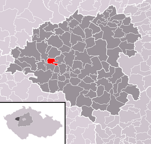
| Location of Řeřichy in the Rakovník district | ||||

|
||||
Řeřichy (German Röscha ) is a municipality in the Czech Republic . It is located eleven kilometers southwest of Rakovník and belongs to the Okres Rakovník .
geography
Řeřichy is located on the edge of the Rakonitzer basin on a hill between the two source streams of the Řeřišský potok. The Jesenicko Nature Park extends to the west. The Kukle (403 m) rises to the east, the U Vrchu (522 m) and the V Jedlinách (544 m) to the south, the Hokovský vrch (565 m) to the southwest and the Báňská hora (576 m) and the Obecní vrch to the west (589 m). The Řeřišský rybník pond is located in the northern part of the village.
Neighboring towns are Švihov and Pšovlky in the north, Vinice, Nouzov, Senomaty and Šanov in the northeast, Hostokryje, Brant and Nový Dvůr in the east, Petrovice , Obora and Zavidov in the southeast, Václavy , Křekovice and Zdeslav in the south, Hokovské Domky and Velištná Chmelištná Chmelištná in the south , Hůrky, Svatý Hubert and Plaveč in the west and Soseň, Klečetné and Oráčov in the northwest.
history
The first written mention of the village took place in 1337. In 1512 it belonged to Peter von Václavy, who also owned the Václavy, Šanov, Pšovlky and Hostokryje estates. In the middle of the 16th century Václav Dlask von Vchynice bought Řeřichy together with Václavy and struck both villages to his estate Petrovice . The subsequent owners of Petrovice included Radslaw Wchinsky von Wchinitz from 1569 and Georg Hrobschitzky von Hrobschitz at the beginning of the 17th century . Because of Georg Hrobschitzky's participation in the uprising of the estates, the Petrowitz estate was confiscated after the Battle of the White Mountain and sold to Johann Zeller in 1623. Later the village was added to the Křic manor . Wenzel Lažanský von Buggau ( Lažanský z Bukové ) on Manětín bequeathed the Křic rule to his daughter Maria Gabriela in 1715. She died in 1758 as superior of the imperial monastery noble fräulein in the New Town of Prague and left the rule to the monastery, which later received the name kk free world noble women's monastery for the holy angels in the old town of Prague .
In 1843 Röscha or Resche / Reže consisted of 24 houses with 207, mostly German-speaking inhabitants. The parish was Petrowitz . Until the middle of the 19th century, Röscha remained subject to the Křic rule.
After the abolition of patrimonial formed Röscha / Rèze or Režihy 1850 a municipality in the district Saaz and judicial district Jechnitz. In 1868 Röscha was assigned to the Podersam district . At the end of the 19th century Reže or Řeřihy and since the beginning of the 20th century Reže were used as a Czech place name. 1921 Řeřichy became the official Czech name form. In 1930 there were 284 people in Röscha . In the same year Nový Dvůr / Neuhof was reassigned from Šanov to Röscha. After the Munich Agreement , the community was added to the German Reich in 1938 and belonged to the Podersam district until 1945 . In 1939 the community had 216 inhabitants. After the end of the Second World War, Řeřichy came back to Czechoslovakia, the German-speaking residents were expelled . The Okres Podbořany was abolished in 1960, since then Řeřichy belongs to the Okres Rakovník . On January 1, 1980 Řeřichy was incorporated into Zavidov , on November 24, 1990 the village became independent again. The municipality has belonged to the Čistá - Senomaty microregion since 1999.
Community structure
The municipality Řeřichy consists of the districts Nový Dvůr ( Neuhof ) and Řeřichy ( Röscha ). The basic settlement units are named Řeřichy and Řeřišský Nový Dvůr.
Attractions
- Chapel in the village square
Web links
Individual evidence
- ↑ http://www.uir.cz/obec/565504/Rerichy
- ↑ Český statistický úřad - The population of the Czech municipalities as of January 1, 2019 (PDF; 7.4 MiB)
- ↑ Křivoklátsko a Rakovnicko - Kde nebudete vědět came dřív ( Memento from November 12, 2013 in the Internet Archive )
- ↑ Johann Gottfried Sommer : The Kingdom of Bohemia. Represented statistically and topographically. Volume 13: Rakonitz Circle. Calve, Prague 1845, p. 20.
- ↑ Johann Gottfried Sommer: The Kingdom of Bohemia. Represented statistically and topographically. Volume 13: Rakonitz Circle. Calve, Prague 1845, p. 26.
- ^ Michael Rademacher: German administrative history from the unification of the empire in 1871 to the reunification in 1990. Podersam district (Czech: Podborany). (Online material for the dissertation, Osnabrück 2006).
- ↑ http://www.uir.cz/casti-obce-obec/565504/Obec-Rerichy
- ↑ http://www.uir.cz/zsj-obec/565504/Obec-Rerichy


