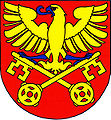
Žitenice
| Žitenice | ||||
|---|---|---|---|---|
|
||||
| Basic data | ||||
| State : |
|
|||
| Region : | Ústecký kraj | |||
| District : | Litoměřice | |||
| Area : | 1307.5853 ha | |||
| Geographic location : | 50 ° 33 ' N , 14 ° 9' E | |||
| Height: | 224 m nm | |||
| Residents : | 1,536 (Jan 1, 2019) | |||
| Postal code : | 411 41 - 412 01 | |||
| License plate : | U | |||
| traffic | ||||
| Street: | Litoměřice - Ploskovice | |||
| structure | ||||
| Status: | local community | |||
| Districts: | 3 | |||
| administration | ||||
| Mayor : | Hana Pawlíková (as of 2007) | |||
| Address: | Pohořanská 118 411 41 Žitenice |
|||
| Municipality number: | 565962 | |||
| Website : | mesta.obce.cz/zitenice | |||
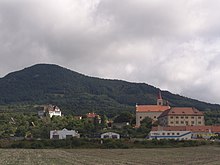
Žitenice (German Schüttenitz ) is a municipality with 1,300 inhabitants in the Okres Litoměřice of Ústecký kraj in the Czech Republic . The village, which has over a hundred houses, is located in the Bohemian Central Uplands , immediately northeast of the old bishopric Litoměřice ( Leitmeritz ). With an annual mean temperature of 9.42 ° C, Žitenice is considered the warmest place in Bohemia .
geography
Žitenice is located on the southern slope of the Křížova hora (590 m) in the Bohemian Central Mountains.
Neighboring towns are Pohořany in the northeast, Maškovice in the east, Podviní in the southeast, Litoměřice and Pokratice in the southwest, and Močidla, Skalice and Poustevna in the northwest.
history
Schittenz was mentioned for the first time in 1057 when Duke Spytihněv II founded the Collegiate Monastery of St. Stefan in Litoměřice . The southern slope has been used for viticulture and fruit growing since that time. In addition to cherries , in the 240 m above sea level. M. lying village also cultivated peaches and apricots . Vratislav II gave the village to the monastery on Vyšehrad as a gift. During the Hussite Wars , Jan Žižka took possession of Žitenice. In the middle of the 15th century, the Lords of Ruppau acquired the place. The next owners were the Vřesovec from Vresovice. During the reign of Ferdinand I , the chapter from Vyšehrad got back the illegally lost property. In 1540 a fortress was built, which was converted into a castle in the 17th century. About 900 people lived in Schüttenitz around 1800. Until 1945, a predominantly German-speaking population lived in Schüttenitz. In their dialect they called their village Schittenz. In addition to a castle, Žitenice also had its own brewery .
Community structure
The municipality Žitenice consists of the districts Pohořany ( Pohorschan ), Skalice ( Skalitz b. Leitmeritz ) and Žitenice ( Schüttenitz ), which also form cadastral districts.
Personalities
Sons and daughters of the church
- Josef Grunert (* 1857), dialect writer
- Willibald Teich (* 1924), local history researcher
Lived and worked in the place
- Franz Jacob Heinrich Kreibich (1759–1833), cartographer, scientist and priest was pastor and dean in Schüttenitz between 1788 and 1829
Attractions
- Žitenice Castle
- baroque church of St. Peter and Paul, built in 1680
- Rectory
- Lorettokapello on the hill west of the village
literature
- The mills of Schüttenitz / Willibald Teich / 1995
- Schüttenitzer Reading Book, History and Stories of a North Bohemian Village / Willibald Teich / 1995
- Wie's dahejme wor, photos from "then" from villages on the southern edge of the Bohemian Central Mountains / Willibald Teich, Georg Pohlai
- The expulsion of the Schüttenitzer / Willibald Teich / 1998
- Home district Leitmeritz: Leitmeritz and the Bohemian Central Uplands 2nd edition 1994 Fulda


