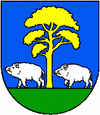
Baška (Slovakia)
| Baska | ||
|---|---|---|
| coat of arms | map | |

|
|
|
| Basic data | ||
| State : | Slovakia | |
| Kraj : | Košický kraj | |
| Okres : | Košice-okolie | |
| Region : | Košice | |
| Area : | 4.50 km² | |
| Residents : | 675 (Dec. 31, 2019) | |
| Population density : | 150 inhabitants per km² | |
| Height : | 350 m nm | |
| Postal code : | 044 20 | |
| Telephone code : | 0 95 | |
| Geographic location : | 48 ° 42 ' N , 21 ° 11' E | |
| License plate : | KS | |
| Kód obce : | 521159 | |
| structure | ||
| Community type : | local community | |
| Administration (as of November 2018) | ||
| Mayor : | Ján Serbin | |
| Address: | Obecný úrad Baška 044 20 Baška |
|
| Website: | www.baska-obec.sk | |
| Statistics information on statistics.sk | ||
Baška (Hungarian Baska ) is a municipality in eastern Slovakia in the Okres Košice-okolie . It is located at the western end of the Košická kotlina and the eastern foothills of the Slovak Ore Mountains .
The place was mentioned in writing for the first time as Bosk in 1322 , it probably originated in the 13th century, the area was named Pousa in 1247. In the 15th century, like in neighboring Myslava, some German families immigrated , these but are quickly assimilated by the Slovak population, only the field name Bangort mentioned in documents at that time (hence the German name "Baumgarten", which is often mentioned for the community) and many German-sounding family names in the village still bear witness to this.
The residents lived mainly from agriculture and, thanks to the many forests, also from forestry, but also benefited from the proximity to the city of Košice in the east.
Until 1918 the community in Abaúj-Torna County belonged to the Kingdom of Hungary and then came to the newly formed Czechoslovakia . She came back to Hungary for a short time from 1938 to 1945 through the First Vienna Arbitration .


