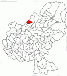
Cozma (Mureș)
|
Cozma Kozmatelke |
||||
|
||||
| Basic data | ||||
|---|---|---|---|---|
| State : |
|
|||
| Historical region : | Transylvania | |||
| Circle : | Mureș | |||
| Coordinates : | 46 ° 48 ' N , 24 ° 31' E | |||
| Time zone : | EET ( UTC +2) | |||
| Height : | 408 m | |||
| Area : | 29.62 km² | |||
| Residents : | 562 (October 20, 2011) | |||
| Population density : | 19 inhabitants per km² | |||
| Postal code : | 547170 | |||
| Telephone code : | (+40) 02 65 | |||
| License plate : | MS | |||
| Structure and administration (as of 2016) | ||||
| Community type : | local community | |||
| Structure : | Cozma, Fânațele Socolului , Socolu de Câmpie , Valea Sasului , Valea Ungurului | |||
| Mayor : | Petru Ormenișan ( PNL ) | |||
| Postal address : | Str. Principală nr. 41 loc. Cozma, jud. Mureș, RO-547170 |
|||
| Website : | ||||
Cozma (outdated Cosma ; Hungarian Kozmatelke ) is a municipality in the Mureș County , in the Transylvania region in Romania .
Geographical location
The municipality of Cozma is located in the Transylvanian Heath (Câmpia Transilvaniei) , part of the Transylvanian Basin . Cozma is located 20 kilometers west of the town of Reghin (Saxon Rain) and about 45 kilometers north of the district capital Târgu Mureş (Neumarkt am Mieresch) on the Agriș brook and the district road (drum județean) DJ 162A .
history
The place Cozma was first mentioned in a document in 1231.
According to József Hampel and Márton Roska , an archaeological find on the area of the incorporated village of Socolu de Câmpie ( Mikldorf ) was assigned to the Bronze Age . Some of the items found are in a Budapest museum.
In the Kingdom of Hungary , the place belonged to the chair district of Teke in the Cluj County, then to the historical Mureş District and from 1950 to the present Mureş District.
population
The population of the municipality of Cozma developed as follows:
| census | Ethnic composition | ||||
|---|---|---|---|---|---|
| year | population | Romanians | Hungary | German | other |
| 1850 | 1,504 | 1,445 | 20th | - | 39 |
| 1941 | 2,260 | 2.151 | 92 | - | 17th |
| 2002 | 644 | 640 | - | - | 4th |
| 2011 | 562 | 551 | 2 | - | 9 |
The highest number of inhabitants has been registered in the area of today's municipality since 1850 and that of the Magyars in 1941. The highest number of Romanians (2,227) was recorded in 1956, the Roma (34) in 1850 and that of Romanian Germans (5) in 1910.
Attractions
- In the community center the ruins of a former church and a cemetery from the 14th century are under monument protection.
Web links
Individual evidence
- ↑ 2011 census in Romania ( MS Excel ; 1.3 MB)
- ↑ Heinz Heltmann, Gustav Servatius (Ed.): Travel Guide Siebenbürgen . Kraft, Würzburg 1993, ISBN 3-8083-2019-2 , p. 517 .
- ^ Institute Of Archeology - Cozma, accessed February 8, 2019 (Romanian).
- ↑ Censuses 1850–2002, last updated November 2, 2008 (PDF; 1 MB; Hungarian).
- ↑ List of historical monuments of the Romanian Ministry of Culture, updated 2015 (PDF; 12.7 MB; Romanian)


