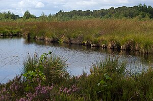
Emsdettener Venn
|
Emsdettener Venn
|
||
|
Emsdettener Venn nature reserve (September 2015) |
||
| location | North Rhine-Westphalia , Germany | |
| surface | 3.411 km² | |
| Identifier | ST-047 | |
| WDPA ID | 81607 | |
| Geographical location | 52 ° 11 ' N , 7 ° 28' E | |
|
|
||
| Setup date | 1941 | |
| particularities | EU bird sanctuary " Wet meadows in northern Münsterland " | |
The Emsdettener Venn nature reserve is located in the area of the cities of Emsdetten and Rheine in the Steinfurt district in North Rhine-Westphalia .
The approximately 341.7 hectare area, which was placed under nature protection in 1941 , extends west of the core town of Emsdetten. On the southern edge of the area runs the L 583 state road and the L 578 to the northwest.
In the north, the Lütkebach drains the area in the direction of Frischhofsbach .
The nature reserve is part of the European bird sanctuary " Feuchtwiesen im northern Münsterland ".
See also
Individual evidence
- ↑ Topographical Information Management, Cologne District Government, Department GEObasis NRW ( Notes )
Web links
Commons : Emsdettener Venn - Collection of images, videos and audio files
- "Emsdettener Venn" nature reserve in the specialist information system of the State Office for Nature, Environment and Consumer Protection in North Rhine-Westphalia
- World Database on Protected Areas - Emsdettener Venn (English)

