Evrytania
|
Evrytania Regional Unit Περιφερειακή Ενότητα Ευρυτανίας (Ευρυτανία) |
|
|---|---|
| Basic data | |
| State : | Greece |
| Region : | Central Greece |
| Area : | 1,869 km² |
| Residents : | 20,081 (2011) |
| Population density : | 10.7 inhabitants / km² |
| NUTS 3 code no. : | EL643 |
| Structure: | 2 municipalities |
| Website: | www.evrytania.gr |
Evrytania ( Greek Ευρυτανία , spoken and alternative transcription Evritania ) is one of the five regional districts of the Greek region of Central Greece with the capital Karpenisi . Before the administrative reform of 2010 , the area had the status of a prefecture , whose competencies have since been transferred to the region of Central Greece and which have been merged to two reduced municipalities. Evrytania sends three MPs to the Central Greek Regional Council, but has no political significance beyond that. It is divided into the municipalities of Agrafa and Karpenisi.
location
Evrytania is located in the west of the Central Greece region in the middle of the southern part of mainland Greece. Evrytania has no access to the sea.
geography
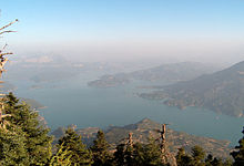
Evrytania is dominated by several mountain ranges in its geography. Plains are rare, only the river valleys offer limited space for agriculture and extensive settlements. It has no coastline by the sea; the nearest sea coast would be the east coast of the Ambracian Gulf of the Ionian Sea in the west in about 30 km as the crow flies.
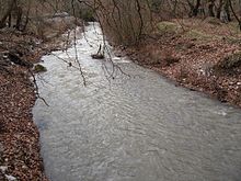
In the north and northwest of the prefecture you will find the massifs of the southern Pindos Mountains with summit heights of over 2000 m. In this massif is also the second highest point of the prefecture with the mountain Pteris at an altitude of 2128 m. The Agrafiotis River rises from the Agrafa Mountains immediately to the south and flows south (initially parallel) to the Acheloos , with the southern Agrafiotis Valley forming part of the Kremasta reservoir of the Acheloos since 1969 . In the northwest the valley of the Acheloos and in the west the Kremasta reservoir form the boundary line of the prefecture. The Acheloos valley cuts through the mountains of the southern Pindos Mountains. In the northeast, between the valleys of the Agrafiotis and the Tavropos ( Megdova ) rivers, there are only mountains of the southern Pindos massif.
The south-west and south of Evrytania is limited by the Panetoliko massif and its summit (Giorla 1924 m). The valley of the river Krikellopotamos with its massif of Kaliakouda (2052 m) to the north and the peaks of Platani (1779 m) and Anninos (1708 m) south of the river valley fills the south of the prefecture. The Oxia and Kokkalia massifs (1922 m and 1720 m) close the prefecture to the southeast and east.
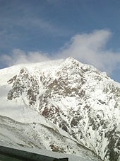
In the eastern center of the prefecture, in the valley of the Karpenissiotis river, lies the capital Karpenissi. Immediately to the east-northeast of the capital is the Tymfristos massif with a maximum height of 2315 m. The Tymfristos is also the highest point in the prefecture of Evrytania and a well-known ski area in Greece. At the same time it fills the east of the prefecture and delimits it to the prefecture of Fhthiotis. The Tymfristos massif is bounded to the north and west by the river Tavropos ( Megdova ) and its valley. The Tavropos flows first in a southerly, then in a south-easterly direction to the Acheloos, after which it flows to the Kremasta reservoir itself.

| summit | Greek name | Mountains / massif | Height above MSL |
|---|---|---|---|
| Tym Fristos (Velouchi) | Τυμφρηστός (Βελούχι) | Tym Fristos | 2315 m |
| Deldimi | Ντελιδίμι | Agrafa | 2163 m |
| Voutsikaki | Βουτσικάκι | Agrafa | 2154 m |
| Fteri | Φτέρη | South Pindus , Agrafa | 2128 m |
| Kaliakounda | Καλιακούδα | Kaliakounda | 2052 m |
| Liakoura | Λιάκουρα | Agrafa | 2038 m |
| Chelidona | Χελιδώνα | Agrafa | 1975 m |
| Panetoliko (Giorla) | Παναιτωλικό | Panetoliko | 1924 m |
| Oxia (Grammeni Oxia) | Οξυά (Γραμμένη Οξυά) | Oxia | 1922 m |
| Kokkalia | Κοκκάλια | Kokkalia | 1720 m |
| Martsa | Μάρτσα | South Pindus | 1690 m |
| Voulgara | Βουλγάρα | South Pindus | 1654 m |
| Lykominimata | Λυκομνήματα | South Pindus | 1522 m |
| flow | Greek name | Flow direction | source | muzzle |
|---|---|---|---|---|
| Acheloos (Aspropotamos) | Αχελώος (Ασπροπόταμος) | North to South-Southwest | Lakmos (Peristeri) | Ionian sea |
| Trikeriotis | Τρικεριώτης | Southeast to northwest | Confluence of Krikellopotamos and Karpenissiotis | Acheloos ( Kremasta Lake ) |
| Tavropos ( Megdova ) | Ταυρωπος (Μέγδοβα) | North to Southwest | Karditsa | Acheloos ( Kremasta Lake ) |
| Agrafiotis | Αγραφιώτης | North to south | Agrafa | Acheloos ( Kremasta Lake ) |
| Krikellopotamos | Κρικέλλοποταμος | East to southwest | Kokkalia | Trikeriotis river |
| Karpenissiotis | Καρπενήσιοτης | Northeast to southwest | Tym Fristos | Trikeriotis river |
history
The region of the prefecture of Evrytania was very likely settled in pre-ancient times. Finds of tools from the region date back to 5000 BC. Finds of tools from the immediate vicinity of Karpenissi date from 2000 to 1600 BC. Like arrowheads. Between 2000 and 1600 BC BC people from a Boeetian tribe inhabited the area in Evrytania. 1433 BC A large earthquake shook the region (quake of Deukaliona). Between 1300 and 1000 BC The Dorians immigrated to Greece. This caused the Aetolians who originally lived in Thessaly to move south, so that they colonized the Evrytania region. In the further course of the migration of the Dorians, four population groups formed in the area of today's prefecture Evrytania: in the north and northeast the Doloper, in the west, in the middle and in the southeast the Evrytanians (or Euritanians), in the south the Aetolians, in the west and Northwest the Agraioi and in the north the Aperantoi reaching into the middle. The settlement boundaries of the individual population groups were mainly based on the river valleys. The most important population group were the Dolopers, who also took part in the Greek military expedition to Troy.
Antiquity
During the Peloponnesian War in the 5th century BC Sources such as Thucydides report a uniform language, a uniform religion as well as uniform customs and traditions of the four population groups in the area of today's prefecture Evrytania. According to the population groups, the area of today's Evrytania was called Evrytania (significantly smaller than today's), Dolopia, Aperantia and Agraia (Agrea). The four population groups took part in the Peloponnesian War on the side of the Aetolians.
A significant event in the history of Evrytania was the invasion of the Celts ( Galatians ) around 279 BC. To Greece. The Dolopi, Aetolians and Evrytanians won a battle against the Galatians in the west of today's prefecture at the pass, which separates the mountain ranges of the Tymfristos and Oxia, near the sources of the Krikelliotikos river at 1,720 m altitude. The historian Pausanias reported on this dispute. The Galatians lost the decisive battle against the Aetolians at Delphi . Along with the other Greek territories, Evrytania came under Roman control in 168 BC.
middle Ages
During the Byzantine period, the iconoclasm dispute over the use or non-use of icons in churches was also fought in Evrytania . It is said that the majority of the small villages in Evrytania kept the icons in their churches against the will of the iconoclastic Byzantine emperors. During this period, the inhabitants of Evrytania also gained a certain degree of autonomy within the Byzantine Empire. The absence of the Evrytania region in the empire's tax lists led to the region being designated as Agrafa ( Greek Άγραφα , "not written" ). Around 900 Wallachians came to Evrytania, who mixed with the local population. During this time the capital of today's prefecture, Karpenissi, was founded. Around 1200 a plague raged in Evrytania. After the conquest of Constantinople by the Crusaders as part of the 4th Crusade in 1204, Evrytania probably fell to the despotate of Epirus . In 1340 Evrytania fell to Serbia after Stefan Uroš IV. Dušan conquered it. Between 1447 and 1453 the Ottomans conquered Evrytania, which brought it under the rule of the Ottoman Empire .
Modern times
During the Ottoman occupation, the area of Evrytania was divided into two provinces: the north of Evrytania was established as the Agrafa province, the south around Karpenissi as the province of Karpenissi. Only in Karpenissi (Ottoman name: Kerepes) lived about 100 Ottoman families during the Ottoman occupation: the rest of Evrytania did not experience Ottoman settlement like other parts of Greece. Evlia Tselebi describes Karpenissi on his travels through Greece between 1667 and 1670 as a region (Sancak) of the province Nafpaktos (Inebachti), which has a judge and a Sancak-Bey (Sancak leader). There is also a Janissary unit there, an Ottoman head tax administrator, as well as a bazaar and a mosque.
On May 10, 1821, K. Velis (Stergiopoulos) proclaimed the revolt of the Greeks against the Ottoman occupation in the village of Kerasovo . The ensuing war also took place with several skirmishes in the Evrytania region (Rentina, Kangelia on June 19, 1821, Ternos, Kefalovrisso on August 9, 1823 with the participation of Markos Botsari, Kaliakouda on August 23, 1823). Approx. 800 fighters from Evrytania take part in the war of independence on the Greek side. On July 22, 1821, 70 remaining Ottoman families left Karpenissi through the Symbetheriko valley northwest of Karpenissi in the direction of Trikala, after the Greek War of Independence broke out. Evrytania becomes part of the Kingdom of Greece in 1829 with the defeat of the Ottoman Empire in the Greek War of Independence.
After the invasion of the Wehrmacht ( company Marita , World War II ) into Greece from April 6, 1941 to the end of April 1941 (except Crete), almost no fighting took place in Evrytania due to its geographical location and remoteness. German occupation forces were never stationed in Evrytania between April 1941 and September 1943. After the division of Greece into three zones of occupation, the Vienna talks between the German Foreign Minister von Ribbentrop and the Italian Foreign Minister Ciano determined that Evrytania, like the entire Greek mainland except Macedonia and Thrace as well as Athens and Attica, would come under Italian control. In June 1941 an Italian garrison was stationed in Karpenissi accordingly. On June 7, 1942, the first armed resistance group against the occupation of Greece by the Axis powers Italy and Germany and Bulgaria, an ally of these states, was founded in Domnista. One of the leaders of this group was Aris Velouchiotis . His pseudonym Velouchiotis is based on the alternative name of the mountain Tymfristos: Velouchis. The ELAS took over gained power in the following period. Originally right-wing or national people even joined the left-wing ELAS; Members of the Elliniki Organosis Neon (EON) , a right-wing youth organization founded by the Greek dictator Ioannis Metaxas in his reign from 1936 to 1941, joined ELAS for the purpose of resisting the occupying forces of the Axis. In addition to this motivation for resistance, the miserable living situation of most of the people in Evrytania was the main reason why they sought their political and above all economic salvation in membership of ELAS. Evrytania, like the rest of Greece, was hit by the Great Famine in the winter of 1941/42 , which killed up to 300,000 people in all of Greece . ELAS and its superstructure organization, EAM, worked to improve the population suffering from hunger and diseases such as polio , malaria , typhoid and tuberculosis .
With the expansion of power of ELAS from mid-1942, a balance of power leveled off in Evrytania under Italian occupation: the Italian garrison controlled the small town of Karpenissi and its immediate surroundings. The left-wing ELAS rebels controlled the entire rest of what would later become the prefecture of Evrytania. When Italy surrendered to the Allies in September 1943, the Italian was replaced by the German occupying power. After the Wehrmacht withdrew in autumn 1944, Evrytania came back under sole Greek control.
This Greek control was mainly exercised by the left-wing ELAS rebels; however, it did not bring Evrytania any rest or peace in the true sense of the word. As early as 1945, the Greek civil war that broke out openly only one year later cast its “shadow”. As a result of the December riots in Athens in 1944 ( battle for Athens between Greek government and British troops on the one hand and ELAS rebels on the other), the Varkiza Agreement was concluded in February 1945 . This provided for a disarmament of the ELAS rebels. The simultaneous disarming of right-wing organizations such as “ Organization X ”, the Ethniki Organosi Vasilikofronon (National Organizations of the King) or “Ethnikofrones” (Nationalists) did not take place. These sparked an offensive against the left-wing ELAS or its umbrella organization, EAM in Evrytania, partly including the security battalions (Tagmata Asfalias) collaborating with the German Wehrmacht . Although the prefect Stamatis was a member of Georgios Papandreou's social democratic party, he and the newly appointed mayor of Karpenissi Kotsibos adhered to the local elites, which were consistently monarchist and right-wing orientated. The supremacy of EAM / ELAS that still existed at the beginning of 1945 was gradually abolished. At the end of 1945 right-wing paramilitaries such as Organization X went on a downright hunt for left-wing people and members of the EAM / ELAS, especially in the community of Ktimenia (Ktimenio).
Until 1946, the left-wing people and groups could not defend themselves against the attacks of the right-wing ones; In the course of 1946, left-wing residents of Evrytania set up so-called Aftoamyna units (Autoamyna = self-defense) under the command of former ELAS commanders . In mid-1946, the Greek civil war broke out after the DSE attacked the Litochoro police station . In this civil war until the beginning of September 1949, Evrytania is a main scene especially in 1947 and 1948.
In the 1950s and 1960s, many residents of Evrytania left for economic reasons and settled in Central Europe, North America and Australia.
traffic
The geographical location of Evrytania in the middle of the mountain ranges of the southern Pindos Mountains makes it difficult to connect to the rest of Greece by transport. There is no railway connection. Nor is an airport. Road traffic is the exclusive mode of transport. The national road 38 leads from the west from Agrinio through the prefecture and Karpenissi through to the east in the direction of Lamia . It is also the European route 952 . The course of the road is difficult due to the mountainous nature: winding, narrow stretches form the road network. Critical bottlenecks such as the Tymfristos pass east of Karpenissi have only recently been defused by structures such as the Tymfristos tunnel or the Episkopi bridge over the Kremasta reservoir.
economy
Before the Second World War , the standard of living in Evrytania was low. Despite occupation in agriculture with cattle breeding and the production of animal products such as cheese and milk, the average family in Evrytania spent almost all of their income on the purchase of food. Grain was scarce; hence the bread was made from corn ( bobota ). The settlement structures were accordingly: almost the entire population lived in small villages and hamlets. Most of the time people lived in two-story houses made of uncut stones: the animals on the ground floor, the people on the upper floor.
In the present day the inhabitants of Evrytania earn their living mainly from agriculture. In recent years, due to the natural conditions, tourism has also gained in importance. One of the larger ski areas in Greece can be found on Tymfristos . Energy production is significant - if not in the form of employment. In 1969 the Acheloos was dammed up by the Kremasta dam to form the Kremasta reservoir , which thoroughly revised the landscape in western Evrytania. The damming also affected the tributaries of the Acheloos like the Agrafiotis , Tavropos and Trikeriotis.
Administrative and settlement structure
Evrytania was founded in 1946 by splitting off the east of the Aetolia-Acarnania prefecture . Before the Second World War , Evrytania had a population of over 50,000. According to the author Georgios Goulas, Evrytania had 47,000 inhabitants in 169 settlements when it was founded as a prefecture. Due to the exodus of the population in the 1950s and 1960s, the population of Evrytania decreased significantly. Only in the last years of the 20th and in the first years of the 21st century does the population increase thanks to the improved economic situation.
The only larger settlement in Evrytania is the small town of Karpenisi. All other settlements are more or less large villages.
Through the Kapodistrias community reform in 1997, the originally 169 independent communities (Kinotita) were combined into 11 communities (Ez. Gr. Dimos ). Most of the previously independent communities thus lost their independence. With the administrative reform of 2010, these 11 municipalities were combined again, since then only the municipalities of Karpenisi and Agrafa exist .
Web links
- The district's website with information on tourism and history (in Greek).
Individual evidence
- ↑ Results of the 2011 census at the National Statistical Service of Greece (ΕΛ.ΣΤΑΤ) ( Memento from June 27, 2015 in the Internet Archive ) (Excel document, 2.6 MB)
- ↑ John Sakkas: The Civil War in Evrytania. In: Mark Mazower (Ed.). After the war was over. Reconstructing the family, nation and state in Greece, 1943-1960. Princeton University Press, 2000. pp. 190. ISBN 0-691-05842-3
- ↑ John Sakkas: The Civil War in Evrytania. In: Mark Mazower (Ed.). After the war was over. Reconstructing the family, nation and state in Greece, 1943-1960. Princeton University Press, 2000. p. 191. ISBN 0-691-05842-3
- ^ A b John Sakkas: The Civil War in Evrytania. In: Mark Mazower (Ed.). After the war was over. Reconstructing the family, nation and state in Greece, 1943-1960. Princeton University Press, 2000. p. 192. ISBN 0-691-05842-3
- ↑ John Sakkas: The Civil War in Evrytania. In: Mark Mazower (Ed.). After the war was over. Reconstructing the family, nation and state in Greece, 1943-1960. Princeton University Press, 2000. p. 196. ISBN 0-691-05842-3
- ↑ John Sakkas: The Civil War in Evrytania. In: Mark Mazower (Ed.). After the war was over. Reconstructing the family, nation and state in Greece, 1943-1960. Princeton University Press, 2000. p. 198. ISBN 0-691-05842-3
- ^ A b John Sakkas: The Civil War in Evrytania. In: Mark Mazower (Ed.). After the war was over. Reconstructing the family, nation and state in Greece, 1943-1960. Princeton University Press, 2000. pp. 185. ISBN 0-691-05842-3
Coordinates: 38 ° 57 ' N , 21 ° 45' E

