Ferrensac
| Ferrensac | ||
|---|---|---|
|
|
||
| region | Nouvelle-Aquitaine | |
| Department | Lot-et-Garonne | |
| Arrondissement | Villeneuve-sur-Lot | |
| Canton | Le Val du Dropt | |
| Community association | Communes des Bastides en Haut Agenais Périgord | |
| Coordinates | 44 ° 39 ′ N , 0 ° 38 ′ E | |
| height | 65-151 m | |
| surface | 12.32 km 2 | |
| Residents | 211 (January 1, 2017) | |
| Population density | 17 inhabitants / km 2 | |
| Post Code | 47330 | |
| INSEE code | 47096 | |
| Website | www.ferrensac.fr | |
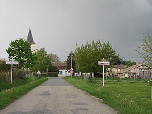
 Entrance to Ferrensac |
||
Ferrensac is a French municipality with 211 inhabitants (at January 1, 2017) in the department of Lot-et-Garonne in the region Nouvelle-Aquitaine (before 2016: Aquitaine ). The municipality belongs to the arrondissement of Villeneuve-sur-Lot and the canton of Le Val du Dropt (until 2015: canton of Castillonnès ).
The name of the municipality probably goes back to the Roman name Ferrandus .
The inhabitants are called Ferrensacois and Ferrensacois .
geography
Ferrensac is located about 30 km northwest of Villeneuve-sur-Lot in the historic province of Agenais on the northern edge of the department.
Ferrensac is surrounded by the seven neighboring municipalities:
| Saint-Quentin-du-Dropt | Cavarc | Doudrac |
| Castillonnès |

|
Bournel |
| Lougratte | Montaut |
Ferrensac is located in the catchment area of the Garonne River .
The Dropt , a tributary of the Garonne, forms the natural border with the northern neighboring communities of Saint-Quentin-du-Dropt, Cavarc and Doudrac.
The Douyne, a tributary of the Dropt, largely forms the natural border with the neighboring municipality of Castillonnès to the west.
The Barraca crosses the municipality and flows into the Douyne.
history
In the hamlet of Les Rouchoux, traces of a Roman road are evidence of settlement during antiquity . In addition, the remains of a rich villa from the early imperial era were discovered in 1965 . The excavations brought to light embossed ceramic shards from Terra Sigillata , a fibula with a bronze arch and fire tongs. Waste of animal origin such as oyster shells, snail shells and bones from large mammals reveal the eating habits of the former owners.
The parish of Saint-Étienne-de-Ferrensac was first mentioned in 1266, but its history goes back further into the past. Traces of a burial mound on which an aristocratic seat, the nucleus of the village, was built, dates from the High Middle Ages . The etymology of the name of the hamlet of Rouchoux is a reference to a castle that was built on this site. The "rocky mountain" actually means a moth .
In 1259, the Bastide of Castillonnès was founded and the parish of Ferrensac was in its judicial district. From an ecclesiastical point of view, it was under the diocese of Sarlat until the French Revolution .
The history of the village is essentially linked to that of its noble owner families. In the Middle Ages , Ferrensac was dependent on the fief of the Alphéry family and later on that of the Belcastel family.
In 1825, the municipality of Saint-Martin-Transfort was incorporated into Ferrensac.
Population development
With the incorporation of Saint-Martin-Transfort, the population rose to a high of 670 in the first half of the 19th century. In the period that followed, the size of the community fell to around 165 inhabitants during short recovery phases until the turn of the millennium, before a phase of growth began. which stabilized the number of inhabitants at around 215.
| year | 1962 | 1968 | 1975 | 1982 | 1990 | 1999 | 2006 | 2011 | 2017 |
|---|---|---|---|---|---|---|---|---|---|
| Residents | 249 | 217 | 191 | 195 | 171 | 163 | 204 | 220 | 211 |
Attractions
- Saint-Étienne parish church , completely redesigned in the 19th century
- Saint-Martin chapel in Saint-Martin-Transfort, first mentioned in 1152
- Lamothe Castle from the 18th century
- La Mespoule Castle from the 16th century
Economy and Infrastructure
Agriculture is the municipality's most important economic factor.

total = 27
traffic
Ferrensac can be reached via Routes départementales 2 and 257, as well as via secondary roads that branch off from Route départementale 250.
Web links
Individual evidence
- ^ Ernest Nègre: Toponymie générale de la France ( fr ) Librairie Droz, Geneva. P. 466. 1990. Retrieved February 9, 2019.
- ↑ Lot-et-Garonne ( fr ) habitants.fr. Retrieved February 9, 2019.
- ↑ Ma commune: Ferrensac ( fr ) Système d'Information sur l'Eau du Bassin Adour Garonne. Retrieved February 9, 2019.
- ^ A b Ferrensac ( fr ) Conseil régional d'Aquitaine. Archived from the original on September 9, 2016. Retrieved on February 9, 2019.
- ↑ Notice Communale Ferrensac ( fr ) EHESS . Retrieved February 9, 2019.
- ↑ Populations légales 2016 Commune de Ferrensac (47096) ( fr ) INSEE . Retrieved February 9, 2019.
- ↑ Caractéristiques des établissements en 2015 Commune de Ferrensac (47096) ( fr ) INSEE . Retrieved February 9, 2019.


