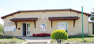
Doudrac
| Doudrac | ||
|---|---|---|
|
|
||
| region | Nouvelle-Aquitaine | |
| Department | Lot-et-Garonne | |
| Arrondissement | Villeneuve-sur-Lot | |
| Canton | Le Haut Agenais Périgord | |
| Community association | Communes des Bastides en Haut Agenais Périgord | |
| Coordinates | 44 ° 40 ′ N , 0 ° 41 ′ E | |
| height | 70-115 m | |
| surface | 8.61 km 2 | |
| Residents | 90 (January 1, 2017) | |
| Population density | 10 inhabitants / km 2 | |
| Post Code | 47210 | |
| INSEE code | 47083 | |
 Mayor's office of Doudrac |
||
Doudrac is a French municipality with 90 inhabitants (at January 1, 2017) in the department of Lot-et-Garonne in the region Nouvelle-Aquitaine (before 2016: Aquitaine ). The municipality belongs to the arrondissement of Villeneuve-sur-Lot and the canton of Le Haut Agenais Périgord (until 2015: canton of Villeréal ).
The name of the community is derived from an estate that belonged to a "Dotirius".
The inhabitants are called Doudracais and Doudracaises .
geography
Doudrac is located about 28 km north of Villeneuve-sur-Lot in the historic province of Agenais on the northern border with the neighboring Dordogne department .
Doudrac is surrounded by the five neighboring communities:
|
Sainte-Radegonde (Dordogne) |
||
| Cavarc |

|
Mazières-Naresse |
| Ferrensac | Bournel |
Doudrac lies in the catchment area of the Garonne River .
The Dropt , one of its tributaries, forms the natural border with the neighboring municipality of Bournel to the south. The Bournègue , a tributary of the Dropt, forms the natural border with the northern neighboring municipality of Sainte-Radegonde. The Pontillou flows into the Bournègue in the municipality.
history
Until the 13th century the village was dependent on the Seigneur of Montaut , then on the councils of Castillonnès . In the center was located next to the Romanesque one church once Priory , which the abbey of Sarlat was under and disappeared.
In 2004 traces of early settlement were discovered in the area of the municipality. It is an underground refuge that is believed to date from the Middle Ages . Below a hill that is now privately owned, a single entrance grants access to a facility with an area of 20 m². It consists of three rooms connected by a tunnel.
Population development
After records began, the population rose to a peak of around 395 by the first half of the 19th century. In the following period, the size of the community fell to around 80 inhabitants during brief recovery periods until the 1980s, before the size reached a level of around 100 inhabitants, but has recently stagnated again.
| year | 1962 | 1968 | 1975 | 1982 | 1990 | 1999 | 2006 | 2011 | 2017 |
|---|---|---|---|---|---|---|---|---|---|
| Residents | 121 | 115 | 103 | 81 | 97 | 101 | 98 | 108 | 90 |
Attractions
- Parish Church of Saint-Jean-Baptiste
Economy and Infrastructure
Agriculture is the municipality's most important economic factor.

total = 22
traffic
Doudrac is crossed by Route départementale 250. The commune can also be reached by secondary roads that branch off from Routes départementales 207 (Dordogne: 14) and 250E (Dordogne: 19).
Web links
Individual evidence
- ↑ a b Doudrac ( fr ) Conseil régional d'Aquitaine. Archived from the original on September 9, 2016. Retrieved on February 9, 2019.
- ↑ Lot-et-Garonne ( fr ) habitants.fr. Retrieved February 9, 2019.
- ↑ Ma commune: Doudrac ( fr ) Système d'Information sur l'Eau du Bassin Adour Garonne. Retrieved February 9, 2019.
- ↑ Notice Communale Doudrac ( fr ) EHESS . Retrieved February 9, 2019.
- ↑ Populations légales 2016 Commune de Doudrac (47083) ( fr ) INSEE . Retrieved February 9, 2019.
- ↑ Caractéristiques des établissements en 2015 Commune de Doudrac (47083) ( fr ) INSEE . Retrieved February 9, 2019.


