Glux-en-Glenne
| Glux-en-Glenne | ||
|---|---|---|
|
|
||
| region | Bourgogne-Franche-Comté | |
| Department | Nièvre | |
| Arrondissement | Château-Chinon (Ville) | |
| Canton | Château-Chinon | |
| Community association | Morvan Sommets et Grands Lacs | |
| Coordinates | 46 ° 57 ' N , 4 ° 2' E | |
| height | 409-855 m | |
| surface | 22.06 km 2 | |
| Residents | 93 (January 1, 2017) | |
| Population density | 4 inhabitants / km 2 | |
| Post Code | 58370 | |
| INSEE code | 58128 | |
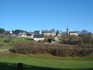
 View of Glux-en-Glenne |
||
Glux-en-Glenne is a French municipality with 93 inhabitants (at January 1, 2017) in the department of Nièvre in the region of Bourgogne Franche-Comté . It belongs to the arrondissement of Château-Chinon (Ville) and to the Morvan Sommets et Grands Lacs community association founded in 2016 . The residents call themselves Gluxois .
geography
The community is located about 30 kilometers west of Autun in the Morvan Regional Nature Park, immediately south of Mont Haut-Folin , the Morvan's highest peak at 901 m . In the wooded south of the municipality is the summit of Mont Beuvray at 821 m and to the west of the municipality is the 855 m high Mont Préneley , on the eastern flank of which is the enclosed spring of the 292 km long Yonne . The Yonne flows to the north, the Alène tributary Roche drains the municipality to the south. Forests cover more than half of the 22.06 km² municipal area. On the territory of the municipality, near Mont Beuvray, there is part of the Celtic oppidum Bibracte from the younger pre-Roman Iron Age , site of the Battle of Bibracte . In the north and east, the municipality borders on the Saône-et-Loire department . Several hamlets and individual farms belong to Glux-en-Glenne. The largest hamlets are Les Calots, Villechaise, Anvers and L'Échenault .
Neighboring municipalities of Glux-en-Glenne are Arleuf in the north, Saint-Prix in the northeast, Saint-Léger-sous-Beuvray in the southeast, Larochemillay in the south, Villapourçon in the west and Fâchin in the northwest.
The closest ski area to Paris is in Glux-en-Glenne, around 250 kilometers away .
Place name
The name of the small village Glux in the castellany of Glenne first appeared in a document as Ly in 1287 . The name changed via Lyeu (1297), Lyeux (1454) and Loco (1478) to Glue (1707) before the official name Glux was established in 1790 . In 1981 the name was changed to Glux-en-Glenne . A derivation from the Latin locus for place or from the Latin Lucus for holy wood is considered possible. The name can also come from the Morvanburgundian language , in which the term glu stood for the roofs of the farmhouses covered with rye straw. The term Glenne refers to a rocky ridge east of Glux on which the Castrum de Glana stood. The Latin glans stands for the fruits of the oaks, which are found in abundance in the forests here. Jacques Gabriel Bulliot , the amateur archaeologist and discoverer of Bibracte, suspected the Celtic word glen for gorge as the origin of the name.
Population development
| year | 1962 | 1968 | 1975 | 1982 | 1990 | 1999 | 2006 | 2016 | |
| Residents | 306 | 242 | 175 | 143 | 114 | 105 | 103 | 94 | |
| Source: Cassini and INSEE | |||||||||
Attractions
- Oppidum Bibracte with attached archaeological excavation site and the research center, which François Mitterrand inaugurated in 1996 shortly before his death
- The Saint-Denis church was originally from the 12th century with a Romanesque apse and archway. In 1843 the nave was enlarged - with fatal consequences: structural problems suggested the collapse of the church. It was closed in 2001 and extensively restored. The reopening took place on May 31, 2009 with the celebration of Mass by the Bishop of Nevers, François Joseph Pierre Deniau . As a result, three multi-colored wooden statues (St. Dionysius, 16th century, Virgin and Child, 17th century and St. Stephan, 19th century) came to light again.
- Gallo-Roman oratory near the church, excavated by Jacques Gabriel Bulliot
- several hall crosses
- Ruins of the Château d'Abboville , built in 1888 with a pink granite facade and partially destroyed by fire in 1983; it is privately owned and cannot be viewed or photographed.
- La Picherotte village fountain
- La Ferme morvandelle , a typical Morvan farm with a rye straw roof on a frame of hazelnut branches
- La Pierre de la Wivre : a boulder measuring 12 × 4 m with a basin that holds 25 to 30 liters of water; The name of the boulder goes back to vouivre = snake and was considered by mystics to be the guardian of a buried treasure
Economy and Infrastructure
In the wooded municipality of Glux-en-Glenne there are six forest holdings and five livestock farms. Hotels, guest houses and holiday homes are available to tourists visiting the Oppidum Bibracte and, in winter, the ski slopes in Morvan .
Glux-en-Glenne is on the road that connects Arleuf with Saint-Léger-sous-Beuvray and thus opens up the southern Morvan mountains. The 2007 Tour de France followed this path . In Nevers , 65 kilometers to the west, there is a connection to the A77 autoroute .
Partner communities
Glux-en-Glenne has a partnership with the northern Italian municipality of Monterenzio .
Personalities
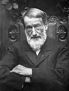
- Jacques Gabriel Bulliot (1817–1902), amateur archaeologist and discoverer of Bibracte
literature
- Le Patrimoine des Communes de la Nièvre. Volume 1, Flohic Editions, Charenton-le-Pont 1999, ISBN 2-84234-054-X , pp. 182-184.
supporting documents
- ↑ Origin of the name on patrimoinedumorvan.org (French)
- ↑ Origin of the name on gallica.bnf.fr (French)
- ↑ Glux-en-Glenne on cassini.ehess.fr
- ↑ Glux-en-Glenne on insee.fr
- ^ Oppidum Bibracte in the Base Mérimée of the French Ministry of Culture (French)
- ↑ Château on patrimoinedumorvan.org (French)
- ↑ fountain on mairie-glux-en-glenne.fr (French)
- ↑ Pierre de la Wivre on patrimoinedumorvan.org (French)
- ↑ Forestry operations on annuaire-mairie.fr
- ↑ Farms on annuaire-mairie.fr


