Sainte-Colombe (Seine-et-Marne)
| Sainte-Colombe | ||
|---|---|---|

|
|
|
| region | Île-de-France | |
| Department | Seine-et-Marne | |
| Arrondissement | Provins | |
| Canton | Provins | |
| Community association | Provinois | |
| Coordinates | 48 ° 32 ' N , 3 ° 16' E | |
| height | 71-153 m | |
| surface | 8.13 km 2 | |
| Residents | 1,822 (January 1, 2017) | |
| Population density | 224 inhabitants / km 2 | |
| Post Code | 77650 | |
| INSEE code | 77404 | |
| Website | http://www.mairie-sainte-colombe.fr/ | |
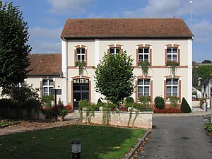
 Town hall (Mairie) of Sainte-Colombe |
||
Sainte-Colombe is a French commune with 1,822 inhabitants (as of January 1 2017) in the department of Seine-et-Marne in the region Ile-de-France . It belongs to the Arrondissement of Provins and the Canton of Provins . The inhabitants are called Saint-Colombinois .
geography
Sainte-Colombe is located about 45 kilometers southeast of Paris on the Voulzie . Sainte-Colombe is surrounded by the neighboring communities of Poigny in the north, Chalautre-la-Petite in the east, Soisy-Bouy in the southeast, Longueville in the south, Saint-Loup-de-Naud in the west and Vulaines-lès-Provins in the north-west.
Population development
| year | 1962 | 1968 | 1975 | 1982 | 1990 | 1999 | 2006 | 2012 |
| Residents | 1,209 | 1,178 | 1,309 | 1,407 | 1,555 | 1,697 | 1,705 | 1,795 |
| Source: Cassini and INSEE | ||||||||
Attractions
See also: List of Monuments historiques in Sainte-Colombe (Seine-et-Marne)
- Remains of the old infirmary ( Monument historique )
- Remains of the former Benedictine abbey in the district of Le Mez-de-la-Madeleine
literature
- Le Patrimoine des Communes de la Seine-et-Marne. Flohic Editions, Volume 2, Paris 2001, ISBN 2-84234-100-7 , pp. 1269-1270.
Web links
Commons : Sainte-Colombe - Collection of images, videos and audio files
