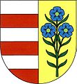
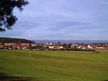
Drhovy
| Drhovy | ||||
|---|---|---|---|---|
|
||||
| Basic data | ||||
| State : |
|
|||
| Region : | Středočeský kraj | |||
| District : | Příbram | |||
| Area : | 636.1045 ha | |||
| Geographic location : | 49 ° 44 ' N , 14 ° 14' E | |||
| Height: | 410 m nm | |||
| Residents : | 264 (Jan. 1, 2019) | |||
| Postal code : | 263 01 | |||
| License plate : | S. | |||
| traffic | ||||
| Street: | Dobříš - Sedlčany | |||
| structure | ||||
| Status: | local community | |||
| Districts: | 2 | |||
| administration | ||||
| Mayor : | Jiří Mašek (as of 2015) | |||
| Address: | Drhovy 65 263 01 Dobříš |
|||
| Municipality number: | 540188 | |||
| Website : | www.drhovy.cz | |||
Drhovy (German Drhow , also Derhow ) is a municipality in the Czech Republic . It is located seven kilometers southeast of Dobříš and belongs to the Okres Příbram .
geography
Drhovy is located in the Dobříšská pahorkatina ( Dobrian hill country ). The village lies on the left side of the Drhovský creek, which is dammed in the Drhovský rybník pond on the eastern outskirts of Drhovy. To the north rise the Šiberný (419 m nm) and the Stráně (423 m nm), in the northeast the Čihadlo (528 m nm) and the Pod Skálou (528 m nm), to the east the Kopanice (481 m nm), in the southeast the Mýtka (410 m nm) and Na Skalách (460 m nm), to the west the Varta (457 m nm) and to the northwest the Libický vrch (465 m nm). The state road II / 119 runs through Drhovy between Dobříš and Sedlčany .
Neighboring towns are Novy Dvur in the north, Hranice and Chramiště in the Northeast, Jezera, Dražetice, Borotice and Homole the east, Slovanský Dvůr, Milina, Slovanská Lhota, Nechalov and Radčany the southeast, Drhovce in the south, Bělohrad , Skalice and Daleké Dušníky in the southwest, Libice in the west and Budín, Dolík, Vojířovský Mlýn and Rybníky in the north-west.
history
The first written mention of the village Drhov , subject to the Dobříš rule, took place in 1653. The owner of the rule was Franz Maximilian Graf von Mansfeld . Until 1714 the village belonged to the Podbrder district, after which it became part of the Berauner district . After the male line had died out in 1780 with the death of Joseph Wenzel von Mansfeld , his sister Maria Isabella inherited the Dobřisch rule. The name and coat of arms were merged with the family of her husband Franz de Paula Gundaker von Colloredo-Waldsee-Mels to the Colloredo-Mannsfeld family . After Maria Isabella's death in 1794, her son Rudolph Joseph II inherited the property. After the death of the childless Rudolf Joseph II von Colloredo-Mannsfeld, the rule fell to his nephew Franz de Paula Gundaccar II von Colloredo-Mannsfeld in 1844 .
In 1846 the village Drhow or Drhowa consisted of 34 houses with 199 inhabitants. Parish was Borotitz . Until the middle of the 19th century Drhow remained subject to the Dobřisch rule.
After the abolition of patrimonial Drhov / Drhow formed a municipality in the judicial district of Dobříš from 1850 with the districts Budín, Drevníky , Drhovce, Homole, Hranice, Kozí Hory, Libice, Nechalov, Rybníky and Slovanská Lhota. From 1868 the municipality belonged to the Příbram District . At the end of the 19th century, Kozí Hory and Hranice broke up and formed the Kozí Hory municipality. In 1920 the place name was changed to Drhovy . In the following period, the area fell apart. Nechalov, Homole and Drhovce separated from Drhovy in the 1920s and formed the Nechalov parish; from the districts Drevníky, Homole and Slovanská Lhota in 1930 the municipality Drevníky was established. In 1932 Budín, Libice and Rybníky broke away from Drhovy and formed the Rybníky community. From 1949 Drhov belonged to the newly formed Okres Dobříš, after its abolition the municipality was again part of the Okres Příbram in 1960 . At the beginning of 1980, Nechalov was incorporated (with Drhovce and Homole). On January 1st, 1998 Nechalov and Drhovce were transferred to Drevníky.
Community structure
The municipality Drhovy consists of the districts Drhovy ( Drhow ) and Homole, which also form cadastral districts. The Budkovna and Nový Dvůr ( Neuhof ) layers also belong to Drhovy .
Attractions
- Chapel in Drhovy
- Chapel in Homole
Web links
Individual evidence
- ↑ http://www.uir.cz/obec/540188/Drhovy
- ↑ Český statistický úřad - The population of the Czech municipalities as of January 1, 2019 (PDF; 7.4 MiB)
- ^ Johann Gottfried Sommer The Kingdom of Bohemia, Vol. 16 Berauner Kreis, 1849, p. 233
- ↑ http://www.uir.cz/casti-obce-obec/540188/Obec-Drhovy
- ↑ http://www.uir.cz/katastralni-uzemi-obec/540188/Obec-Drhovy


