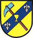
Nové Dvory u Dobříše
| Nové Dvory | ||||
|---|---|---|---|---|
|
||||
| Basic data | ||||
| State : |
|
|||
| Region : | Středočeský kraj | |||
| District : | Příbram | |||
| Area : | 839.1834 ha | |||
| Geographic location : | 49 ° 48 ' N , 14 ° 21' E | |||
| Height: | 410 m nm | |||
| Residents : | 261 (Jan. 1, 2019) | |||
| Postal code : | 262 03 - 264 01 | |||
| License plate : | S. | |||
| traffic | ||||
| Street: | Nový Knín - Štěchovice | |||
| structure | ||||
| Status: | local community | |||
| Districts: | 2 | |||
| administration | ||||
| Mayor : | František Dědina (status: 2013) | |||
| Address: | Nové Dvory 33 262 03 Nový Knín |
|||
| Municipality number: | 540897 | |||
| Website : | novedvory-pb.cz | |||
Nové Dvory (German Neuhof ) is a municipality in the Czech Republic . It is located five kilometers northeast of Nový Knín and belongs to the Okres Příbram .
geography
Nové Dvory is located in the north of the Středočeská pahorkatina in the basin of the Novodvorský creek. The Královka (382 m) and the Čihadlo (380 m) rise to the north, the Chlum (451 m), the Čihadlo (434 m) and the Bouska (450 m) to the northeast, the Tetřívek (449 m) southwest and the west the Nevada (420 m). State road II / 102 runs east of Nové Dvory between Zbraslav and Kamýk nad Vltavou .
Neighboring towns are Bratřínov , Královky, U Kocáby, Falkův Mlyn, Bojanovice and Masečín in the north, Porostliny, Bouska and Slapy in the Northeast, Přestavlky and Buš the east, Nová Hospoda, Jílová, V Trnovcích and U Dobré Vody in the southeast, Čím , Háje, Křížov and Pánkov in the south, Moravce, Sidovice and Krámy in the south-west, U Pařeza, Velká Hraštice, Spálený Mlýn and Za Kocábou in the west and Velká Lečice and Malá Lečice in the north-west.
history
The first written mention of the place belonging to the Slapy manor came in 1432. The owner was the Cistercian monastery Königsaal . After the abolition of the monastery in 1785, its goods fell to the religious fund. On January 3, 1825, Karl Korb Ritter von Weidenheim bought the Slapy estate with all its accessories.
In 1845 Neuhof / Nowy Dwůr consisted of 26 houses with 191 inhabitants. The Meierhof Neuhof was emphyteized at that time. The parish was Schlap . Until the middle of the 19th century Neuhof remained subordinate to the Slap rule in the Berauner district .
After the abolition of patrimonial Nový Dvůr / Neuhof formed a municipality in the judicial district of Dobříš from 1850. Since 1868 the municipality has belonged to the Příbram District . The district of Porostliny was changed from Buš to Nový Dvůr in 1880 . The municipality has been called Nové Dvory since 1887 . In 1949 the community was assigned to the newly formed Okres Dobříš, since its abolition in 1960 it has belonged to the Okres Příbram . Krámy was incorporated in 1961.
Community structure
The municipality Nové Dvory consists of the districts Krámy ( Kram ) and Nové Dvory ( Neuhof ), which also form cadastral districts. It is divided into the settlement units Krámy, Nové Dvory and Porostliny ( Porostlina ). Nové Dvory also includes the Královky and Nová Hospoda layers.
Attractions
- Chapel in Nové Dvory, built in 1924
- Chapel in Krámy
Individual evidence
- ↑ http://www.uir.cz/obec/540897/Nove-Dvory
- ↑ Český statistický úřad - The population of the Czech municipalities as of January 1, 2019 (PDF; 7.4 MiB)
- ^ Johann Gottfried Sommer The Kingdom of Bohemia, Vol. 16 Berauner Kreis, 1849, p. 63
- ↑ http://www.uir.cz/casti-obce-obec/540897/Obec-Nove-Dvory
- ↑ http://www.uir.cz/katastralni-uzemi-obec/540897/Obec-Nove-Dvory
- ↑ http://www.uir.cz/zsj-obec/540897/Obec-Nove-Dvory


