Suchodol (Czech Republic)
| Suchodol | ||||
|---|---|---|---|---|
|
||||
| Basic data | ||||
| State : |
|
|||
| Region : | Středočeský kraj | |||
| District : | Příbram | |||
| Area : | 647.6624 ha | |||
| Geographic location : | 49 ° 43 ' N , 14 ° 5' E | |||
| Height: | 447 m nm | |||
| Residents : | 375 (Jan. 1, 2019) | |||
| Postal code : | 261 01 | |||
| License plate : | S. | |||
| traffic | ||||
| Street: | Dobříš - Příbram | |||
| structure | ||||
| Status: | local community | |||
| Districts: | 2 | |||
| administration | ||||
| Mayor : | Emil Tabaček (as of 2015) | |||
| Address: | Suchodol 8 261 01 Příbram |
|||
| Municipality number: | 541371 | |||
| Website : | www.obecsuchodol.cz | |||
Suchodol is a municipality in the Czech Republic . It is located seven kilometers northeast of the city center of Příbram and belongs to the Okres Příbram .
geography
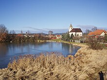
Suchodol is located in the Dobříšská pahorkatina ( Dobrian hill country ). The village is located in the valley of the Suchodolský brook, which is dammed in the village in three nameless ponds. To the south-east is the Příbram airfield. To the north rises the Sedlo (471 m nm), in the east the Velký Chlum (481 m nm), southeast the Drásovský Chlum (490 m nm), in the south the Staré Hory (541 m nm), southwest the Na Vartě (572 m nm) and the Strážný (559 m nm), in the west of the Kosovec (505 m nm) and northwest of the Katov (487 m nm).
Neighboring towns are Buková u Příbramě , Vršek and U Kostinků in the north, Kotenčice and Obořiště in the Northeast, Druhlice and Dlouhá Lhota to the east, Višňová and Skalka in the southeast, Dubenec in the south, Občov in the southwest, LihA and Žírovy the west and Hluboš and Pičín in Northwest.
history
The oldest written mention of a chapel in Suchodol is said to come from around 972. According to tradition, the Suchodol estate is said to have belonged to Abbess Adelheid from the Benedictine monastery of St. George at Prague Castle in the 11th century, who exchanged it with Bishop Severus for the Nezelice estate.
The first written mention of the village comes from 1360 as the seat of Vladiken Petr von Suchý Dol. Between 1413 and 1605 the Korka von Korkin family owned the estate; The most important landlord at this time was the state chief tax collector Pavel Ritter Korka von Korkin, who owned Suchodol from 1567. From 1605 the goods Suchodol and Wostrow belonged to Karl Path, who lost them after the battle of the White Mountain . In 1623 the Bohemian Chamber sold Suchodol and Wostrow to Katharina Wratislaw von Mitrowitz . The Suchodol fortress was extinguished in the 17th century, and a yard was built in its place . In 1669, Franz Maximilian acquired von Mansfeld the estate Suchydul and graduated his rule Dobřisch on. In 1692 Franz Maximilian's son Karl Franz Anton von Mansfeld inherited the rule, followed by his son Heinrich in 1717. Until 1714 the village belonged to the Podbrder district, after which it became part of the Berauner district . After Heinrich von Mansfeld's death in 1780, his inheritance fell to his son Joseph Wenzel, who died six weeks later without heirs. The male line died out, and the Dobřisch rule was inherited by Joseph Wenzel's sister Maria Isabella. The name and coat of arms were merged with the family of her husband Franz de Paula Gundaker von Colloredo-Waldsee-Mels to the family Colloredo-Mannsfeld . After Maria Isabella's death in 1794, her son Rudolph Joseph II inherited the property. After the death of the childless Rudolf Joseph II von Colloredo-Mannsfeld, the rule fell to his nephew Franz de Paula Gundaccar II von Colloredo-Mannsfeld in 1844 .
In 1846 the village Suchodol or Suchý Dul consisted of 37 houses with 273 inhabitants, including three Jewish and one Protestant family. In the place there was a branch church, an authoritative Meierhof and a Dominical sheep farm. The parish was Pitschin . Until the middle of the 19th century, Suchodol remained subject to the Dobřisch rule.
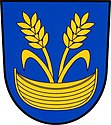
After the abolition of patrimonial Suchodol formed from 1850 a district of the Občov municipality in the judicial district of Příbram. From 1868 the village belonged to the Příbram district . In the 1870s Suchodol became the seat of the municipality consisting of the districts Občov, Suchodol, Skalka and Líha. At the end of the 19th century Občov, and at the beginning of the 20th century Líha too, broke away from Suchodol and formed their own communities. In 1906 a school was built in Suchodol. In 1932 there were 424 people living in Suchodol (with Skalka). In 1960 Skalka was reassigned to Drásov and Líha was incorporated again. In 1972 the community celebrated the 1000th anniversary of Suchodol and published a commemorative publication based on archival studies by Václav Pilous (1930–2008). Since Pilous completely renounced sources, his research results are now being called into question. On April 1, 1976, the incorporation of Kotenčice and Občov took place. On July 1, 1990, Kotenčice and Občov were independent again. Suchodol has had a coat of arms and a banner since 2013.
Community structure
The municipality Suchodol consists of the districts Líha ( Liha ) and Suchodol. The municipality is divided into the cadastral districts of Liha and Suchodol.
Attractions
- Church of St. Luke the Evangelist in Suchodol, the date of its construction is not known, the oldest of the bells was donated in 1582 by Pavel Korka von Korkin. Inside there is a baroque altar with the image of the Evangelist Luke. There is a cemetery around the church.
- Guest house "U Kšandů" in Suchodol
- Chapel in Líha
Sons and daughters of the church
- Jaroslav Vožniak (1933–2005), painter, sculptor and graphic artist
literature
- Suchodol 972-1972, MNV Suchodol 1972
Web links
Individual evidence
- ↑ http://www.uir.cz/obec/541371/Suchodol
- ↑ Český statistický úřad - The population of the Czech municipalities as of January 1, 2019 (PDF; 7.4 MiB)
- ^ Johann Gottfried Sommer The Kingdom of Bohemia, Vol. 16 Berauner Kreis, 1849, pp. 233–234
- ↑ http://www.uir.cz/casti-obce-obec/541371/Obec-Suchodol
- ↑ http://www.uir.cz/katastralni-uzemi-obec/541371/Obec-Suchodol


