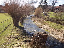
Lhota u Příbramě
| Lhota u Příbramě | ||||
|---|---|---|---|---|
|
||||
| Basic data | ||||
| State : |
|
|||
| Region : | Středočeský kraj | |||
| District : | Příbram | |||
| Area : | 350.8907 ha | |||
| Geographic location : | 49 ° 43 ' N , 13 ° 59' E | |||
| Height: | 487 m nm | |||
| Residents : | 477 (Jan 1, 2019) | |||
| Postal code : | 261 01 | |||
| License plate : | S. | |||
| traffic | ||||
| Street: | Příbram - Sádek | |||
| structure | ||||
| Status: | local community | |||
| Districts: | 1 | |||
| administration | ||||
| Mayor : | Vladimír Drmla (as of 2015) | |||
| Address: | Lhota u Příbramě 77 261 01 Příbram 1 |
|||
| Municipality number: | 598411 | |||
| Website : | www.lhotaupribrame.cz | |||
Lhota u Příbramě (German German Lhota ) is a municipality in the Czech Republic . It is four kilometers northwest of the city center of Příbram and belongs to the Okres Příbram .
geography
Lhota u Příbramě is located in the Příbramská pahorkatina ( Příbram hill country ). The village lies on the left side of the Obecnický potok or Čepkovský potok, just before its confluence with the Litavka . South of the village is the area of Kovohutě Příbram. The Hůrka (535 m nm) and the Jalovčiny (519 m nm) rise to the northeast, the Huťský lesík (541 m nm) to the southeast, the Malá Dubová hora (570 m nm) to the south and the Dubová hora (627 m nm) to the southwest ) and the Malá Třemošná (701 m nm), west of the Čihadlo (511 m nm) and in the north-west of the V Dubkově (547 m nm).
Neighboring towns are Drahlín , Sádek and Hůrky in the north, Bratkovice , Hluboš , Kardavec and Valcha in the Northeast, Drátovna, trhové dušníky , Škrtilka, Mikovcův Mlyn and Hutě the east, Příbram in the southeast, Nové Podlesí and Staré Podlesí in the south, OSEC and Borek in Southwest, Šachta and Obecnice in the west and Malý Drahlín in the northwest.
history
The first written mention of Německá Lhota took place in 1292, when King Wenceslaus II donated the village to the newly founded Cistercian monastery Königsaal . Later, probably during the Hussite Wars , the village came to secular owners. In the 16th century the gentlemen bought Bechinie from Lazan Německá Lhota; the point in time can no longer be determined, as the Bohemian land panels were lost in the fire of Prague Castle in 1541 . In the course of the new production of the burned land panels, Wenzel the Elder was Ä. Lazan Bechinie registered on May 5, 1556 as the owner of the Skorotín fortress with the village of Líha, including Kmet farms , as well as Kmet farms in Lhota Německá and the Občov farm with a farm and Kmet farms. On October 16, 1612, Wenceslaus the Elder's widow sold J. Bechinie from Lazan, Judith Bechinie from Předenice, the festivals and the village Dušníky with the villages Občov, Líha and Lhota Německá for 27,000 Meissen shock to Ulrich Bechinie from Lazan and his wife Anna Kokořovcová from Kokořov. After Ulrich Bechinie's death, his widow Anna sold the property to the Prague citizen Johann Werdemann in 1623. He sold the Dušníky estate two years later to Countess Katharina von Sulz, née Lobkowicz . From their daughter in 1644 Vladislav Chlumčanský from Přestavlk bought the place. Until 1714 the village belonged to the Podbrder district, after which it became part of the Berauner district . From the Chlumčanský Wenceslas de Bossi acquired the Dušníky rule in 1734 and sold it in 1741 to the town of Příbram .
In 1846 Teutsch-Lhota or Lhota německá consisted of a total of 46 houses with 359 inhabitants, including two Jewish families. Eleven houses belonged to the Dobřisch domain . There was an inn in the village. Parish was Přibram . Until the middle of the 19th century, Teutsch-Lhota remained subservient to the royal silver mining town of Přibram as part of the Příbram villages.
After the abolition of patrimonial formed Německá Lhota / German Lhota 1850 a district of the municipality Dušníky in the judicial district Příbram. From 1868 the village belonged to the Příbram district . In the 1870s Německá Lhota and Oseč broke away from Dušníky and formed the municipality of Německá Lhota . A decade later, Oseč became independent. In 1932, 640 people lived in Německá Lhota . In 1947 the place was renamed Lhota u Příbramě . At the beginning of 1980 Lhota u Příbramě was incorporated into Příbram. Between 1983 and 1990 the district was named Lhota . On November 24, 1990 Lhota broke away from Příbram and formed its own community. On April 1, 1991, the name of the municipality was changed to Lhota u Příbramě .
Mining and industry
Mining used to be carried out in the vicinity of the village. Lead ore containing silver and iron ore were extracted. In addition to mining and agriculture, the Příbram silver and lead works founded in the 14th century was an essential source of income for the residents of Lhota. Today the high chimney of the Kovohutě Příbram in the Litavka valley below the village characterizes the townscape.
Community structure
No districts have been identified for the municipality of Lhota u Příbramě.
Attractions
- Chapel on the village square, built in 1829
- Crucifix in front of the chapel
Web links
Individual evidence
- ↑ http://www.uir.cz/obec/598411/Lhota-u-Pribrame
- ↑ Český statistický úřad - The population of the Czech municipalities as of January 1, 2019 (PDF; 7.4 MiB)
- ^ Johann Gottfried Sommer The Kingdom of Bohemia, Vol. 16 Berauner Kreis, 1849, p. 217
- ↑ Předpis č. 7/1948 Sb.


