
Kirchberg (Haut-Rhin)
| Kirchberg | ||
|---|---|---|
.svg)
|
|
|
| region | Grand Est | |
| Department | Haut-Rhin | |
| Arrondissement | Thann-Guebwiller | |
| Canton | Masevaux | |
| Community association | Vallée de la Doller et du Soultzbach | |
| Coordinates | 47 ° 48 ' N , 6 ° 57' E | |
| height | 433–1,070 m | |
| surface | 6.74 km 2 | |
| Residents | 762 (January 1, 2017) | |
| Population density | 113 inhabitants / km 2 | |
| Post Code | 68290 | |
| INSEE code | 68167 | |

Kirchberg is a French commune with 762 inhabitants (as of January 1, 2017) in the Haut-Rhin department in the Grand Est region (until 2015 Alsace ). It belongs to the Arrondissement Thann-Guebwiller , the canton Masevaux and the municipality association Vallée de la Doller et Soultzbach, founded in 2001 .
geography
The municipality of Kirchberg is located in the south-eastern Vosges . The Doller river separates Kirchberg from the community of Wegscheid, both of which together form a cohesive area of settlement. The summit of the Ballon d'Alsace (Alsace Belchen), 1247 m high, rises about ten kilometers west of Kirchberg. The municipal area bordering the Franche-Comté region in the southwest is part of the Ballons des Vosges Regional Nature Park .
Neighboring communities of Kirchberg are Oberbruck in the north (point of contact), Wegscheid in the northeast, Sickert , Niederbruck and Masevaux in the southeast, Lamadeleine-Val-des-Anges in the southwest and Dolleren in the west.
history
From 1871 until the end of the First World War , Kirchberg belonged to the German Empire as part of the realm of Alsace-Lorraine and was assigned to the Thann district in the Upper Alsace district .
Population development
| year | 1910 | 1962 | 1968 | 1975 | 1982 | 1990 | 1999 | 2007 | 2017 |
| Residents | 777 | 674 | 685 | 656 | 709 | 802 | 843 | 821 | 762 |

Church of St. Vincent
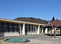
primary school


See also
literature
- Le Patrimoine des Communes du Haut-Rhin. Flohic Editions, Volume 1, Paris 1998, ISBN 2-84234-036-1 , pp. 729-730.