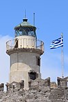
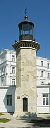
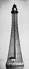
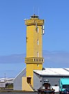
This list of lighthouses in Europe includes a selection of European lighthouses , whereby the term “Europe” is not limited to the geographical definition, but also refers to historical, cultural, political, economic, legal, ideal and identity aspects.
Surname
region
Waters
position
Identifier
height
scope
comment
image
Shabla lighthouse Black Sea
43 ° 32 ′ 27 " N , 28 ° 36 ′ 21" E 43.540833333333 28.605833333333
360 ° white 3 times every 20 seconds
36 m
14 nm
Cape Kaliakra (lighthouse) Black Sea
43 ° 21 '43.4 " N , 28 ° 27' 55.8" E 43.362056 28.46549
360 ° knows every 5 seconds
68 m
17 nm
Ekrene
Black Sea
43 ° 19 '27.3 " N , 28 ° 3' 2.5" E 43.32425 28.050694444444
white 2 times every 30 u. 6 seconds
94 m
20 nm
Euxinograd (lighthouse) Black Sea
43 ° 12 ′ 59.8 " N , 27 ° 59 ′ 12.8" E 43.2166 27.9869
360 ° red
05! 5 nm
Varna harbor (lighthouse) Black Sea
43 ° 11 ′ 29 " N , 27 ° 55 ′ 34" E 43.191388888889 27.926111111111
360 ° white every 10 seconds
10 nm
Cape Galata (lighthouse) Black Sea
43 ° 10 ′ 30 ″ N , 27 ° 57 ′ 0 ″ E 43.175 27.95
360 ° white 3 times every 15 seconds
25 nm
Cape Sweti Atanas (lighthouse) Black Sea
42 ° 51 '16.2 " N , 27 ° 54' 7.6" E 42.8545 27.90211
360 ° red flash every 7 seconds
12 nm
Cape Emine (lighthouse) Black Sea
42 ° 42 '5.1 " N , 27 ° 53' 59.8" E 42.701417 27.899952
360 ° white every 6 seconds
64 m
16 nm
Tower height 9.4 m, in operation since December 15, 1880
Surname
region
Waters
position
Construction year
Tower height
Fire height
Identifier
image
Brimnesviti
Austurland
Greenland Sea
65 ° 18 ′ 29.8 " N , 13 ° 46 ′ 8.9" W. 65.30827 -13.76913
1938
07! 7 m
12 m
Fl (2) WRG.10s
Hafnarnesviti
Austurland
Greenland Sea
64 ° 52 ′ 27.7 " N , 13 ° 45 ′ 57.5" W. 64.87436 -13.76597
1938
06! 6 m
16 m
Fl.WRG.20s
Hraunhafnartangaviti
Norðurland eystra
Greenland Sea
66 ° 32 '10.2 " N , 16 ° 1' 34.1" W. 66.53618 -16.02614
1945
18 m
20 m
Mon (N) WR.30s
Skarðsviti
Norðurland vestra
Greenland Sea
65 ° 29 '8.3 " N , 20 ° 59' 15.4" W. 65.48565 -20.9876
1951
14 m
52 m
Fl (3) HR.30s
Dyrholaeyarviti
Southurland
North Atlantic
63 ° 24 '8.1 " N , 19 ° 7' 49.8" W. 63.40224 -19.13051
1927
13 m
99! 123 m
Fl.W.10s
Knarrarósviti
Southurland
North Atlantic
63 ° 49 '24 " N , 20 ° 58' 32.4" W. 63.82333 -20.97567
1939
26 m
30 m
LFl.W.30s
Gróttuviti
Höfuðborgarsvæðið
North Atlantic
64 ° 9 ′ 54 ″ N , 22 ° 1 ′ 19 ″ W. 64.165 -22.02195
1897/1947
24 m
24 m
Fl (3) WRG.20s
Reykjanesviti
Suðurnes
North Atlantic
63 ° 48 ′ 56.6 " N , 22 ° 42 ′ 15.3" W. 63.81571 -22.70425
1878/1908
31 m
69 m
Fl (2) W.30s
Bjargtangaviti
Vestfirdir
Denmark Strait
65 ° 30 '9.1 " N , 24 ° 31' 53.8" W. 65.50254 -24.53161
1948
06! 6 m
60 m
Fl (3) W.15s
Akranesvitar
Vesturland
Denmark Strait
64 ° 18 ′ 31.8 " N , 22 ° 5 ′ 41.7" W. 64.30884 -22.09493
1918/1947
21 m
24 m
Fl (2) WRG.20s
Elliðaeyjarviti
Vesturland
Denmark Strait
65 ° 8 ′ 43.8 " N , 22 ° 48 ′ 11.4" W. 65.1455 -22.80317
1951
09! 9 m
47 m
Fl.WRG.10s
Malarrifsviti
Vesturland
Denmark Strait
64 ° 43 ′ 41.6 " N , 23 ° 48 ′ 10.3" W. 64.72821 -23.80286
1946
24 m
31 m
Fl (4) WRG.30s
Súgandisey
Vesturland
Denmark Strait
65 ° 4 ′ 49.1 " N , 22 ° 43 ′ 24" W. 65.0803 -22.72332
1948
04! 4 m
31 m
Fl.WRG.3s
Sandgerdi
Suðurnes
North Atlantic
64 ° 2 ′ 24.5 " N , 22 ° 42 ′ 51" W. 64.0401267 -22.714169
1921
19 m
25 m
Oc.WRG.6s
Garðskagaviti
Suðurnes
North Atlantic
64 ° 4 ′ 55.2 " N , 22 ° 41 ′ 23.8" W. 64.081989 -22.689936
1944
23 m
31 m
Fl.W.5s
Selvogsviti
Southurland
North Atlantic
63 ° 49 '16.2 " N , 21 ° 39' 5.9" W. 63.821173 -21.65163
1919/1930
15 m
21 m
Fl (2) W.10s
The lighthouses are operated by the Northern Lighthouse Board .
Surname
region
Waters
position
Construction year
Tower height
Fire height
Identifier
scope
image
Rovinj, Punta Santa Eufemia
Istria
Gulf of Venice
45 ° 5 '2.5 " N , 13 ° 37' 46.3" E 45.084038 13.629527
1883/1903
7 m
19 m
Fl.W.4s
Sveti Ivan na Pučini
Istria
Gulf of Venice
45 ° 2 ′ 34.7 " N , 13 ° 36 ′ 51.2" E 45.04296 13.61423
1853
15 m
23 m
Fl (2) W.10s
24 nm
Peneda
Istria
Gulf of Venice
44 ° 53 '17 " N , 13 ° 45' 11.3" E 44.888063 13.753139
1877
15 m
20 m
Iso W 4s
11 nm
Porer
Istria
Gulf of Venice
44 ° 45 '29.2 " N , 13 ° 53' 27.4" E 44.758122 13.890938
1833
31 m
35 m
Fl (3) W.15s
25 nm
Plič Albanež
Istria
Adriatic / Kvarner Bay
44 ° 44 ′ 10 " N , 13 ° 54 ′ 15" E 44.736111 13.904167
1910
15 m
15 m
Fl (2) WR.8s
10/6 nm
Prestenice
Cres
Adriatic / Kvarner Bay
45 ° 7 '12.6 " N , 14 ° 16'22.4" E 45.120172 14.272875
1872
13 m
17 m
Fl (2) W.10s
10 nm
Zaglav
Cres
Adriatic / Kvarner Bay
44 ° 55 ′ 16.2 " N , 14 ° 17 ′ 18.4" E 44.921167 14.288439
1876
15 m
20 m
Fl (3) WR.15s
10 nm
Trstenik
Trstenik
Adriatic / Kvarner Bay
44 ° 40 ′ 7.4 " N , 14 ° 34 ′ 41.3" E 44.668723 14.578144
1873
- m
26 m
Fl W / G. 10s
11/8 nm
Vnetak
Unije
Adriatic / Kvarner Bay
44 ° 37 '9.6 " N , 14 ° 14" 8.5 " E 44.619347 14.235697
1873
13 m
17 m
Fl (3) WR.10s
10/7 nm
Koludarc
Koludarc
Adriatic / Kvarner Bay
44 ° 33 '27.6 " N , 14 ° 25' 48.1" E 44.557674 14.430022
1873
7 m
10 m
Fl G.3s
3 sm
Murtar
Murtar
Adriatic / Kvarner Bay
44 ° 33 '0.2 " N , 14 ° 25' 16.2" E 44.550048 14.42116
1867
5 m
9 m
Fl W.8s
8 sm
Susak
Susak
Adriatic / Kvarner Bay
44 ° 30 '51.9 " N , 14 ° 18' 6.3" E 44.514414 14.301742
1881
12 m
100 m
Fl (2) W.10s
19 sm
Prisnjak
Prisnjak
Adriatic / Middle Adriatic
43 ° 49 ′ 31.7 " N , 15 ° 33 ′ 32.1" E 43.825464 15.558926
1886
- m
19 m
Fl (3) W.10s
9 nm
Kukuljari
Kukuljari
Adriatic / Middle Adriatic
43 ° 45 '36.6 " N , 15 ° 38' 2.7" E 43.760174 15.634092
1881
5 m
11 m
Fl W.5s
10 nm
Smokvica Vela
Smokvica Vela
Adriatic / Middle Adriatic
43 ° 44 ′ 3.5 " N , 15 ° 28 ′ 22.6" E 43.734317 15.472945
?
8 m
13 m
Fl R. 3s
5 nm
Blitvenica
Blitvenica
Adriatic / Middle Adriatic
43 ° 37 '30.7 " N , 15 ° 34' 28.1" E 43.625185 15.574475
1872
21 m
38 m
Fl (2) W. 30s
24 nm
Kremik
Kremik
Adriatic / Middle Adriatic
43 ° 34 '28.1 " N , 15 ° 54' 59.7" E 43.574466 15.916593
1899
8 m
10 m
Fl W. 3s
8 sm
Surname
region
Waters
position
Construction year
Tower height
Fire height
Identifier
image
Stawa Młyny pier fire
West Pomerania
Pomeranian Bay
53 ° 55 '34.3 " N , 14 ° 16'38.6" E 53.9262 14.2774
1902
11 m
11 m
Oc.Y.10s
Świnoujście lighthouse
West Pomerania
Pomeranian Bay
53 ° 54 ′ 57.6 " N , 14 ° 17 ′ 3" E 53.916 14.28417
1858
68 m
68 m
Oc.WR.5s
Kikut lighthouse
West Pomerania
Pomeranian Bay
53 ° 58 '53.2 " N , 14 ° 34' 49.1" E 53.98145 14.5803
1826/1962
18 m
92 m
Iso.W.10s
Niechorze lighthouse
West Pomerania
Pomeranian Bay
54 ° 5 '40.8 " N , 15 ° 3' 50.1" E 54.09467 15.06393
1866/1948
45 m
63 m
Fl.W.10s
Kołobrzeg lighthouse
West Pomerania
Baltic Sea
54 ° 11 '11 " N , 15 ° 33' 15.3" E 54.1864 15.55424
1899/1948
26 m
33 m
Fl.W.3s
Gąski lighthouse
West Pomerania
Baltic Sea
54 ° 14 '34.2 " N , 15 ° 52' 21.8" E 54.24283 15.87273
1878
50 m
50 m
Oc (3) W.15s
Darłowo lighthouse
West Pomerania
Baltic Sea
54 ° 26 ′ 25.2 " N , 16 ° 22 ′ 42.8" E 54.44033 16.37855
1885
22 m
20 m
LFl (2) W.15s
Jarosławiec lighthouse
West Pomerania
Baltic Sea
54 ° 32 '22.9 " N , 16 ° 32' 32.4" E 54.5397 16.54232
1838
33 m
50 m
Fl (2) W.9s
Ustka lighthouse
Pomerania
Baltic Sea
54 ° 35 '16.6 " N , 16 ° 51' 16.2" E 54.58795 16.8545
1871/1892
23 m
22 m
Oc.W.6s
Czołpino lighthouse
Pomerania
Baltic Sea
54 ° 43 '5.9 " N , 17 ° 14' 28.4" E 54.7183 17.24122
1875
25 m
75 m
Oc (2) W.8s
Latarnia Morska Stilo
Pomerania
Baltic Sea
54 ° 47 '12.6 " N , 17 ° 44' 2.3" E 54.78682 17.733969
1906
34 m
75 m
Fl (3) W.12s
Rozewie lighthouse
Pomerania
Baltic Sea
54 ° 49 '49.4 " N , 18 ° 20' 10.5" E 54.83038 18.33625
1822
32 m
83 m
Fl.W.3s
Jastarnia lighthouse
Hel Peninsula
Baltic Sea / Gdańsk Bay
54 ° 42 '0.8 " N , 18 ° 40' 53.8" E 54.70023 18.68162
1938/1950
13 m
22 m
Mon (A) W.20s
Lighthouse Hel
Hel Peninsula
Baltic Sea / Gdańsk Bay
54 ° 36 ′ 0 " N , 18 ° 48 ′ 46.3" E 54.6 18.81287
1827/1942
40 m
41 m
Iso.W.10s
Sopot lighthouse
Pomerania
Gdańsk Bay
54 ° 26 '43.2 " N , 18 ° 34' 14.3" E 54.44532 18.57065
1904/1957
33 m
25 m
Fl.W.4s
Gdańsk Nowy Port lighthouse
Pomerania
Gdańsk Bay
54 ° 24 ′ 22.6 " N , 18 ° 39 ′ 40.3" E 54.40628 18.6612
1758/1894
27 m
27 m
deleted (1984)
Gdańsk Port Północny Lighthouse
Pomerania
Gdańsk Bay
54 ° 23 '59.2 " N , 18 ° 41' 46.4" E 54.39977 18.69622
1984
61 m
56 m
Fl (3) W.9s
Krynica Morska lighthouse
Fresh spit
Gdańsk Bay
54 ° 23 '7.4 " N , 19 ° 27' 2.6" E 54.3854 19.45071
1895/1951
27 m
53 m
Fl (2) W.12s
Lighthouse is called Farul in Romanian
All lighthouses are automated and monitored and controlled from the Trinity House control center in Harwich .
Surname
region
Waters
position
Construction year
Tower height
Fire height
Identifier
image
Trwyn Du Lighthouse
Anglesey
Irish Sea
53 ° 18 '46.6 " N , 4 ° 2' 26.4" W. 53.31294 -4.04067
1838
29 m
19 m
Fl.W.5s
Point Lynas Lighthouse
Anglesey
Irish Sea
53 ° 25 '0.6 " N , 4 ° 17' 20.7" W. 53.41682 -4.28909
1835
11 m
39 m
Oc.W.10s
Skerries Lighthouse
Anglesey
Irish Sea
53 ° 25 ′ 16 " N , 4 ° 36 ′ 30.1" W. 53.42111 -4.60835
1717
23 m
36 m
Fl (2) W.10s
South Stack Lighthouse
Anglesey
Irish Sea
53 ° 18 '24.3 " N , 4 ° 41' 58.3" W. 53.30676 -4.69952
1809
28 m
60 m
Fl.W.10s
Bardsey Lighthouse
Gwynedd
St. George's Canal
52 ° 44 '59.9 " N , 4 ° 47' 58.6" W. 52.74996 -4.79961
1821
30 m
39 m
Fl (5) W.15s
St Tudwal's Lighthouse
Gwynedd
St. George's Canal
52 ° 47 ′ 53.4 " N , 4 ° 28 ′ 17" W. 52.79818 -4.47138
1877
11 m
46 m
Fl.WR.5s
Strumble Head Lighthouse
Pembrokeshire
St. George's Canal
52 ° 1 '47 " N , 5 ° 4' 26.1" W. 52.02972 -5.07391
1908
17 m
45 m
Fl (4) W.15s
South Bishop Lighthouse
Pembrokeshire
St. George's Canal
51 ° 51 ′ 9.6 " N , 5 ° 24 ′ 43" W. 51.85266 -5.41195
1839
11 m
44 m
Fl.W.5s
Smalls Lighthouse
Pembrokeshire
St. George's Canal
51 ° 43 '16.4 " N , 5 ° 40' 11.4" W. 51.72121 -5.66984
1861
33 m
36 m
Fl (3) W.15s
Skokholm Lighthouse
Pembrokeshire
Celtic sea
51 ° 41 ′ 37.9 " N , 5 ° 17 ′ 13.1" W. 51.69387 -5.28698
1916
18 m
54 m
Fl.WR.10s
St. Ann's Head Lighthouse
Pembrokeshire
Celtic sea
51 ° 40 ′ 52.5 " N , 5 ° 10 ′ 25.4" W. 51.68126 -5.17373
1841
13 m
48 m
Fl.WR.5s
Caldey Lighthouse
Pembrokeshire
Celtic sea
51 ° 37 '53.6 " N , 4 ° 41' 3.4" W. 51.63156 -4.68427
1829
16 m
65 m
Fl (3) WR.20s
Mumbles Lighthouse
Swansea
Bristol Channel
51 ° 34 '0.7 " N , 3 ° 58' 15.7" W. 51.56685 -3.97103
1794
17 m
35 m
Fl (4) W.20s
Nash Point Lighthouse
Vale of Glamorgan
Bristol Channel
51 ° 24 '3.1 " N , 3 ° 33' 7.7" W. 51.40085 -3.55213
1832
37 m
56 m
Fl (2) WR.15s
Flat Holm Lighthouse
Cardiff
Bristol Channel
51 ° 22 '32.3 " N , 3 ° 7' 7.4" W. 51.37564 -3.11871
1737
30 m
50 m
Fl (3) WR.10s
The lighthouses, along with the lighthouses in Ireland , are operated by the Commissioners of Irish Lights .
Surname
region
Waters
position
Construction year
Tower height
Fire height
Identifier
image
Rathlin West Lighthouse
Rathlin
North channel
55 ° 18 '3.1 " N , 6 ° 16' 48.9" W. 55.30086 -6.28025
1917
18 m
62 m
Fl.R.5s
Rathlin East Lighthouse
Rathlin
North channel
55 ° 18 ′ 5.7 " N , 6 ° 10 ′ 16" W. 55.30158 -6.17112
1856
27 m
74 m
Fl (4) W.20s
Rue Point Lighthouse
Rathlin
North channel
55 ° 15 ′ 32 " N , 6 ° 11 ′ 28.4" W. 55.25888 -6.19123
1915/1921
11 m
16 m
Fl (2) W.5s
Maidens Lighthouse
Mid and East Antrim
North channel
54 ° 55 '44.9 " N , 5 ° 43' 40.2" W. 54.92913 -5.72782
1829
23 m
29 m
Fl (3) W.15s
Chaine Tower Lighthouse
Mid and East Antrim
North channel
54 ° 51 '16.2 " N , 5 ° 47' 52.7" W. 54.8545 -5.79796
1899
23 m
23 m
Iso.WR.5s
Blackhead Lighthouse
Mid and East Antrim
North channel
54 ° 46 ′ 1 ″ N , 5 ° 41 ′ 21 ″ W. 54.76694 -5.68917
1902
16 m
45 m
Fl.W.3s
Mew Island Lighthouse
Ards and North Down
North channel
54 ° 41 '54.9 " N , 5 ° 30' 48.9" W. 54.69857 -5.51357
1884
37 m
37 m
Fl (4) W.30s
Donaghadee Lighthouse
Ards and North Down
North channel
54 ° 38 '41.9 " N , 5 ° 31' 51.2" W. 54.64497 -5.53088
1836
16 m
17 m
Iso.WR.4s
St John's Point Lighthouse
Newry, Morne and Down
Irish Sea
54 ° 13 '34.7 " N , 5 ° 39' 33.4" W. 54.2263 -5.65929
1844/1893
39 m
37 m
Q (2) W.7.5s
Haulbowline Lighthouse
Newry, Morne and Down
Irish Sea
54 ° 1 '11.7 " N , 6 ° 4' 44.4" W. 54.01993 -6.079
1824
34 m
32 m
Fl (3) W.10s
See also Web links
<img src="https://de.wikipedia.org//de.wikipedia.org/wiki/Special:CentralAutoLogin/start?type=1x1" alt="" title="" width="1" height="1" style="border: none; position: absolute;">


