Kwidzyn
| Kwidzyn | ||
|---|---|---|

|
|
|
| Basic data | ||
| State : | Poland | |
| Voivodeship : | Pomerania | |
| Powiat : | Kwidzyn | |
| Area : | 21.82 km² | |
| Geographic location : | 53 ° 44 ' N , 18 ° 56' E | |
| Height : | 42 m npm | |
| Residents : | 38,444 (Jun. 30, 2019) |
|
| Postal code : | 82-500 to 82-504 | |
| Telephone code : | (+48) 55 | |
| License plate : | GKW | |
| Economy and Transport | ||
| Street : | DK 55 : Nowy Dwór Gdański - Stolno | |
| DK 90 : Dąbrówka –Kwidzyn | ||
| Ext. 518 : Gniew –Kwidzyn | ||
| Rail route : | PKP - route 207: Toruń – Malbork | |
| Next international airport : | Danzig | |
| Gmina | ||
| Gminatype: | Borough | |
| Surface: | 21.82 km² | |
| Residents: | 38,444 (Jun. 30, 2019) |
|
| Population density : | 1762 inhabitants / km² | |
| Community number ( GUS ): | 2207011 | |
| Administration (as of 2010) | ||
| Mayor : | Andrzej Krzysztofiak | |
| Address: | ul. Warszawska 19 82-500 Kwidzyn |
|
| Website : | www.kwidzyn.pl | |
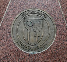
Kwidzyn ( ˈkfʲiʣɨn ), German Marienwerder , is a city in the Pomeranian Voivodeship in Poland and the seat of the Powiat Kwidzyński .
location
The city is located in the former West Prussia , five kilometers east of the Vistula on the River Liwa (love) .
history
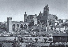
Until 1919 Marienwerder was the capital of the Marienwerder administrative district of the same name in the province of West Prussia . With the castle of the Pomesan cathedral chapter ( Bishop's Castle ), the city houses one of the most important castle complexes of the Teutonic Order state , Marienwerder Castle . The Anglo-Saxon navigator Wulfstan von Haithabu mentioned an island called Quidin in the Vistula delta at the end of the 9th century . The name can be traced back to the Prussian ("kweita") and the Slavic (Polish "kwiat") word for "flower".
Teutonic Order State
In 1233 , under Hermann Balk, the Teutonic Order had built a castle called Insula sanctae Mariae on a hill fortified by the Pruzzen in the area of the village of Queden (1236 to 1945 Tiefenau , since then Tychnowy ) . In the same year he moved it 5 kilometers further south on a hill that had also been fortified beforehand by the Pruzzen. The city of Marienwerder itself laid out a little later north of this castle and equipped it with a festival . After the founding of the diocese of Pomesania , the Ordensburg came into the possession of the bishop in 1254. He chose it as his seat in 1285, but resided in Riesenburg (Polish: Prabuty) from around 1300 . He had a cathedral built north of the city from 1264 to 1284. In 1322 the bishop began building the bishop's castle to house the cathedral chapter founded in 1284 . The Latin school seems to have been founded around this time . Today's cathedral church was built in place of the old one between 1344 and 1355. It contains the tombs of three grand masters and the Pomesan bishops.
On March 14, 1440, the nobles and towns of the Order State founded the Prussian Federation in Marienwerder , which came into opposition to the regional rule of the Order and submitted to the King of Poland in 1454 in return for the assurance of generous privileges . When the previous area of the order was divided in the Second Peace of Thorn , Marienwerder was retained by the order state and was henceforth its only city on the Vistula.
Duchy of Prussia
With the secularization of the religious order in 1525 under Albrecht I , the city became Lutheran and part of the Duchy of Prussia , later the Kingdom of Prussia . In 1540 the demolition of the Ordensburg began except for a small remainder. The name Altschlösschen came up for the castle hill south of today's old town . Towards the end of the 16th century, the Marienwerder Latin School was one of the more important Protestant schools. In the 18th century, the institution was granted discharge to the university. A new school building was built for the Marienwerder grammar school in the period 1835–1838.
Kingdom of Prussia
Due to the reallocation of the Kingdom of Prussia as part of the first division of Poland in 1772, Marienwerder was administratively separated from East Prussia and, after the founding of the Province of West Prussia in 1775, served as the administrative seat. After the border regulations of the Congress of Vienna in the years 1815-1818, West Prussia was expanded to include Danzig, which replaced Marienwerder as the capital. Now it became the district town and capital of the Marienwerder administrative district , which included southern West Prussia. The district court districts of Danzig, Elbing, Graudenz, Konitz and Thorn were assigned to the Marienwerder Higher Regional Court. In 1819 the royal Prussian building inspector Salomo Sachs founded an excellent building trade school here in Marienwerder , which lasted 15 years. Until 1820 he was their headmaster and teacher. At the beginning of the 20th century Marienwerder had two Protestant churches (including the cathedral), a Catholic church, a synagogue , a grammar school, a district court, a higher regional court and various commercial operations.
The Treaty of Versailles resulted in the creation of the Polish Corridor to the Baltic Sea on West Prussian territory and thus the dissolution of the Province of West Prussia. On July 11, 1920, the population in the Marienwerder voting area voted with over 92 percent to remain with Germany, while the rest of the province was divided between Germany, the Polish Corridor and the Free City of Danzig without a vote . In the city of Marienwerder, 7,811 residents voted for the connection to East Prussia and 362 for the connection to Poland. Then the eastern province of West Prussia came as government district of West Prussia , based in Kwidzyn to 1939 for East Prussia . After the attack on Poland , Marienwerder belonged to the Reichsgau Gdansk-West Prussia from 1939 to 1945 .
Poland
Towards the end of the Second World War , Marienwerder was evacuated from the German side in January 1945 . A few weeks later the Red Army occupied the city. Marienwerder, which remained undamaged, served the 2nd Belarusian front as a hospital town from March to November . Several fires broke out in the old town. According to the Potsdam Agreement , Marienwerder came under the administration of the People's Republic of Poland . She renamed Marienwerder in "Kwidzyn" and completely replaced the displaced population with Poles . The rubble cleared in Marienwerder was sent to Warsaw as building material . Since 2002 the old town has been rebuilt on a historical floor plan.
Demographics
| year | Residents | Remarks |
|---|---|---|
| 1400 | about 700 | |
| 1572 | about 700 | not much more |
| 1782 | 3,156 | mostly Evangelical-Lutheran Germans; Marienwerder had become the seat of government of the new province of West Prussia with Kulmerland, Pomesania, Pomeranian and parts of Greater Poland |
| 1783 | 3,297 | 124 of them from the garrison (a squadron of a depot battalion) |
| 1831 | 5,060 | |
| 1864 | 7,373 | thereof 6,360 Evangelicals and 661 Catholics |
| 1871 | 7.172 | including 6,300 Evangelicals and 620 Catholics |
| 1875 | 7,580 | |
| 1880 | 8,238 | |
| 1890 | 8,552 | of which 6,732 Protestants, 1,542 Catholics and 226 Jews |
| 1900 | 9,686 | with the garrison (a division of field artillery No. 71), of which 1,868 were Catholics and 160 Jews |
| 1905 | 11,819 | |
| 1925 | 13,721 | thereof 10,712 Protestants, 2,724 Catholics, 14 other Christians and 190 Jews |
| 1930 | 13,860 | mostly Protestants, of which 2,870 Catholics, 195 Jews and 290 others |
| 1933 | 15,548 | thereof 12,197 Protestants, 3,073 Catholics, 23 other Christians and 169 Jews |
| 1939 | 19,723 | 14,788 Protestants, 4,307 Catholics, 122 other Christians and no Jews |
| 1965 | approx. 13,000 | |
| 2006 | 37,814 |
Buildings
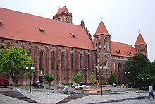
- Marienwerder Castle, castle of the cathedral chapter, built from 1322, originally four-wing complex, the south and east wings demolished in 1798, the battlements around the cathedral also as early as 1677, in the 19th century courthouse and prison, today a museum
- Cathedral church , brick Gothic, built as a new building from 1344 to around 1355, with the tombs of three grand masters and the Pomesan bishops
- Church of the Holy Trinity, built 1846–1858 as the first Catholic church in the city since the Reformation based on a design by Karl Friedrich Schinkel in the arched style as a brick building on a stone foundation. The construction of the two towers was completed in 1886. The church is a three-aisled basilica with a five-sided apse on the choir on the east side. The main entrance consists of three interconnected portals. The holy figures of the apostles Peter and Paul are placed above the portals.
- Old synagogue built in the 1830s
traffic
In the station Kwidzyn no longer operated in passenger meets railway Prabuty-Kwidzyn to the railway Toruń-Malbork . The route to Freystadt i. Western pr.
Since 2013, Kwidzyn has been reconnected to the other side of the Vistula via the newly constructed state road 90 and the Vistula bridge near Kwidzyn .
Kwidzyn Rural Commune
The rural community of Kwidzyn, to which the town itself does not belong, covers an area of 207.25 km² and has 11,423 inhabitants (as of June 30, 2019).
Town twinning
Kwidzyn has been twinned with Celle in Lower Saxony since October 18, 1953 .
Personalities
sons and daughters of the town
- Johannes Marienwerder (1343–1417), theologian
- Johann Friedrich List (1787–1868), Lord Mayor of Königsberg
- Ida von der Groeben (1791–1868), pietist and writer
- Hans von Auerswald (1792–1848), Prussian general
- Friedrich von Hering (1794–1871), Prussian general
- Rudolf von Auerswald (1795–1866), Prussian Prime Minister
- Heinrich Friedrich Jacobson (1804–1868), canon lawyer and church historian
- Hermann Conrad (1814–1885), politician and manor owner
- Ernst Kossak (1814–1880), journalist
- Hermann von Dechend (1814–1890), first President of the Reichsbank
- Bruno von Schrötter (1816–1888), administrative lawyer
- Julian Schmidt (1818–1886), literary historian
- Julius von Hennig (1822–1877), politician
- Rudolf von Bergius (1824–1905), Prussian major general
- Heinrich Ludwig Robert Giseke (1827–1890), poet and writer
- Richard Eduard John (1827–1889) lawyer
- Adalbert von Flottwell (1829–1909), politician and civil servant
- Rudolf Heidenhain (1834–1897), physiologist
- Gustav Cohn (1840–1919), German economist
- Eugen Windmüller (1842–1927), genre and landscape painter
- Albert Ballewski (1843–1909), engineer and businessman
- Adalbert von Conrad (1848–1928), administrative officer and parliamentarian born on the Fronza manor
- Wilhelm Räuber (1849–1926), painter
- Alfred Genzmer (1851–1912), surgeon
- Alfred von Conrad (1852–1914), administrative lawyer and politician born on the Fronza manor
- Georg von Bülow (1853–1936), Prussian officer, most recently major general
- Albert Kolbe (1871–1941), Lord Mayor of Stargard in Pomerania
- Ernst Kolbe (1876–1945), painter
- Kurt Rosenfeld (1877–1943), politician
- Thuro Balzer (1882–1967), painter
- Friedrich Wagner-Poltrock (1883–1961), architect
- Robert Witthoeft-Emden (1886–1960), Vice Admiral of the Navy, naval attaché in Washington
- Joachim Witthöft (1887–1966), General of the Infantry
- Kunz Finck von Finckenstein (1889–1932), manor owner and member of the Prussian manor house
- Kurt-Jürgen von Lützow (1892–1961), Lieutenant General
- Ida Siekmann (1902–1961), first victim of the Berlin Wall
- Rolf Lahr (1908–1985), diplomat
- Ernst Tillich (1910–1985), politician
- Dieter Gütt (1924–1990), radio and television journalist
- Hans-Jürgen Karp (* 1935), historian and editor
- Hans-Herlof Hardtke (* 1939), entrepreneur
- Hardy Rodenstock (1941–2018), artist manager and music publisher
- Bodo Krämer (1945–2003), actor
- Bernard Nowak (* 1950), writer, publisher and editor
- Zbigniew Jan Wesołowski (* 1957), sinologist
- Marek Szulen (* 1975), composer and musician
Honorary citizen
- Hans Pfundtner (1881–1945), State Secretary in the Reich Ministry of the Interior
Others
- Otto Friedrich von der Groeben (1657–1728), Prussian explorer and Polish lieutenant general, grave monument in the city's cathedral.
- August Kind (1824–1904), superstructure inspector in the building department of the district government, German architect and building officer of the Reichspost
See also
literature
- Daniel Heinrich Arnoldt : Brief messages from all preachers who have admitted to the Lutheran churches in East Prussia since the Reformation. Königsberg 1777, pp. 485-490.
- Johann Friedrich Goldbeck : Complete topography of the Kingdom of Prussia. Part II: Topography of West Prussia. Marienwerder 1789, pp. 3-6 ( full text ).
- August Eduard Preuss : Prussian country and folklore. Königsberg 1835, pp. 441–444, no. 58 ( full text ).
- Hans Christoph Wilhelm Jahn: Supplements to supplement the chronicle of the city of Marienwerder in West Prussia. Kanter, 1843.
- Max Toeppen : History of the city of Marienwerder and its engineering structures. Marienwerder 1875.
- Marienwerder . In: Meyers Konversations-Lexikon . 4th edition. Volume 11, Verlag des Bibliographisches Institut, Leipzig / Vienna 1885–1892, p. 248.
- Marienwerder: History of the oldest city of the Reichsdeutsche Ostmark. Edited by Erich Wernicke on behalf of the City of Marienwerder . Weichsel publishing house, 1933.
- Erich Weise (Ed.): Handbook of historical sites , volume: East and West Prussia (= Kröner's pocket edition . Volume 317). Unchanged reprint of the 1st edition 1966. Kröner, Stuttgart 1981, ISBN 3-520-31701-X , pp. 133-136.
Web links
- City website (Polish)
- Photos and history of Marienwerder and the order country
- Castle museum in Marienwerder
Individual evidence
- ↑ a b population. Size and Structure by Territorial Division. As of June 30, 2019. Główny Urząd Statystyczny (GUS) (PDF files; 0.99 MiB), accessed December 24, 2019 .
- ↑ Johannes Voigt : History of Prussia, from the earliest times to the fall of the rule of the German order. Volume 2. Königsberg 1827, p. 234 ff .
- ↑ a b L. Wiese: The higher school system in Prussia. Historical-statistical representation. Berlin 1864, pp. 76-77
- ↑ a b c Meyer's Großes Konversations-Lexikon , 6th edition, Volume 13, Leipzig and Vienna 1908, p. 299.
- ↑ Herbert Marzian , Csaba Kenez : Self-determination for East Germany - A documentation on the 50th anniversary of the East and West Prussian referendum on July 11, 1920. Editor: Göttinger Arbeitskreis , 1970, p. 117
- ↑ A city as a theater of war , report on a Polish-German historians' conference in 2004: Mitteleuropa.de , there also information on the unexplored origins of the new settlers.
- ↑ a b c d Erich Weise (ed.): Handbook of historical sites. Volume: East and West Prussia (= Kröner's pocket edition. Volume 317). Unchanged reprint of the 1st edition 1966. Kröner, Stuttgart 1981, ISBN 3-520-31701-X , pp. 133-136.
- ^ A b Johann Friedrich Goldbeck : Complete topography of the Kingdom of Prussia . Part II, Marienwerder 1789, pp. 3-6.
- ^ August Eduard Preuss: Prussian country and folklore . Königsberg 1835, pp. 441-444.
- ^ E. Jacobson: Topographical-statistical manual for the administrative district Marienwerder , Danzig 1868, pp. 106-107, no. 158 .
- ^ Gustav Neumann: Geography of the Prussian State . 2nd edition, Volume 2, Berlin 1874, pp. 48-49, item 2.
- ↑ a b c d e f Michael Rademacher: German administrative history from the unification of the empire in 1871 to the reunification in 1990. Province of West Prussia, Marienwerder district. (Online material for the dissertation, Osnabrück 2006).
- ↑ Der Große Brockhaus , 15th edition, Volume 12, Leipzig 1932, p. 143.


