Route national 107bis
| Route national 107 BIS in France | ||||||||||||||||||||||||||||||||||||||||||||||||||||||||||||||||||||||||||||||||||
| N 107 TO | ||||||||||||||||||||||||||||||||||||||||||||||||||||||||||||||||||||||||||||||||||
| Basic data | ||||||||||||||||||||||||||||||||||||||||||||||||||||||||||||||||||||||||||||||||||
| Operator: | ||||||||||||||||||||||||||||||||||||||||||||||||||||||||||||||||||||||||||||||||||
| Overall length: | 70 + 70.5 km | |||||||||||||||||||||||||||||||||||||||||||||||||||||||||||||||||||||||||||||||||
|
Regions : |
||||||||||||||||||||||||||||||||||||||||||||||||||||||||||||||||||||||||||||||||||
| old panneau Michelin in Ispagnac | ||||||||||||||||||||||||||||||||||||||||||||||||||||||||||||||||||||||||||||||||||
|
Course of the road
|
||||||||||||||||||||||||||||||||||||||||||||||||||||||||||||||||||||||||||||||||||
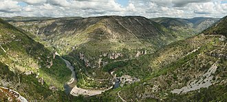
The N107 BIS was a French national road established in 1869 between Alès (then 'Alais') and Florac. Their length was 70 kilometers. In 1882 it was extended to Aguessac by the Gorges du Tarn. The length was now 140.5 kilometers. In 1973 the second part was downgraded and the first part was taken over from the N106.
Web links
- Route nationale française 107 BIS on WikiSara (French)

