Ford County (Illinois)
 Ford County Courthouse |
|
| administration | |
|---|---|
| US state : | Illinois |
| Administrative headquarters : | Paxton |
| Address of the administrative headquarters: |
Ford County Courthouse 200 West State Street Paxton, IL 60957 |
| Foundation : | February 17, 1859 |
| Made up from: | Vermilion County |
| Area code : | 001 217 |
| Demographics | |
| Residents : | 14,081 (2010) |
| Population density : | 11.2 inhabitants / km 2 |
| geography | |
| Total area : | 1260 km² |
| Water surface : | 1 km² |
| map | |
| Website : fordcounty.illinois.gov | |
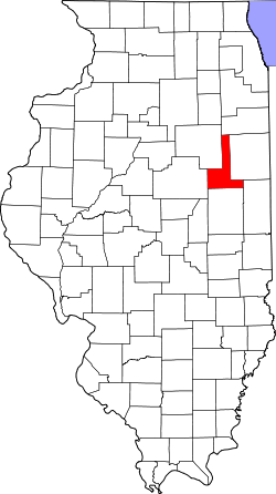
The Ford County is a county in the US -amerikanischen State Illinois . In 2010 , the county had 14,081 residents and a population density of 11.2 people per square kilometer. The county seat is in Paxton .
geography
The county is located in northeastern Illinois. It has an area of 1260 square kilometers, one square kilometer of which is water. The following neighboring counties border Ford County:
| Kankakee County | ||
| Livingston County |

|
Iroquois County |
| McLean County | Champaign County | Vermilion County |
history
The Ford County was formed on February 17, 1859 from parts of Vermilion County as the 102nd County in Illinois, making it the youngest county. It was named after Thomas Ford , the eighth governor of Illinois.
The first sedentary settlers were Joshua and Robert Trickel, two brothers from Ohio . They founded Trickel's Grove in 1836 and soon had many new neighbors. Another early settler was Michael L Sullivant. He bought thousands of acres of land and cultivated it. A few years later it was named the largest grain farm in the world with one-man management . In 1866 a number of Norwegian settlers also came.
Another notable event in Ford County's history was the county's first and only hanged man. The jury found him guilty in 1897 of killing a woman in northwest Gibson City.
Demographic data
| Population development | |||
|---|---|---|---|
| Census | Residents | ± in% | |
| 1860 | 1979 | - | |
| 1870 | 9103 | 360% | |
| 1880 | 15,099 | 65.9% | |
| 1890 | 17,035 | 12.8% | |
| 1900 | 18,359 | 7.8% | |
| 1910 | 17.096 | -6.9% | |
| 1920 | 16,466 | -3.7% | |
| 1930 | 15,489 | -5.9% | |
| 1940 | 15.007 | -3.1% | |
| 1950 | 15.901 | 6% | |
| 1960 | 16.606 | 4.4% | |
| 1970 | 16,382 | -1.3% | |
| 1980 | 15,265 | -6.8% | |
| 1990 | 14,275 | -6.5% | |
| 2000 | 14,241 | -0.2% | |
| 2010 | 14,081 | -1.1% | |
| Before 1900 1900–1990 2000 2010 | |||
According to the 2010 census , Ford County had 14,081 people in 5,638 households. The population density was 11.2 people per square kilometer. Statistically, 2.38 people lived in each of the 5638 households.
The racial the population was composed of 97.6 percent white, 0.9 percent African American, 0.3 percent Native American, 0.3 percent Asian and other ethnic groups; 0.9 percent were descended from two or more races. Hispanic or Latino of any race was 2.4 percent of the population.
23.3 percent of the population were under 18 years old, 57.8 percent were between 18 and 64 and 18.9 percent were 65 years or older. 51.0 percent of the population was female.
The median income for a household was 48,667 USD . The per capita income was $ 23,401. 8.3 percent of the population lived below the poverty line.
Ford County localities
1 - partially in Kankakee County
structure
Ford County is divided into twelve townships :
|
|
See also
Individual evidence
- ↑ GNIS-ID: 424228. Retrieved on February 22, 2011 (English).
- ↑ a b c U.S. Census Bureau, State & County QuickFacts - Ford County, IL ( Memento of the original from July 10, 2011 on WebCite ) Info: The archive link was automatically inserted and has not yet been checked. Please check the original and archive link according to the instructions and then remove this notice. Retrieved December 3, 2012
- ^ A b National Association of Counties.Retrieved December 3, 2012
- ^ US Census Bureau - Census of Population and Housing.Retrieved March 15, 2011
- ↑ Extract from Census.gov . Retrieved February 15, 2011
- ↑ Missouri Census Data Center - Illinois ( page no longer available , search in web archives ) Info: The link was automatically marked as defective. Please check the link according to the instructions and then remove this notice. Retrieved December 3, 2012
Web links
Coordinates: 40 ° 35 ′ N , 88 ° 13 ′ W


