
Edgar County
![The Edgar County Courthouse, listed on NRHP No. 81000221 [1]](https://de.wikipedia.org/wiki/Datei:EdgarCtyILCourthouse.jpg) The Edgar County Courthouse, listed on NRHP No. 81000221 |
|
| administration | |
|---|---|
| US state : | Illinois |
| Administrative headquarters : | Paris |
| Address of the administrative headquarters: |
County Courthouse 115 West Court Street Paris, IL 61944-1739 |
| Foundation : | January 3, 1823 |
| Made up from: | Clark County |
| Area code : | 001 217 |
| Demographics | |
| Residents : | 18,576 (2010) |
| Population density : | 11.5 inhabitants / km 2 |
| geography | |
| Total area : | 1617 km² |
| Water surface : | 2 km² |
| map | |
 |
|
| Website : edgarcountyillinois.com | |
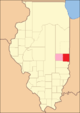
The Edgar County is a county in the US -amerikanischen State Illinois . In 2010 , the county had 18,576 residents and a population density of 11.5 people per square kilometer. The county seat is Paris .
geography
The county is located in eastern Illinois on the Indiana border . It has an area of 1617 square kilometers, of which two square kilometers are water. The following neighboring counties border Edgar County:
| Champaign County | Vermilion County |
Vermillion County (Indiana) |
|
Douglas County Coles County |
.svg)
|
|
| Clark County |
Vigo County, Indiana |
Rivers in the county
- Bonwell Branch
- Catfish Creek
- East Fork
- Hickory Grove Creek
- Hughes Drain
- Lick Run
- McCalls Branch
- Shiloh Number 2 Drain
- Snake Creek
history
Edgar County was formed in 1823 from parts of Clark County. It was named after John Edgar , a native Irishman who served as captain of the Royal Navy and fought in the American Revolutionary War.
Territorial development

When founded in 1823

Between 1825 and 1826
Between 1826 and 1830

Since 1830


Demographic data
| Population development | |||
|---|---|---|---|
| Census | Residents | ± in% | |
| 1830 | 4071 | - | |
| 1840 | 8225 | 102% | |
| 1850 | 10,692 | 30% | |
| 1860 | 16,925 | 58.3% | |
| 1870 | 21,450 | 26.7% | |
| 1880 | 25,499 | 18.9% | |
| 1890 | 26,787 | 5.1% | |
| 1900 | 28,273 | 5.5% | |
| 1910 | 27,336 | -3.3% | |
| 1920 | 25,769 | -5.7% | |
| 1930 | 24,966 | -3.1% | |
| 1940 | 24,430 | -2.1% | |
| 1950 | 23,407 | -4.2% | |
| 1960 | 22,550 | -3.7% | |
| 1970 | 21,591 | -4.3% | |
| 1980 | 21,725 | 0.6% | |
| 1990 | 19,595 | -9.8% | |
| 2000 | 19,704 | 0.6% | |
| 2010 | 18,576 | -5.7% | |
| Before 1900 1900–1990 2000 2010 | |||
As of the 2010 census , Edgar County had 18,576 people in 7,877 households. The population density was 11.5 inhabitants per square kilometer. In the 7,877 households there were statistically 2.32 people each.
The racial the population was composed of 98.3 percent white, 0.6 percent African American, 0.2 percent Native American, 0.2 percent Asian and other ethnic groups; 0.7 percent were descended from two or more races. Hispanic or Latino of any race was 1.2 percent of the population.
22.0 percent of the population were under 18 years old, 59.3 percent were between 18 and 64 and 18.7 percent were 65 years or older. 51.5 percent of the population was female.
The median income for a household was 39,904 USD . The per capita income was $ 22,175. 13.5 percent of the population lived below the poverty line.
Edgar County localities
1 - partially in Clark County
structure
Edgar County is divided into 15 townships :
|
|
|

See also
Individual evidence
- ^ Extract from the National Register of Historic Places . Retrieved March 13, 2011
- ↑ GNIS-ID: 424224. Retrieved on February 22, 2011 (English).
- ↑ a b c U.S. Census Bureau, State & County QuickFacts - Edgar County, IL ( June 6, 2011 memento on Internet Archive )
- ^ A b National Association of Counties , accessed November 29, 2012
- ↑ Jesse White: Origin and Evolution of Illinois Counties (PDF; 5.3 MB) , accessed November 29, 2012
- ^ US Census Bureau - Census of Population and Housing , accessed March 15, 2011
- ↑ Excerpt from Census.gov , accessed on February 15, 2011
- ^ Overview of Edgar County, Illinois (County). In: statisticalatlas.com. Retrieved July 12, 2018 .
Web links
List of counties in Illinois
Adams |
Alexander |
Bond |
Boone |
Brown |
Bureau |
Calhoun |
Carroll |
Cass |
Champaign |
Christian |
Clark |
Clay |
Clinton |
Coles |
Cook |
Crawford |
Cumberland |
DeKalb |
DeWitt |
Douglas |
DuPage |
Edgar |
Edwards |
Effingham |
Fayette |
Ford |
Franklin |
Fulton |
Gallatin |
Greene |
Grundy |
Hamilton |
Hancock |
Hardin |
Henderson |
Henry |
Iroquois |
Jackson |
Jasper |
Jefferson |
Jersey |
Jo Daviess |
Johnson |
Kane |
Kankakee |
Kendall |
Knox |
LaSalle |
Lake |
Lawrence |
Lee |
Livingston |
Logan |
Macon |
Macoupin |
Madison |
Marion |
Marshall |
Mason |
Massac |
McDonough |
McHenry |
McLean |
Menard |
Mercer |
Monroe |
Montgomery |
Morgan |
Moultrie |
Ogle |
Peoria |
Perry |
Piatt |
Pike |
Pope |
Pulaski |
Putnam |
Randolph |
Richland |
Rock Island |
Saline |
Sangamon |
Schuyler |
Scott |
Shelby |
St. Clair |
Strong |
Stephenson |
Tazewell |
Union |
Vermilion |
Wabash |
Warren |
Washington |
Wayne |
White |
Whiteside |
Will |
Williamson |
Winnebago |
Woodford
Coordinates: 39 ° 41 ′ N , 87 ° 45 ′ W